| Thursday | Thursday Night | Friday | |
|---|---|---|---|
| Cloud Cover: | Mostly Cloudy | Mostly Cloudy | Mostly Cloudy |
| Temperatures: | 27 to 33 deg. F. | 23 to 29 deg. F. | 27 to 34 deg. F. |
| Wind Direction: | Southwest | Southwest | South |
| Wind Speed: | 10G28 | 18G32 | 6G32 |
| Snowfall: | 0 to 1" in. | 0" in. | 0" in. |
| Snow Line: | 4000' | 4000' | 3500' |
Whitefish Range
Swan Range
Flathead Range and Glacier National Park
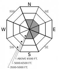
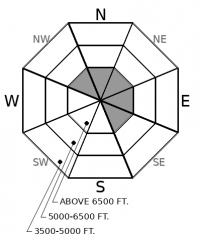
How to read the forecast
Avoid steep slopes with fresh deposits of drifted snow, where you can trigger shallow slabs that can have large consequences. Be wary of large, open slopes with well-developed snowpacks, particularly close to the Continental Divide in Glacier National Park. On these slopes, the primary danger is triggering large slabs that break on old snow near the ground or a rain crust formed in mid November.

No Rating
?
Above 6500 ft.
No Rating
?
5000-6500 ft.
No Rating
?
3500-5000 ft.
-
Type ?
-
Aspect/Elevation ?

-
Size ?HistoricVery LargeLargeSmall

With westerly winds forecast to increase this afternoon, small slabs of drifted snow may form near ridgecrests and summits. While most will be small, they can pose outsized consequences because getting in caught in one will make you intimately familiar with rocks, logs, and stumps near the ground. These will be most widespread in central Glacier National Park, where more snow is available for transport, and near the crests of the Swan and Whitefish ranges. Look for and avoid freshly-formed drifts near the tops of steep chutes, along the sides of gullies, and in other terrain prone to collecting drifting snow.
-
Type ?
-
Aspect/Elevation ?

-
Size ?HistoricVery LargeLargeSmall

On steep, upper elevation slopes, you may be able to trigger slabs 1 to 3 feet thick that break around crusts that formed in late October and mid November. The thickest slabs exist in bowls and large slopes that face north through east and that didn't recieve rain in mid-October, as evidenced by a cycle of very large avalanches reported Nov. 22. Slopes like these are more widespread closer to the Continental Divide in Glacier National Park. Elsewhere, recent snow has accumulated above the Nov. 19 rain crust or a surface hoar layer that formed a few days later, creating other potenially dangerous structures. Step back from steep slopes if you see the unambiguous signs of instability - shooting cracks, whumpfing collapses, and recent slides.
Sadly, low tide conditions continue. Sadly, unless you're a beachcomber. In that case, you can find plenty of flotsam, jetsom, and debris between the valleys and about 5500 feet.
A brief history of the snowpack so far:
The most significant weather event in the past few weeks was rain that reached to upper elevations. While the exact elevation varies, it was higher in the western parts of our forecast region, and lower closer to the Continental Divide in central Glacier National Park. The crust it left behind varies in thickness, from several inches to a glaze. On some southerly and lower elevation slopes, this crusts is at or very near the ground. We are referring to it as the Nov. 19 crust.
Dribs and drabs of new and drifted snow accumulated over the rest of November. On slopes with more than a foot or so of snow - generally above about 5500 feet - the snowpack structure resembles a wafer cookie: a stack of crusts with weak facets between them. On slopes near ridges, you can also find shallow deposits of drifted snow, though blustery north and east winds have scoured some start zones to the ground. There's also a sneaky layer of surface hoar lurking above the Nov. 19 rain crust as well.
While there's little dangerous about the wafer cookie structure right now, it will become a concern once we start piling more weight on top of it. The structure has the potential to produce large avalanches, as evidenced by several very large avalanches that released from the highest elevations in Glacier National Park after the Nov. 19 rain event. This area got snow and wind, instead of rain, during the mid-November storm, which caused a thick slab to form on top of one of the wafer cookies that formed in October.
Current Conditions:
Sine December 1, a series of weak storms has brushed over the area. The storms have dropped less than an inch of SWE in the the Swan Range (0.6" at Noisy Basin) and in the northern Whitefish Range (0.7" at Stahl Peak). Accumulations are notaby higher closer to the Divide in Glacier National Park (2.4" SWE at Flattop Mountain). Winds shifted from northerly to southwest and west, peaking on Dec. 3 at speeds strong enough to move snow.
While we have limited field observations so far, it appears the most well developed snowpack and the potential for the largest slides is near the Continental Divide. Recent storms have built thicker slabs above the Nov. 19 rain crust, which stops at lower elevations there. Elsewhere, the persistent slab problem is more isolated, and wind slabs are a more immediate concern.
While winds are light this morning, they're forecast to increase this afternoon at upper elevations. Stormier conditions this weekend could start building more cohesive slabs above the crust-facet layers at upper elevations.
Despite a rather thin snowpack, the FAC is transitioning to daily forecasts this Saturday, December 7th. We want to keep our adventurous bushwackers and beachcombers informed on conditions until we can coax the storm tracks to point towards us.
We can expect mild temperatures today with snow showers at upper elevations and rain showers down low. Gusty westerly winds will develop this afternoon, mostly above 7000 feet. Friday looks to be dry, and the weekend forecast calls for colder, snowier weather, with snowfall favoring areas near the Continental Divide.
This forecast applies only to backcountry areas outside established ski area boundaries. The forecast describes general avalanche conditions and local variations always occur. This forecast expires at midnight on the posted day unless otherwise noted. The information in this forecast is provided by the USDA Forest Service who is solely responsible for its content.


