| Saturday | Saturday Night | Sunday | |
|---|---|---|---|
| Cloud Cover: | Mostly Cloudy | Mostly Cloudy | Mostly Cloudy |
| Temperatures: | 31 to 39 deg. F. | 24 to 27 deg. F. | 31 to 39 deg. F. |
| Wind Direction: | Southwest | West | Southwest |
| Wind Speed: | 10 to 20 G30 | 15 to 25 G50 | 20 to 30 G55 |
| Snowfall: | 1” to 3" in. | 4” to 7” in. | 2" to 3" in. |
| Snow Line: | 4500' | 3500' | 4000’ |
Whitefish Range
Swan Range
Flathead Range and Glacier National Park
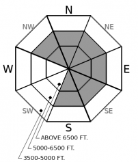
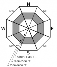
How to read the forecast
Changing conditions are underway. Strong winds and snowfall will form increasingly thick slabs through Sunday. Be especially cautious of leeward terrain features. Mild temperatures and bouts of sunshine could contribute to ongoing wet loose avalanches. The best, safest riding will be on wind protected slopes with cold snow that are free of glide cracks, but stay alert on all steep terrain if we get more than about 6 inches of new snow.

No Rating
?
Above 6500 ft.
No Rating
?
5000-6500 ft.
No Rating
?
3500-5000 ft.
-
Type ?
-
Aspect/Elevation ?

-
Size ?HistoricVery LargeLargeSmall

6" to 12" of new snow will be accompanied by strong southwest to west winds this weekend. Small wind slabs that form on Saturday afternoon will thicken and become more widespread by Sunday. Freshly drifted slabs will be forming over crusts that may not bond well. You are most likely to find trouble below corniced ridgelines or in cross-loaded gullies at mid and upper elevations, where winds will be forming thicker, denser drifts. You've found trouble if you see cracks shooting from beneath you or see snow blowing onto a steep slope.
-
Type ?
-
Aspect/Elevation ?

-
Size ?HistoricVery LargeLargeSmall

Wet weather this week has produced a surge in natural loose wet avalanche activity. Sunshine or warming temperatures on Saturday may spur continued instabilities if surface crusts soften into wet, mushy snow. On Sunday, be wary of the fresh snow moistening and sluffing off of steep slopes as air temperatures rise through the day. Monitor the snow surface to identify this problem: rollerballs, pinwheels, or sluffing underfoot are warning signs to find colder snow or lower angle terrain.
-
Type ?
-
Aspect/Elevation ?

-
Size ?HistoricVery LargeLargeSmall

Some areas may receive up to 10" or 12" of new snow by Sunday. The new snow will be accumulating on wet surfaces or crusts. In the latter case, they may not bond immediately. On Sunday, be alert for sluffing or soft slabs to develop in terrain favored by snowfall. Use small test slopes to observe how the new snow is bonding to underlying crusts, and choose less consequential terrain or lower slope angles if you see cracking underfoot. Storm slabs are unlikely to develop on Saturday or in areas that see less than 5" of snow by Sunday.
A spring storm is marching towards NW Montana, bringing a parade of near-surface avalanche concerns this weekend.
First to the show is a loose wet avalanche concern. After a poor refreeze on Friday night, cloud forecasts (which are often dubious), are calling for a mix of sun and clouds on Saturday paired with mild temperatures, which should be enough to thaw any surface crusts. I doubt we'll see the impressive wet avalanche show of the past few days, but we could see continued large naturals and the potential for human triggered wet sluffs on Saturday.
Next in the parade is new and windblown snow signaled by an advancing cold front. Snowfall starts on Saturday afternoon and intensifies overnight, with 6" to 12” in the forecast. Winds start to increase Saturday afternoon and highlight the show on Sunday. Wind slabs should start off small and isolated on Saturday, but by Sunday morning these could be large enough to be dangerous and distributed to more terrain. The warm, wet weather from this week has left saturated snow surfaces which could refreeze into slick crusts as the snow and cold front arrive. Crusts tend to inhibit immediate bonding of new or windblown snow. Storm slabs and loose dry avalanches could also develop if the snow forecasts verify.
The closing act to the parade is rebounding temperatures on Sunday afternoon. As the freezing level rises on Sunday, the new snow that falls on Saturday night has potential to moisten and sluff off of steep slopes, most likely near the mid to low elevation boundary. If this final act to the parade shows up, it will announce itself with rollerballs and pinwheels.
Of course, the omnipresent act during the whole show is a caged monster: the lurking glide avalanche problem, which has developed on a few slopes as the entire snowpack starts to sag downhill over bedrock and grass. Stay out from under those looming glide cracks and you'll be able to focus on the near-surface acts in the parade instead - much easier problems to manage.
This is the last scheduled snowpack update of the season. We will issue a spring travel statement on Monday. Thank you to everyone who contributed to a safe and educational winter: volunteers, supporters, and partners....we couldn't do it without you.
A cold front embedded in Southwest flow will bring increasing winds and lowering snow levels on Saturday night.
This forecast applies only to backcountry areas outside established ski area boundaries. The forecast describes general avalanche conditions and local variations always occur. This forecast expires at midnight on the posted day unless otherwise noted. The information in this forecast is provided by the USDA Forest Service who is solely responsible for its content.


