| Thursday | Thursday Night | Friday | |
|---|---|---|---|
| Cloud Cover: | Partly Cloudy | Partly Cloudy | Mostly Cloudy |
| Temperatures: | 32 to 40 deg. F. | 22 to 25 deg. F. | 34 to 42 deg. F. |
| Wind Direction: | Southwest | Northwest | North |
| Wind Speed: | 8G18 | 7 | 1G22 |
| Snowfall: | 0 to 1" in. | 0" in. | 0 to 1" in. |
| Snow Line: | 4000' | 3500' | 3500' |
Whitefish Range
Swan Range
Flathead Range and Glacier National Park
How to read the forecast
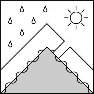
Snow that's accumulated since Tuesday will be the primary avalanche concern over the next few days. Triggered and natural avalanches that break in or at the base of this snow will pose a threat on steep slopes. The nature of this threat - Storm Slabs or Loose wet - will depend on terrain-specific freezing levels and snow accumulations. Areas with more than a foot or so of fresh snow have the potential for large, dangerous avalanches.

No Rating
?
Above 6500 ft.
No Rating
?
5000-6500 ft.
No Rating
?
3500-5000 ft.
-
Type ?
-
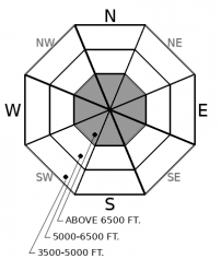
Aspect/Elevation ?
-
Size ?HistoricVery LargeLargeSmall

At upper elevations, slabs of fresh, dry snow can pose a hazard on steep slopes. The exact elevation will vary with location and time of day, thanks to variable new snow accumulations and fluctuating freezing levels. These can break at or near the old/ new snow interface, or within the recent snow. You've found this hazard if you find 8 inches or more of dry snow on a steep slope. Hand pits and slope cuts on small slopes are good ways to test whether these slabs are reactive. The largest, thickest and most dangerous slabs will be near the Continental Divide, where wrap-around moisture has left slabs 1 to 2 feet thick.
-
Type ?
-
Aspect/Elevation ?

-
Size ?HistoricVery LargeLargeSmall

At mid-elevations, large sluffs of dense, wet snow pose a hazard on and below steep slopes. The snow from the past few days fell at warm temperatures, so it's already moist or wet. All it needs is a trigger - you - to get it moving on steep slopes. At upper elevations, brief breaks in the clouds will allow enough sun to trigger natural wet loose slides on steep slopes below cliffs, rocks and trees. Triggered and natural loose snow slides will be largest and most dangerous where there's more than about 8 inches of fresh snow, or where the debris can gouge into old, wet snow. Avoid being under steep slopes where rollerballs fan down from above. Pick lines that aren't above gullies and cliff bands, to minimize the consequences of getting knocked off your feet or snowmachine.
-
Type ?
-
Aspect/Elevation ?

-
Size ?HistoricVery LargeLargeSmall

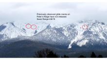
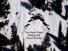
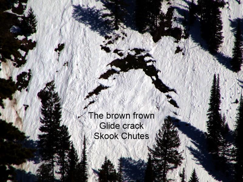
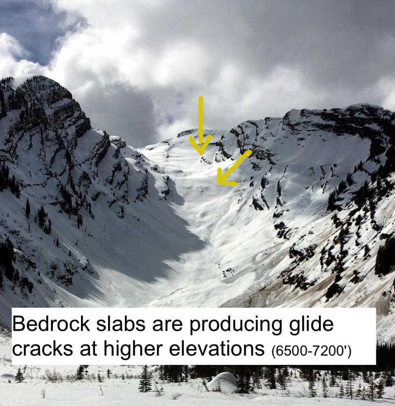
Don't linger on slopes below gaping, frown-shaped cracks in the snow. While you can't trigger the slabs from below, they can fail naturally and catastrophically, bringing down the season's snowpack. They tend to release when meltwater or rain lubricates the bed surface and/ or weakens the snow buttressing the slabs. The most straightforward way to manage this hazard is to scan steep slopes above you for the cracks and avoid climbing or descending beneath them.
The week's wet weather has left new snow at mid and upper elevations throughout the region, but accumulations have varied dramatically. Tuesday's storm dumped up to 15 inches of new snow and over 2 inches of Snow Water Equivalent near Marias Pass. Yet the same area got mostly skunked last night, while the Whitefish Range saw over 8 inches of new snow and an inch of SWE. The new snow is dense and even wet below at least 6500 feet. The winds that accompanied the snowfall were mostly light, with moderate gusts, so not strong enough to drift snow except in the most favored locations. Truth be told, it'd take a spatula to move the paste that fell at mid elevations. Showers over the next few days will drop more snow, though only the Swan Range looks to get more than a few inches.
The fresh snow means the potential for triggered and natural avalanches large enough to be dangerous. The character of those slide will depend on whether the snow is dry or wet. At upper elevations, where the storm snow remains dry, it's a winter-like problem: Storm Slabs. Once the new snow gets moist or wet, it's a Loose Wet avalanche problem. In either case, steep slopes with more than about 12 inches of fresh snow have the potential for slides large enough to bury or injure a person.
Pay close attention to the water content in the fresh snow, so you can switch your tactics from avoiding Storm Slabs to avoiding Loose Wet slides as needed. Keep an eye on steep slopes above you so you can avoid lingering under terrain that poses an overhead hazard - natural wet loose avalanches or glide avalanches. Be prepared for conditions to change abruptly when the sun breaks through the clouds.
Many areas below 5000’ have a thin snowpack which has been worked over by rain, sun, and avalanches from above. This snowpack may be wet and punchy but is generally stable. Avalanche concerns in this terrain primarily consist of overhead hazards. Avalanche paths large enough to reach the lower elevations are found in the Flathead Range and Glacier Park.
This is a late-season snowpack update. The next update will be issued on April 13th at 7 a.m. unless conditions warrant an earlier update.
EDUCATION: The Scoop on Spring Touring: Curious about spring snow and safe travel techniques? This is the talk for you. Join FAC Lead Forecaster Blase Reardon for a FREE one hour talk on spring conditions in the Flathead. The talk begins at 6:30 p.m. tonight (Thursday, April 11th) at Rocky Mountain Outfitters in Kalispell. That evening is also a community night for the Friends of the Flathead Avalanche Center at Sweet Peaks in Kalispell. Stop by for a sweet treat and then head down the street to get the scoop on spring conditions.
With the region under a cool northwest flow, we can expect snow and rain showers, alternating sun and clouds, moderate wind speeds, and temperatures hovering near freezing at upper elevations. Friday morning's temperatures look to be the coldest of the period.
This forecast applies only to backcountry areas outside established ski area boundaries. The forecast describes general avalanche conditions and local variations always occur. This forecast expires at midnight on the posted day unless otherwise noted. The information in this forecast is provided by the USDA Forest Service who is solely responsible for its content.


