| Sunday | Sunday Night | Monday | |
|---|---|---|---|
| Cloud Cover: | Mostly Cloudy | Mostly Cloudy | Mostly Cloudy |
| Temperatures: | 34 to 42 deg. F. | 27 to 31 deg. F. | 37 to 45 deg. F. |
| Wind Direction: | Southwest | Southwest | Southwest |
| Wind Speed: | 10 to 20, Gusting to 35 | 10 to 15, Gusting to 40 | 5 to 10, Gusting to 20 |
| Snowfall: | 2 to 6 in. | 1 to 5 in. | 1 to 2 in. |
| Snow Line: | 6500' | 6000' | 5500' |
Whitefish Range
Swan Range
Flathead Range and Glacier National Park
How to read the forecast
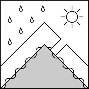
A strong storm from the southwest will make wind slabs a problem beginning Sunday morning. As precipitation transitions to rain, the threat of large wet snow avalanches will rise. Watch for blowing snow and limit your exposure to drifts in the lee of ridgelines and in gullies. As the snowpack becomes wet, dense sluffs may run in steep terrain. Avoid slopes under glide cracks. When faced with uncertainty, be conservative with your terrain selection.

No Rating
?
Above 6500 ft.
No Rating
?
5000-6500 ft.
No Rating
?
3500-5000 ft.
-
Type ?
-
Aspect/Elevation ?
-
Size ?HistoricVery LargeLargeSmall

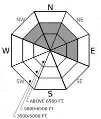
Wind slabs began to develop on Saturday. Wet, heavy snow and strong southwest winds will continue through Sunday. Watch for blowing snow below ridgelines and near crossloaded gullies. Avoid dense, rounded drifts. Be wary of cornices overhead. Shooting cracks are a red flag.
-
Type ?
-
Aspect/Elevation ?
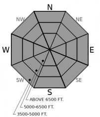
-
Size ?HistoricVery LargeLargeSmall

Limit your exposure to steep gullies and rocky terrain as the snow becomes wet. The freezing level will rise on Sunday. New precipitation will be a mix of rain and snow through Monday. As the surface snow becomes saturated and unsupportable, loose wet avalanches may run from the middle, and even upper elevations. Rollerballs and small point releases are warning signs that larger wet snow avalanches may soon follow. On northerly slopes where the snowpack is still layered, wet sluffs can trigger larger slabs.
-
Type ?
-
Aspect/Elevation ?
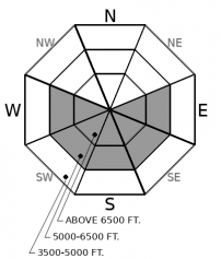
-
Size ?HistoricVery LargeLargeSmall

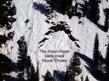
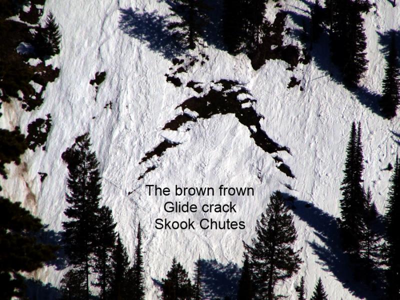
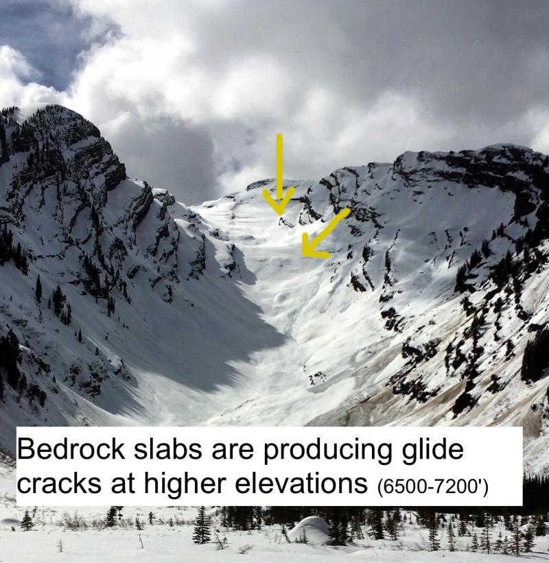
Rain on snow means there is the potential for a lot of new water moving through the snowpack. Glide cracks are the gaping, down-curved gaps that open up as the season's snowpack starts to slide downhill on wet grass or bedrock. We have observed several destructive glide avalanches in the past few weeks. They release when the snow at their flanks and base becomes saturated and weakens. The resulting slides are catastrophic failures that run surprisingly long distances. Choose routes that avoid slopes below open glide cracks. If you can't identify the hazards overhead, choose conservative uphill routes.
It looks like a wet and wild start to the week. An atmospheric river may bring upwards of an inch of new water to the mountains by Monday night. Weather models are favoring the Swan Range and the Continental Divide for the highest amounts. Winds look strong and gusty, freezing levels will rise, and new snowfall may transition to rain into the upper elevations. Not exactly pleasant spring showers.
We got a taste of these conditions on Saturday. Up to an inch of dense snow fell Friday night above about 4000’. Strong southwest winds blew much of that snow away. Zach found very small wind slabs developing just east of Marias Pass. By Saturday afternoon, light rain had raised the snow line about a thousand feet.
A similar pattern is expected through Monday. Strong winds will continue through Sunday. Freezing levels will rise into Sunday night. A mix of rain and snow will fall throughout the forecast period.
Rain on snow will weaken the snow surface. Rollerballs, like those observed across the region this past week, usually begin just before loose wet avalanches. Be aware or moistening snow on steep slopes. Limit your exposure to rocky terrain and gullies as the snow gets wet.
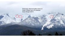
As more water falls and percolates deeper into the snowpack, glide avalanche will become a larger concern. Cracks that have not yet failed remain open where the whole season’s snowpack is slowly sliding on top of wet bear grass or rocky slabs. Glide avalanche release is hard to predict, but above freezing temps and wet weather are not improving the situation. Avoid slopes below the brown frowns. Flat light may make it challenging to identify slopes with overhead glide cracks. Choose cautious up routes if you aren't familiar with the current overhead glide hazards. Where the snowpack is still layered: on northerly aspects above about 6000’, there is a risk of persistent slabs waking up. Collapsing is a sure warning that water is destabilizing persistent weak layers under your feet. Unsupportable wet snow is also a red flag.
This is a late-season snowpack update. The next update will be issued on April 9th at 7 a.m. unless conditions warrant an earlier update.
EDUCATION: The Scoop on Spring Touring: Curious about spring snow and safe travel techniques? This is the talk for you. Join FAC Lead Forecaster Blase Reardon for a FREE one hour talk on spring conditions in the Flathead. The talk begins at 6:30 p.m. Thursday, April 11th at Rocky Mountain Outfitters in Kalispell. That evening is also a community night for the Friends of the Flathead Avalanche Center at Sweet Peaks in Kalispell. Stop by for a sweet treat and then head down the street to get the scoop on spring conditions.
Strong southwest flow will bring moisture to the region through Monday. Upper elevations could recieve upwards of an inch of new water. Freezing levels may rise Sunday into the upper elevations. Winds will be strong but taper through the forecast period.
This forecast applies only to backcountry areas outside established ski area boundaries. The forecast describes general avalanche conditions and local variations always occur. This forecast expires at midnight on the posted day unless otherwise noted. The information in this forecast is provided by the USDA Forest Service who is solely responsible for its content.


