| Saturday | Saturday Night | Sunday | |
|---|---|---|---|
| Cloud Cover: | Increasing Clouds | Mostly Cloudy | Mostly Cloudy |
| Temperatures: | 35 to 43 deg. F. | 26 to 30 deg. F. | 34 to 41 deg. F. |
| Wind Direction: | Southwest | Southwest | Southwest |
| Wind Speed: | 10 to 20, Gusting to 40 | 10 to 20, Gusting to 40 | 10 to 15, Gusting to 30 |
| Snowfall: | 0 to 1" in. | 2" to 3" in. | 2" to 4" in. |
| Snow Line: | 5500' | 5500' | 4500' |
Whitefish Range
Swan Range
Flathead Range and Glacier National Park
How to read the forecast
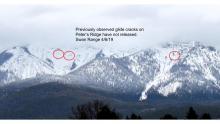
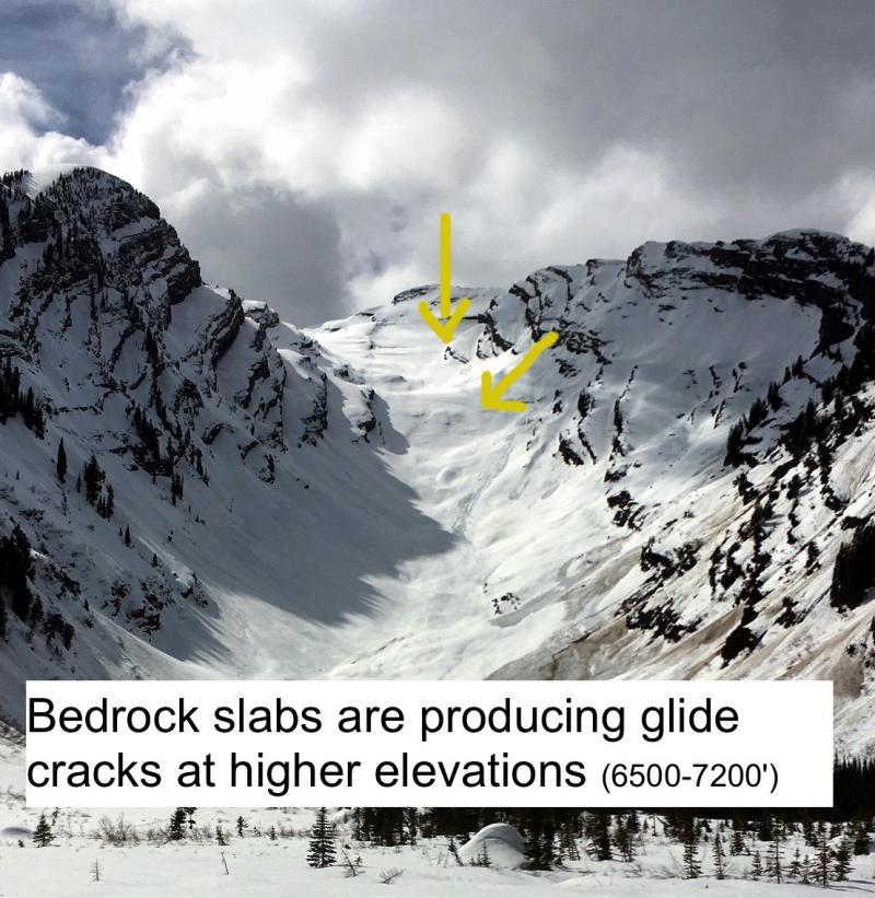
Recent wet weather is weakening the snowpack on terrain with glide cracks and increasing the odds of destructive glide avalanches. Avoid traveling on or under those questionable slopes. Small loose wet avalanches may develop above about 6000 feet, especially if precipitation this afternoon starts as rain.

2. Moderate
?
Above 6500 ft.
2. Moderate
?
5000-6500 ft.
1. Low
?
3500-5000 ft.
- 1. Low
- 2. Moderate
- 3. Considerable
- 4. High
- 5. Extreme
-
Type ?
-
Aspect/Elevation ?
-
Likelihood ?CertainVery LikelyLikelyPossible
 Unlikely
 -
Size ?HistoricVery LargeLargeSmall

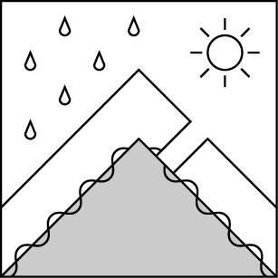
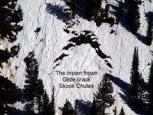
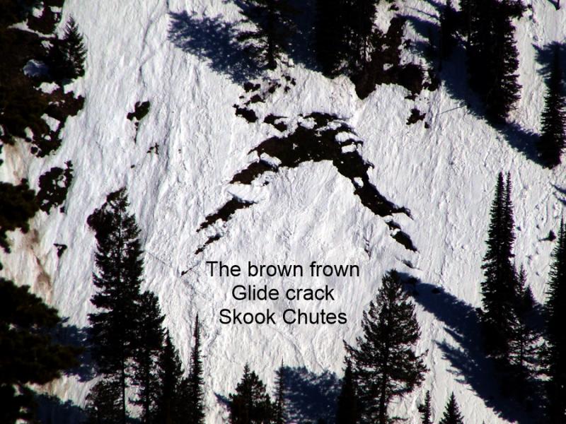
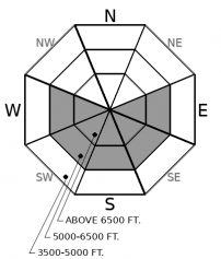
Glide cracks are the obvious "brown frowns" that open up as the season's snowpack starts to slide downhill on grass or bedrock. Several days of above freezing temperatures and rain on the snowpack may worsen the problem today. We have observed several destructive glide avalanches in the past few weeks. Although this is a low likelihood avalanche problem, the resulting slides are catastrophic failures that run surprisingly far distances. The most reliable way to manage their unpredictable failures is to choose routes that avoid slopes below open glide cracks. If you can't identify hazards overhead, choose conservative uphill routes.
-
Type ?
-
Aspect/Elevation ?
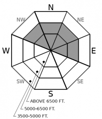
-
Likelihood ?CertainVery LikelyLikelyPossible
 Unlikely
 -
Size ?HistoricVery LargeLargeSmall

Yesterday, observers reported rollerballs and human triggered point release avalanches at middle and high elevations involving the 2" to 4" of moistening snow at the surface. These instabilities remain a concern today. High freezing levels and light rain may keep northerly aspects wet and ripe for wet sluffs. Watch for small natural wet loose avalanches this afternoon if you see rollerballs, pinwheels, or rain on dry snow. If the sky clears midday, sunshine may further wet the surface. Avoid travel on or below steep gullies if you observe an unstable snow surface. Loose snow avalanches can also pose a threat if they sweep you over rocks or into a tree.
A small storm Wednesday night left 3 to 4 inches of new snow above 6000’. The Whitefish Range and Glacier Park picked up the most precipitation with lighter amounts elsewhere. Thursday was partly cloudy and quiet, but freezing levels were high and the snowpak remained isothermal at lower elevations throughout the day yesterday. Observers traveling on northerly aspects in the Flathead Range yesterday reported rollerballs and 2-4” of surface snow sluffing on melt-freeze crusts at middle and upper elevations. A snowboarder recently triggered a very small wind slab below the ridgeline of Doris Creek. I ski cut several small loose wet avalanches at mid elevations in the Middle Fork. Spring showers reached up to ~7000’ yesterday. Big Mountain Ski Patrol noted rain at the summit in the late afternoon. Overnight, most weather stations show a loss of snow – about an inch – but an increase of between 0.1 and 0.5 inches of new precipitation. That spells rain on snow which can weaken the snow on the surface. Rollerballs, like those observed across the region yesterday, usually begin just before loose wet avalanches. Be aware or moistening snow on very steep northerly slopes.
We are going on 3 nights with poor refreezing in many areas. That can free up melt water which further destabilizes the snowpack.Water in the snowpack can weaken the bonds holding the snow in place. That is the source of our concern on slopes with glide cracks. Glide avalanche activity spiked during the mid-March meltdown. Cracks that have not yet failed remain open where the whole season’s snowpack is slowly sliding on top of wet bear grass or rocky slabs. Glide avalanche release is hard to predict, but above freezing temps and wet weather are not improving the situation. Avoid slopes below the brown frowns. Flat light may make it challenging to identify slopes with overhead glide cracks. Choose cautious up routes if you aren't familiar with the current overhead glide hazards.
The possibility of more water moving through the snowpack prompts me to mention buried weak layers that are sitting under several feet of snow at mid elevations. Where the snowpack has buried weak layers and has not yet fully transititioned to a mature spring back (on northerly aspects at mid and upper elevations) there is a low likelihood/high consequence risk of wet slab releases as water continues to move into the snowpack. Collapsing is a sure warning signt that water is destabilizing persistent weak layers under your feet. Unsupportive wet snow is also a red flag.
Winds will increase today as a weak system passes through from the Pacific Northwest. If the snow remains dry at ridgetops, small wind slabs may develop into this evening when more snow is forecast. The problem will develop overnight. Look for blowing snow at upper elevations if precipitation today comes in dry and early.
This is the last daily avalanche forecast of the season. Tomorrow the FAC will switch to a spring snowpack update format with new information being published every other day, or as conditions warrant.
EDUCATION: The Scoop on Spring Touring: Curious about spring snow and safe travel techniques? This is the talk for you. Join FAC Lead Forecaster Blase Reardon for a FREE one hour talk on spring conditions in the Flathead. The talk begins at 6:30 p.m. Thursday, April 11th at Rocky Mountain Outfitters in Kalispell. That evening is also a community night for the Friends of the Flathead Avalanche Center at Sweet Peaks in Kalispell. Stop by for a sweet treat and then head down the street to get the scoop on spring conditions.
Showers this morning will taper off with new precipitation developing by late afternoon. There will be fairly strong southwest winds through Sunday. Moisture and shower coverage will increase Sunday along with snowlevels rising to 5500 feet.
This forecast applies only to backcountry areas outside established ski area boundaries. The forecast describes general avalanche conditions and local variations always occur. This forecast expires at midnight on the posted day unless otherwise noted. The information in this forecast is provided by the USDA Forest Service who is solely responsible for its content.


