| Monday | Monday Night | Tuesday | |
|---|---|---|---|
| Cloud Cover: | Mostly Cloudy | Mostly Cloudy | Mostly Cloudy |
| Temperatures: | 35 to 45 deg. F. | 25 to 30 deg. F. | 35 to 45 deg. F. |
| Wind Direction: | Northeast | East | Northeast |
| Wind Speed: | 5 to 10 | 5 to 10 | 5 to 10, Gusting to 20 |
| Snowfall: | 0 to 2 in. | 0 in. | 0 in. |
| Snow Line: | 4500 | 4500 | 4500 |
Whitefish Range
Swan Range
Flathead Range and Glacier National Park
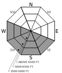
How to read the forecast

1. Low
?
Above 6500 ft.
1. Low
?
5000-6500 ft.
1. Low
?
3500-5000 ft.
- 1. Low
- 2. Moderate
- 3. Considerable
- 4. High
- 5. Extreme
-
Type ?
-
Aspect/Elevation ?
-
Likelihood ?CertainVery LikelyLikelyPossible
 Unlikely
 -
Size ?HistoricVery LargeLargeSmall

Last weeks storm totals varied widely across the area. Many areas saw only minimal accumulations, but portions of the Flathead and the Swan Range received 8-12". Despite recent mild and sunny weather, this snow has remained relatively dry on shaded aspects. Small wet snow instabilities may develop if today's rain showers exceed forecasted amounts, or the freezing level climbs into the mid-elevation band. Natural or triggered rollerballs will be an obvious clue that this snow is becoming moist. Sunny aspects have a granular corn snow surface offering a safer alternative.
-
Type ?
-
Aspect/Elevation ?
-
Likelihood ?CertainVery LikelyLikelyPossible
 Unlikely
 -
Size ?HistoricVery LargeLargeSmall

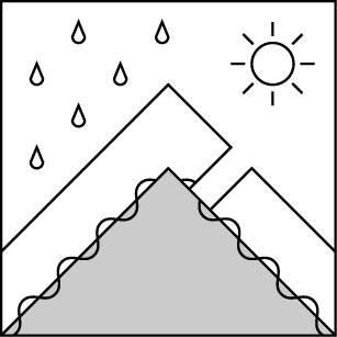
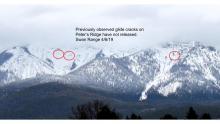
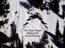
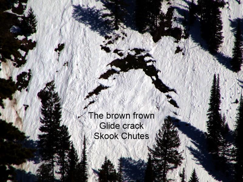
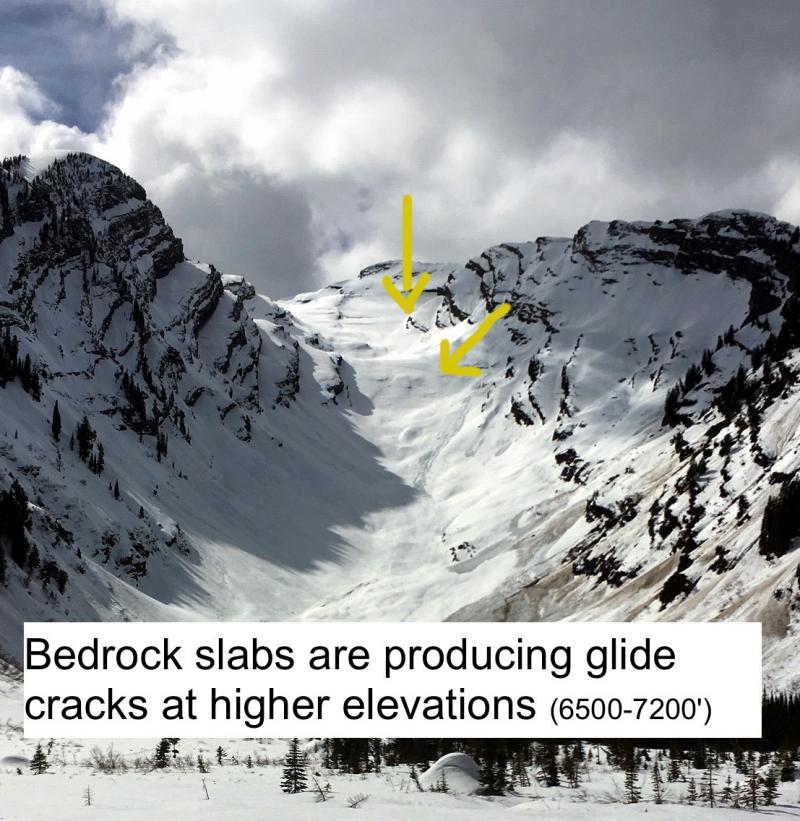
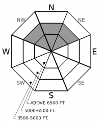
Glide avalanches and developing glide cracks have been noted on sunny aspects throughout our area. The crack forms when the season's snowpack slowly moves downslope, separating itself from the snow above. Predicting when a glide crack will fail is difficult. Failure is often catastrophic and avoiding slopes harboring glide cracks is the best way to manage this uncertainty.
Observations continue to trickle in of snow amounts from last weeks storms. Most areas seem to have received just a few inches with outliers in the Flathead (Example 1, Example 2) and the Swan Range reporting 8-12". On shaded aspects, this snow is remaining dry and offering good riding conditions. At some point, this snow will moisten and may develop wet snow instabilities. This could either be from rain or a greenhouse effect. Today's light rain amounts and freezing levels do not seem to be enough to create a wet snow problem. If rain amounts exceed forecasted totals or the freezing line creeps up in elevation, that will change. Expect instabilities to be generally small but more consequential in long-running gullies and above terrain traps. The angle of the sun is still not high enough for solar to be an influence on its own. One concern with above freezing temperatures and clouds is a greenhouse effect. The clouds reflect radiation back to the snow surface, melting it much faster than might be expected. It doesn't look like that will be a problem today. A good example of what could happen under these conditions was Zach's visit to the Flathead Range a week ago.
The late winter/spring snowpack in NW Montana generally presents us with glide avalanche problems. Numerous glide avalanches and glide cracks have been noted on sunny aspects over the past several weeks. These are generally located on slopes with a beargrass or smooth rock surface and occur on the same slopes each year. Glide avalanches can fail whenever their flanks or base lose the strength needed to support the slabs. Forecasting glide slab release is extremely difficult. The best course of action is to stay out from under them and enjoy slopes that remain covered in snow.
EDUCATION: The Scoop on Spring Touring: Curious about spring snow and safe travel techniques? This is the talk for you. Join FAC Lead Forecaster Blase Reardon for a FREE one hour talk on spring conditions in the Flathead. The talk begins at 6:30 p.m. Thursday, April 11th at Rocky Mountain Outfitters in Kalispell. That evening is also a community night for the Friends of the Flathead Avalanche Center at Sweet Peaks in Kalispell. Stop by for a sweet treat and then head down the street to get the scoop on spring conditions.
Overcast skies with light snow above 5000' and light rain below that.
This forecast applies only to backcountry areas outside established ski area boundaries. The forecast describes general avalanche conditions and local variations always occur. This forecast expires at midnight on the posted day unless otherwise noted. The information in this forecast is provided by the USDA Forest Service who is solely responsible for its content.


