| Saturday | Saturday Night | Sunday | |
|---|---|---|---|
| Cloud Cover: | Mostly Clear | Partly Cloudy | Mostly Cloudy |
| Temperatures: | 40 to 50 deg. F. | 25 to 30 deg. F. | 35 to 45 deg. F. |
| Wind Direction: | Southwest | Sout | South |
| Wind Speed: | Around 5 | Around 5 | 5 to 10, Gusting to 20 |
| Snowfall: | 0 in. | 0 in. | Trace in. |
| Snow Line: | 4500 | 5000 | 4500 |
Whitefish Range
Swan Range
Flathead Range and Glacier National Park
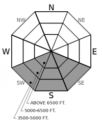
How to read the forecast

1. Low
?
Above 6500 ft.
1. Low
?
5000-6500 ft.
1. Low
?
3500-5000 ft.
- 1. Low
- 2. Moderate
- 3. Considerable
- 4. High
- 5. Extreme
-
Type ?
-
Aspect/Elevation ?
-
Likelihood ?CertainVery LikelyLikelyPossible
 Unlikely
 -
Size ?HistoricVery LargeLargeSmall

After several nights of hard re-freezing, wet snow avalanches are unlikely. Steep slopes near rocky outcrops and trees may thaw and produce isolated, small sluffs in the afternoon. Rollerballs and sinking into wet snow are signs of instability. You can avoid the problem, and find better riding, by heading for lower-angled slopes where the snow surface remains supportable.
-
Type ?
-
Aspect/Elevation ?
-
Likelihood ?CertainVery LikelyLikelyPossible
 Unlikely
 -
Size ?HistoricVery LargeLargeSmall

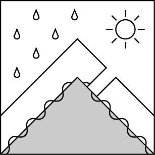
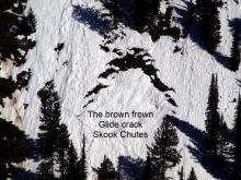
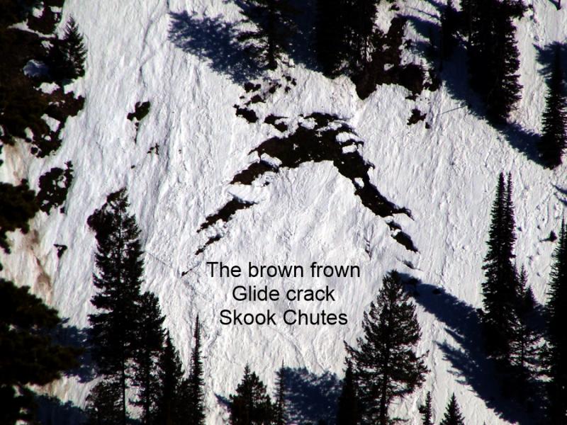
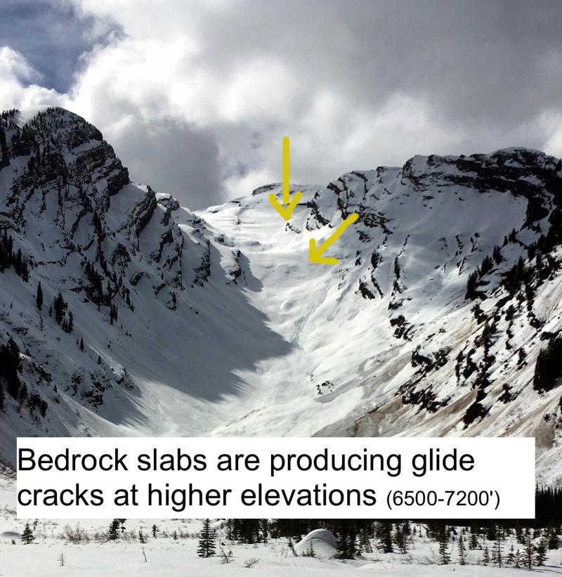
Glide cracks are the gaping, down-curved gaps where a slab of snow has pulled free from the snow upslope. The snow downhill of the slab is often wrinkled. They release when the snow at their flanks and base becomes saturated and weakens. That's hard to predict, so stay out from under these brown frowns.
We are on two nights in a row with a solid re-freeze at all elevations. Most of our snowpack has been through the melt-freeze cycle several times since the 17th, when low elevation, southerly slopes first became wet and saturated. The evidence is obvious from the carnage of the last wet avalanche cycle. Destructive sluffs and slabs began to fail at higher and higher elevations. The full depth of the snowpack became saturated. The last reports we have of avalanches came in around the 25th as low elevation, northerly, slopes finally produced enough melt water to sluff off wet snow. What remains is a snowpack that has mostly reached equilibrium – that and a lot of debris.
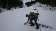
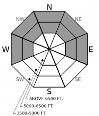
Broadly speaking, there are three states of the current snowpack. On north aspects, at middle and upper elevations, the snowpack remains dry. Yesterday, observers found wintry snow above about 6000 feet with minimal sun and wind effects (Flathead Range/East of the Divide). Below that elevation, and on southerly slopes, riders have been finding spring corn (example 1/example 2). On isolated slopes, generally at middle elevations and on W-NW and NE-E aspects, the snowpack may still be in transition. Since the 26th, a few inches of new snow has fallen above about 5000 feet.
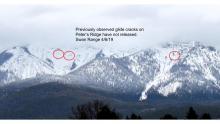
High pressure and lots of sunshine today will start the melt-freeze cycle again. Newer snow may moisten and produced some small sluffs. Surface crusts may break down on sunny aspects. But I don’t expect enough new melt water to create large or widespread instabilities. The wildcards are the big glide cracks that have opened up as the entire snowpack creeps downhill. Glide avalanches can fail whenever their flanks or base lose the strength needed to support the slabs. Forecasting glide slab release is extremely difficult. The best course of action is to stay out from under them and enjoy slopes that remain covered in snow.
EDUCATION: The Scoop on Spring Touring: Curious about spring snow and safe travel techniques? This is the talk for you. Join FAC Lead Forecaster Blase Reardon for a FREE one hour talk on spring conditions in the Flathead. The talk begins at 6:30 p.m. Thursday, April 11th at Rocky Mountain Outfitters in Kalispell. That evening is also a community night for the Friends of the Flathead Avalanche Center at Sweet Peaks in Kalispell. Stop by for a sweet treat and then head down the street to get the scoop on spring conditions.
Today begins a brief stretch of high pressure across the region with light winds and moderating daytime temperatures through Sunday. A change is expected early next week, but details are still unclear.
This forecast applies only to backcountry areas outside established ski area boundaries. The forecast describes general avalanche conditions and local variations always occur. This forecast expires at midnight on the posted day unless otherwise noted. The information in this forecast is provided by the USDA Forest Service who is solely responsible for its content.


