Forecaster Observation - Red Meadow, northern Whitefish Range

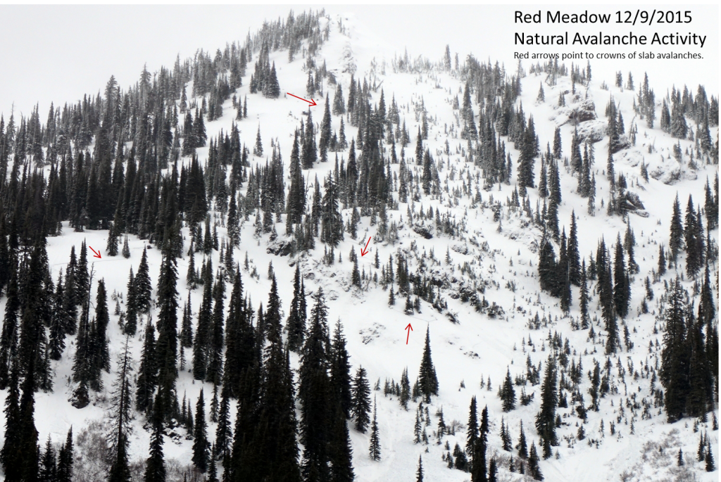
Location Name: 
Forecaster Observation - Red Meadow, northern Whitefish Range
Region: 
Whitefish Range - Northern (north of Coal Creek)
Date and time of avalanche (best estimate if unknown): 
Wed, 12/09/2015 - 11:00
Location Map: 


Red Flags: 
Recent avalanche activity
Recent loading by new snow, wind, or rain
Rapid warming
Obvious avalanche path

Observation made by: Forecaster
Avalanche Observations
Avalanche Type: 
Wet
Dry
Slab
Loose/Point-Release
Trigger type: 
Natural
Crown Height: 
1 ft
Avalanche Width: 
100ft.
Terrain: 
Above Treeline
Elevation: 
6 300ft.
Bed Surface: 
Old Snow
Avalanche Length: 
600ft.
More detailed information about the avalanche: 

Numerous (~10 crowns observed near Red Meadow Lake) natural avalanches size D1-D2. One large avalanche on Red Meadow Peak (directly above the lake) traveled ~1600-1800 vertical feet depositing debris in the lake. We also observed numerous smaller slab avalanches on nearby Link Mountain. We did not investigate the crown of the slides as there were still adjacent slopes that had not yet slid. We stayed off of and out from under slopes greater than 30 degrees today.

Avalanche Photos: 
Avalanche observation video: 

December 9, 2015 - Avalanche Warning, Red Meadow

Weather Observations
Blowing Snow: 
Yes
Cloud Cover: 
100% of the sky covered by clouds
Air temperature: 
Above Freezing
Wind Speed: 
Strong (Whole trees in motion)
Precipitation: 
Rain
Air temperature trend: 
Static
Wind Direction: 
Southwest
More detailed information about the weather: 

It was very wet out there today. However, we observed lots of wind loading above 7000 feet in the area where it likely snowed instead of rained. Wind slabs will still be a problem for a bit. Winds were strong even at Red Meadow lake elevation (~5600 feet).

Activity: 
Snowmobiling