Avalanche Observation - Peak 6996, southern Glacier National Park

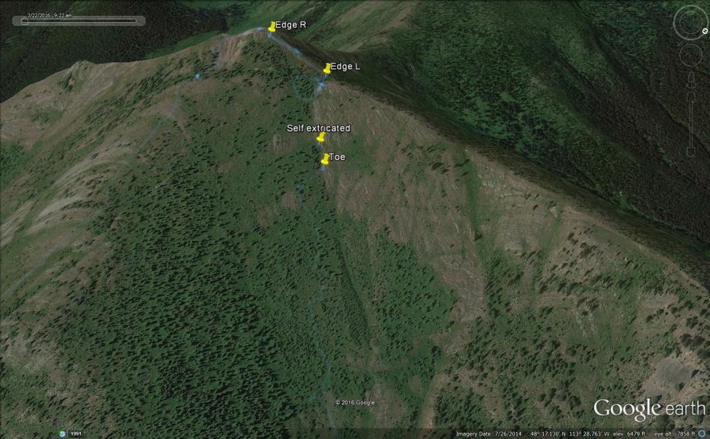
Location Name: 
Avalanche Observation - Peak 6996, southern Glacier National Park
Region: 
Flathead Range/Glacier National Park - John F. Stevens Canyon
Date and time of avalanche (best estimate if unknown): 
Fri, 03/18/2016 - 12:05
Location Map: 


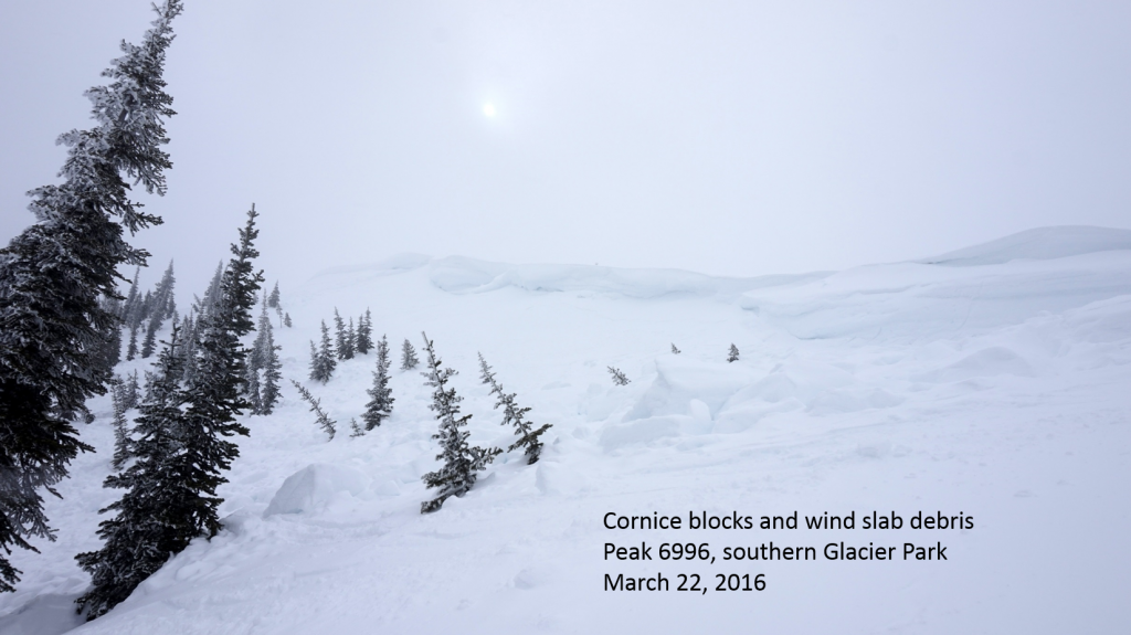
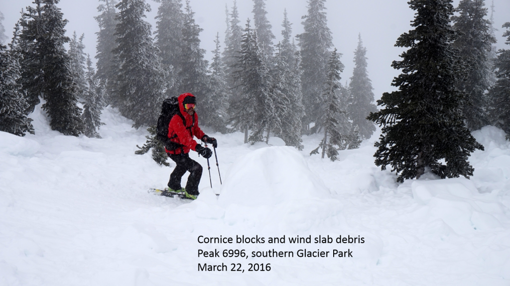
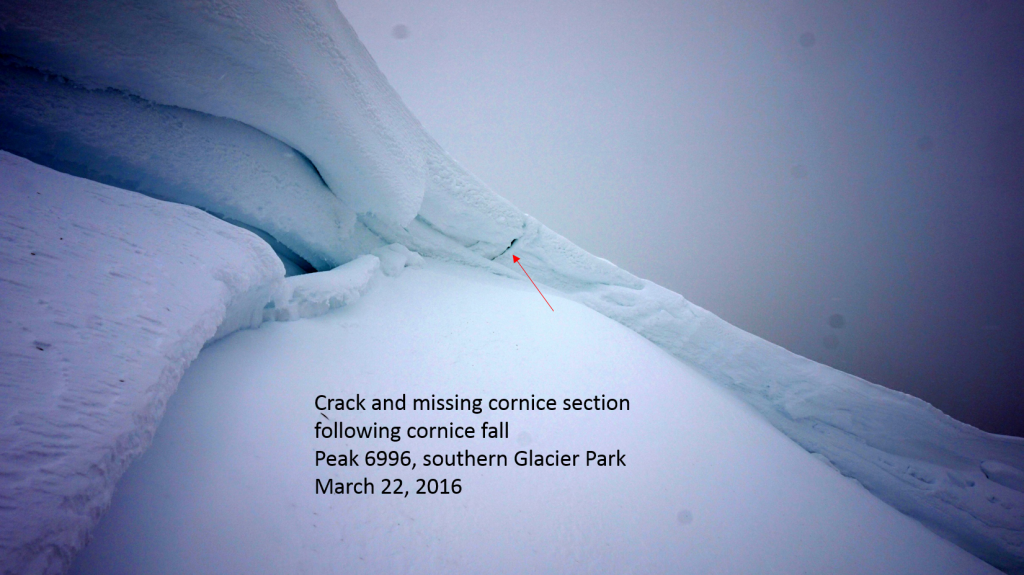
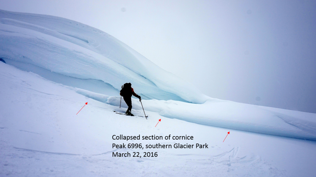
Red Flags: 
Recent loading by new snow, wind, or rain
Obvious avalanche path

Observation made by: Forecaster
Avalanche Observations
Avalanche Type: 
Dry
Slab
Slope: 
45degrees
Trigger type: 
Snowboarder
Crown Height: 
2 ft
Aspect: 
Northeast
Weak Layer: 
Other - explain below
Avalanche Width: 
270ft.
Terrain: 
Above Treeline
Elevation: 
6 980ft.
Bed Surface: 
Other - explain below
Avalanche Length: 
400ft.
Number of people caught: 
1
Number of partial burials: 
0
Number of full burials: 
0
More detailed information about the avalanche: 

A male snowboarder reported an avalanche to the avalanche center on Friday, March 18, 2016. The reporting party stated he started a slide on Peak 6996 in southern Glacier National Park on an east-northeast aspect. His account of the incident is listed below.

He launched from the top and was a couple of turns into the bowl when he saw a crack shoot left and slightly behind him up to the cornice. He remembers at least two sections of cornice falling in his peripheral vision. He said it quickly became like a pool of water all around him. He grabbed a tree and deployed his airbag but the force and weight of the snow pulled him off. He remembers his snowboard acting like an anchor pulling him down. He was drug through the trees and took shots to his board, ankle, pelvis and upper body. At one point he was completely enveloped. He remembered being face down and feeling very vulnerable - hoping not to hit another tree in that position. He described making a concentrated and forceful movement that was able to return him to the surface. It was still moving when he got upright and moved out of the slide. He curved right over and through the still moving debris (toe) and into the trees where he was joined by his two other companions. 

FAC staff (Mark Dundas), one FAC volunteer and a NPS Ranger (Jason Griswold) did a follow up on this incident March 22, 2016.

  • The avalanche initiated in a steep (45 degree) wind loaded northeast aspect 16 vertical feet below the summit of Peak 6996
  • The wind slab was 18 inches (45 cm) thick and ranged from 4F hard (top) to 1F hard (bottom)
  • There was a thin (<1 cm) layer of facets at the base of the slab which acted as the weak layer
  • Below the facets was a 1 cm thick P hard rain crust formed 3/12-3/13. This was the bed surface
  • Stability test results at the crown: ECTP 16 Q1, ECTP 27 Q1, ECTP 21 Q1

The wind slab avalanche propagated skiers left to a sizable cornice.  Portions of the cornice broke off and tumbled down the path.

  • The combination wind slab and cornice debris traveled approximately 400 vertical and 660 linear feet
  • The width of the slide was 270 feet
  • The snowboarder's place of arrest/self extrication was 560 linear feet from the crown

The snowboarder reported minor injuries to his ankle and pelvis and his snowboard was damaged. He was able to ride out to the trailhead under his own power.

  • FAC and NPS staff would like to thank the snowboarder involved for initially alerting us to this incident and for his subsequent openness to sharing information concerning this accident with us.
Avalanche Photos: 
Weather Observations
Blowing Snow: 
No
Cloud Cover: 
Clear
Air temperature: 
Below Freezing
Wind Speed: 
Light (Twigs in motion)
Precipitation: 
None
Air temperature trend: 
Warming
Wind Direction: 
Southwest
Accumulation rate: 
None
More detailed information about the weather: 

The day of the avalanche was the first fully clear and sunny day after over a week of stormy/unsettled weather. The prior week deposited 16-20 inches of new snow over an old crust over a period of 5 days. Moderate average winds with strong gusts accompanied the series of storms over the week.

Activity: 
Snowboarding