| Saturday | Saturday Night | Sunday | |
|---|---|---|---|
| Cloud Cover: | Mostly Cloudy | Mostly Cloudy | Mostly Cloudy |
| Temperatures: | 21 to 26 deg. F. | 18 to 21 deg. F. | 24 to 30 deg. F. |
| Wind Direction: | West | Southwest | Southwest |
| Wind Speed: | 12 | 14G25 | 16G32 |
| Snowfall: | 0" in. | 0" in. | 2" to 3" in. |
| Snow Line: | 2000' | 2500' | 3000' |
Whitefish Range
Swan Range
Flathead Range and Glacier National Park
How to read the forecast
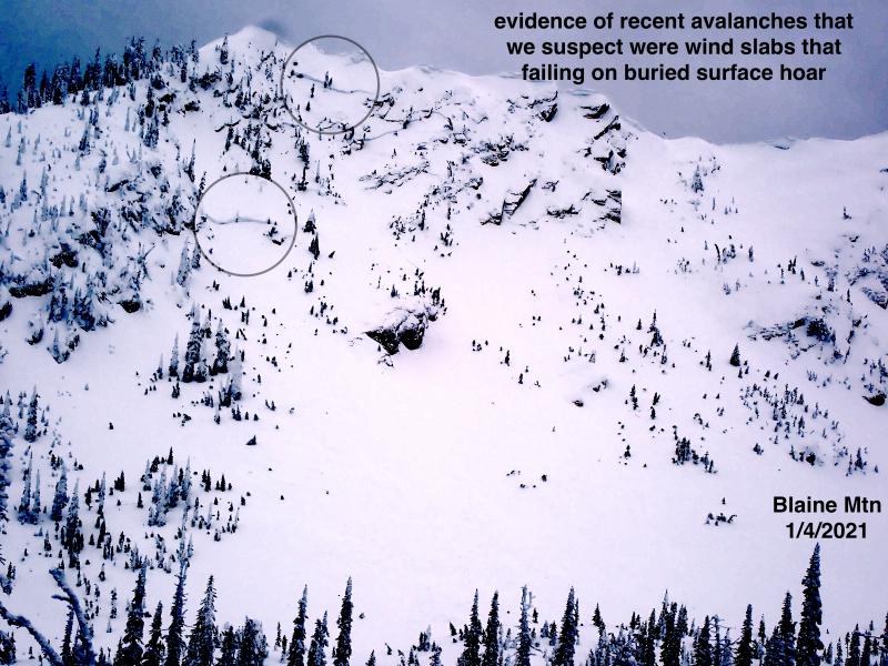
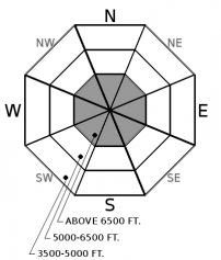
On steep slopes where the snow surface isn't a thick, hard crust, you can still trigger slides that break 1 to 3 feet deep on weak layers buried by this week's storm. Reduce your risk of triggering a slide by sticking to slopes less than 35 degrees that have runouts free of obstacles. The hard, slick rain crust makes for difficult travel and slide-for-life conditions on other steep slopes.

2. Moderate
?
Above 6500 ft.
1. Low
?
5000-6500 ft.
1. Low
?
3500-5000 ft.
- 1. Low
- 2. Moderate
- 3. Considerable
- 4. High
- 5. Extreme
-
Type ?
-
Aspect/Elevation ?
-
Likelihood ?CertainVery LikelyLikelyPossible
 Unlikely
 -
Size ?HistoricVery LargeLargeSmall

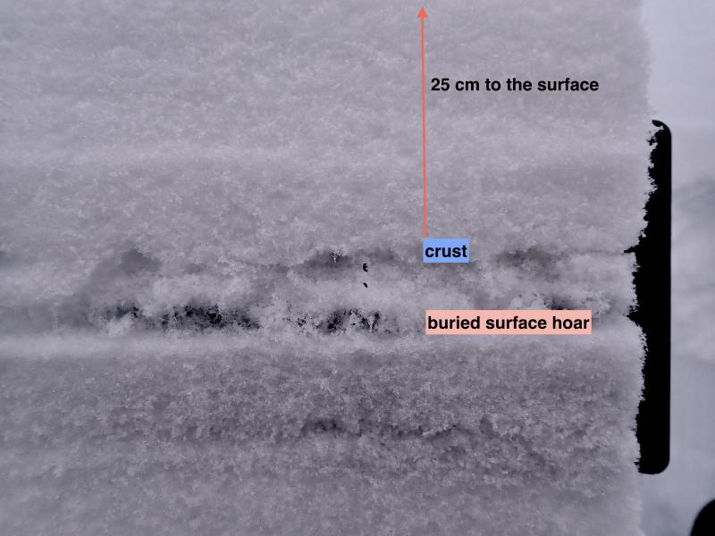
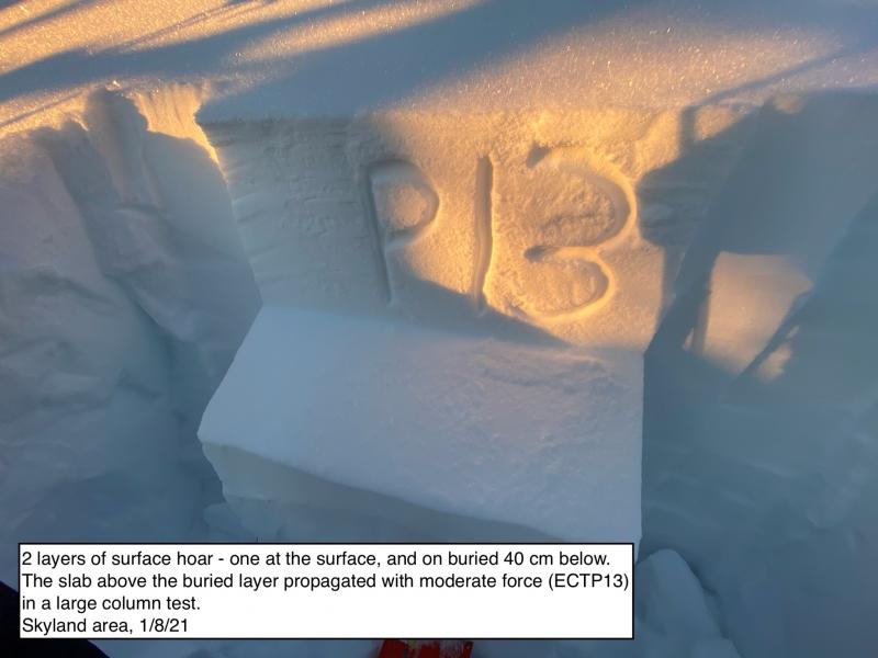
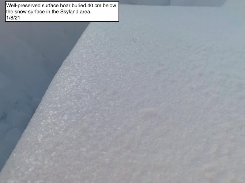
Finding slopes without the 1/13 rain crust will be bittersweet. Rejoice at the improved riding conditions. But be leery of slopes steeper than about 35 degrees, where it's still possible to trigger dangerous avalanches that break on persistent weak layers. The most reactive is a layer of surface hoar buried by this week's snow. It's reported to be a foot or so down. Shaded slopes that didn't avalanche during the storm may also harbor another layer of surface hoar now buried 2 to 3 feet down. At mid elevations, these hazards are isolated. Choose well-supported, planar slopes with runouts free of trees, rocks, gullies and other consequence magnifiers.
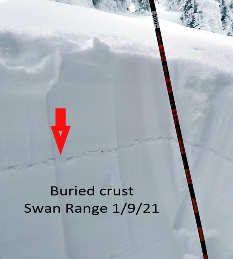
Cliff notes to Chapter 1 of this winter are here. Chapter 2 will be all about the crust deposited on Jan. 13. Right now, the potential for triggered slides is higher on slopes where the crust is not present. Any weak layers that develop around the crust will become a significant concern as a slab accumulates above them.
Friday, observers reported the crust to 7000 feet in the Lake McDonald area and John F. Stevens Canyon, and even to 7500 feet near the Continental Divide. In contrast, a report from the southern Whitefish Range described the surface as "wind pressed and dense snow," which may have buried the crust. In the northern Whitefish Range, the crust was reported up to 6200 feet on Thursday. It extends to at least 7000 feet in the northern Swan Range.
Where the crust isn't present, observers are finding a reactive layer of surface hoar at the old snow/ storm snow interface about a foot below the surface. It's producing propagation in large column tests. Tests aren't propagating where that interface doesn't include surface hoar. To reduce your chances of triggering slabs on this layer, stick to well-supported slopes less than about 35 degrees, ride one a time, and keep your partner in sight. At mid-elevations, this hazard is confined to the isolated slopes where the Jan. 13 crust is thin or non-existant. At upper elevations, expect it to be widespread on shaded slopes.
Weak layers that were leading characters in Chapter 1 have faded to the background. These include the crust/ facets from Dec. 9, as well as other crust/ facet combos from around Christmas, and a surface hoar layer buried Dec. 30. These layers are generally dormant because crusts have deteriorated and the facets are rounding, or they're buried too deeply now to collapse with the weight of a person or snowmachine. Or they've been capped by the Jan. 13 crust. Because of this, we've trimmed the size of potential slides in the Persistent Slab avalanche problem. In a few situations, I'd still be concerned about triggering large to very large slides that break on the Chapter 1 weak layers: booting up or down steep slopes where the snowpack is generally thin and I punch through the Jan. 13 crust. Windward slopes above about 6500 feet where the snow depths are highly variable and weak layers can be closer to the surface and more readily impacted by a person's weight.
Wind slabs deposited by extreme winds Wednesday have stabilized on most slopes, so we've removed them from the problem list. However, bring it back to your own list like a 90s trend if you find yourself on firm snow that's cracking around your boards or machines. The winds were extreme enough to snap the wind sensor off the mast at Snowslip weather station, so be alert for these leftover slabs in unusual places.
Many thanks to everyone who joined us for Thursday night's Topics talk with Cody Townsend. We appreciate your support of the Friends of Flathead Avalanche Center.
Fog and low-level stratus clouds over the valleys will make for a good reason to get up high, where you'll find pleasant conditions: light, westerly winds, seasonable temps, and partly to mostly cloudy skies. A weak system Sunday may bring 2-6 inches of new snow to the region.
This forecast applies only to backcountry areas outside established ski area boundaries. The forecast describes general avalanche conditions and local variations always occur. This forecast expires at midnight on the posted day unless otherwise noted. The information in this forecast is provided by the USDA Forest Service who is solely responsible for its content.


