| Friday | Friday Night | Saturday | |
|---|---|---|---|
| Cloud Cover: | Mostly Cloudy | Partly Cloudy | Mostly Cloudy |
| Temperatures: | 24 to 30 deg. F. | 15 to 18 deg. F. | 21 to 26 deg. F. |
| Wind Direction: | Southwest | West | Southwest |
| Wind Speed: | 14G28 | 12 | 12 |
| Snowfall: | 0" in. | 0" in. | 0" in. |
| Snow Line: | 3000' | 2500' | 1500' |
Whitefish Range
Swan Range
Flathead Range and Glacier National Park
How to read the forecast
You can still trigger slides that break 1 to 4 feet deep on steep slopes where a thick, hard crust doesn't exist at the surface. That hazard is relatively widespread at upper elevations, and isolated at mid elevations. You can reduce your risk of triggering a slide by sticking to slopes less than 35 degrees that have runouts free of trees, rocks, and gullies. The hard, slick rain crust makes for difficult travel and slide-for-life conditions on other steep slopes.

2. Moderate
?
Above 6500 ft.
1. Low
?
5000-6500 ft.
1. Low
?
3500-5000 ft.
- 1. Low
- 2. Moderate
- 3. Considerable
- 4. High
- 5. Extreme
-
Type ?
-
Aspect/Elevation ?
-
Likelihood ?CertainVery LikelyLikelyPossible
 Unlikely
 -
Size ?HistoricVery LargeLargeSmall

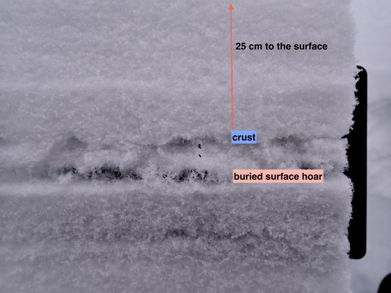
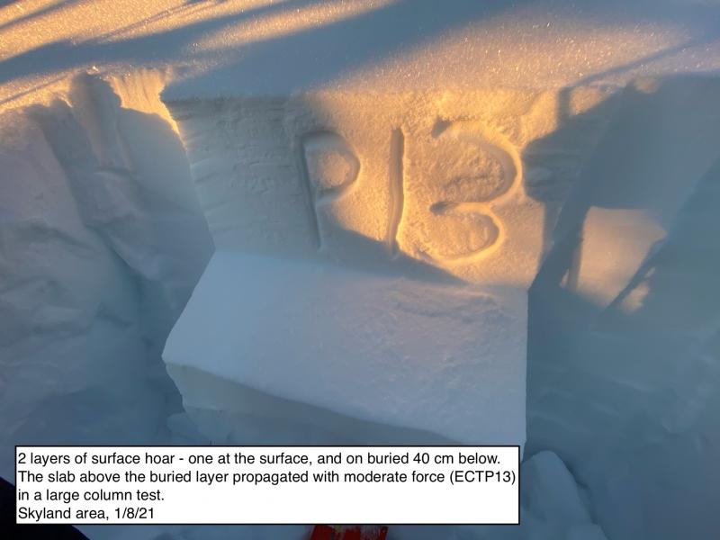
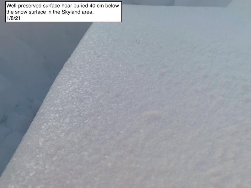
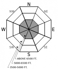
It's still possible to trigger dangerous avalanches that break on weak layers that formed earlier this season, prior to this week's storm. This lingering hazard is most widespread on steep, upper elevation slopes where the storm didn't deposit a hard rain crust on the surface and that haven't already avalanched. At mid elevations, these conditions are isolated. Identifying this terrain should be straightforward - it's terrain where the riding improves dramatically. Be leery about committing to shaded slopes steeper than about 35 degrees; these may harbor a layer of surface hoar that was reactive in tests and to a person's weight prior to the storm. Other persistent weak layers buried earlier in the season remain a concern.
-
Type ?
-
Aspect/Elevation ?
-
Likelihood ?CertainVery LikelyLikelyPossible
 Unlikely
 -
Size ?HistoricVery LargeLargeSmall

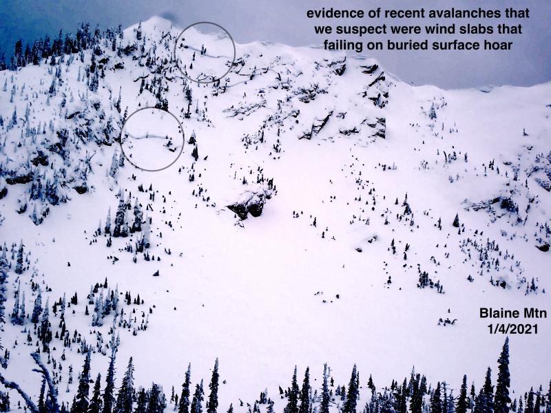
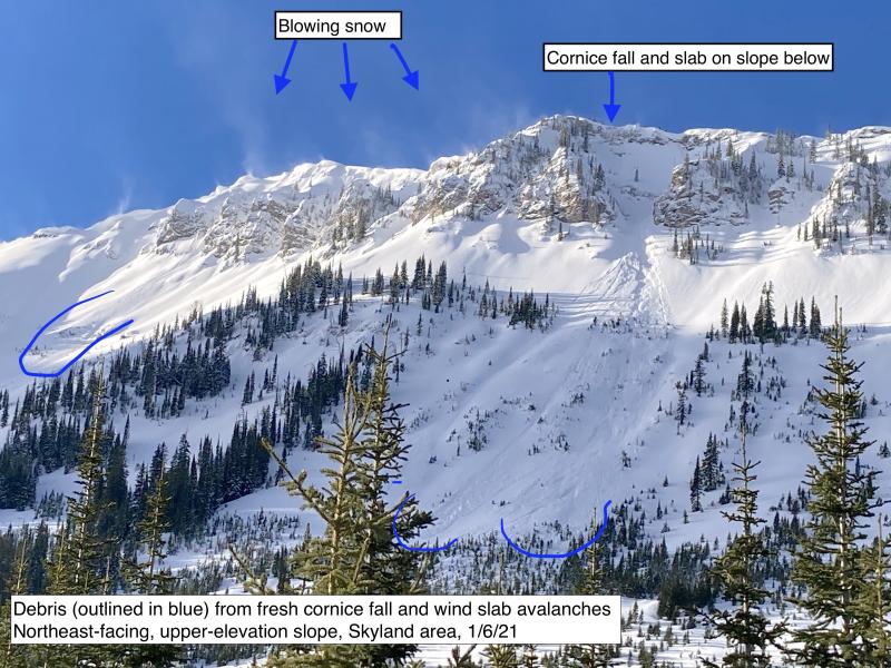
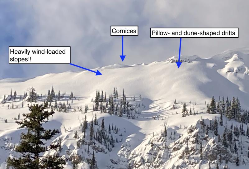
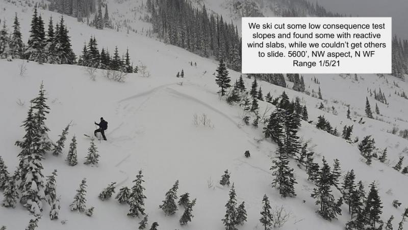
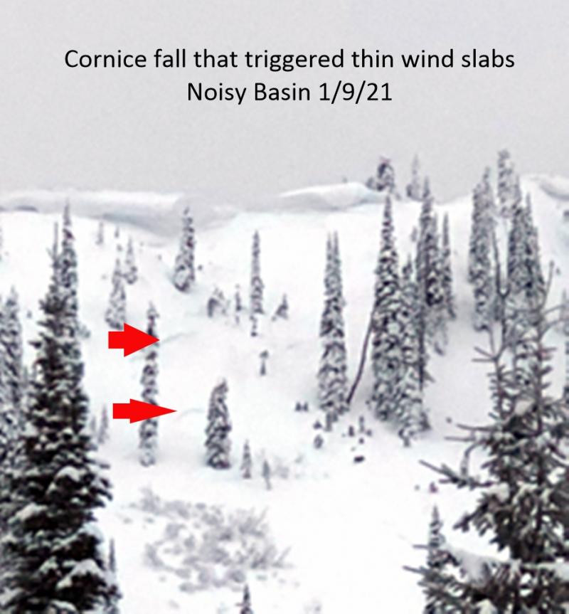
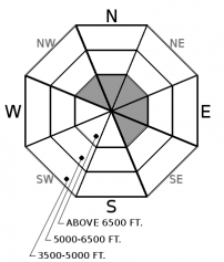
Recently-formed slabs of drifted snow continue to pose a hazard on steep slopes at upper elevations. These slabs are likely to be hard and unpredictable. They can break well above a person, or be triggered where they're thinner, such as their edges. Some may have formed after Wednesday's rain event, and those will be sitting on the hard, slick rain crust. Triggering these slabs will produce debris that runs far and fast, increasing the potential for injury if you're carried downslope. Avoiding recently-formed slabs is the most straightforward way to reduce your exposure to this hazard. Expect them at the tops of chutes, below cornices, on the lee sides of gullies, and on the downhill sides of mid slope convexities. Hollow-feeling snow and cracking are clear signs of this danger.
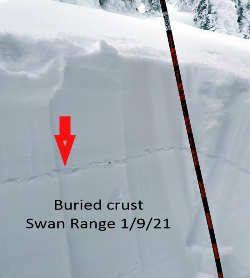
Oh, it was all going so well! Sure, the Bush down low was still thick. Higher, though, we had a deep snowpack with a few persistent weak layers that were mostly behaving predictably. Then an atmospheric river that actually delivered, instead of turning into a rivulet. 2+" inches of snow water equivalent, 10-15 inches or more of new snow. Then...pouring rain. A fast-moving cold front. And now, a 1- to 3-inch thick crust at the snow surface that exists up to at least 6200 feet. What a let down. It's as if Frodo lost The Ring.
Going forward, we gotta live with a Gollum snowpack. At this point, it seems the 1/13 rain didn't have much effect on layers below the storm snow. So the various persistent weak layers that have formed since early November haven't been destroyed. That crust is thick and very hard, and a person is unlikely to collapse a weak layer underneath it. That's still a possibility on higher elevation slopes where it doesn't exist. The 12/30 surface hoar, which was the most reactive layer prior to the Gollum-got-our-precious storm, is the suspect most likely to cause trouble. So be alert for any steep slope where the riding quality improves dramatically - where it feels like the Before Times - because the crust doesn't exist and it hasn't already avalanched. Those are slopes where your weight or the weight of your machine can trigger slabs of recent and drifted snow that break on older, persistent weak layers. Triggered slabs will be 1 to 4 feet thick, and involve more than enough new snow to bury or injure a person. We don't yet have exact elevations at which the crust ends. It seems to be as low as 6200 feet in the northern Whitefish Range, and over 7000 feet in the Swan Range further south.
It'll be worth keeping track of this ice crust as it gets buried. A few inches of snow followed by cold temperatures may produce a layer of facets above the crust, or above hard, slick bed surfaces. These are potentially dangerous structures once a slab consolidates above them.
For the detail-minded, here are some notes about the week's avalanche activity. As people (you!) report more slides, the picture may change. One caveat: few observers have reported from upper elevations, where wind-drifted snow may have filled many crowns.
* A widespread, mostly direct-action avalanche cycle. Dozens of D2-2.5 avalanches in all zones. A few D3s. Many R3s, with crowns < 2' but long propagation. Nothing larger yet reported.
* All aspects, with easterly most common. Many below ridgelines (rain line?), the largest (example) at ridges or below cornices and likely thicker due to top loading by winds.
* A few slabs that may have stepped down to/ released on old snow layers not far below pre-storm interface: Mt. Aeneas, Stanton Peak.
* Suspect 4 different mechanisms for slides: Direct action release during peak snowfall intensity early 1/13. Direct action release with rain-on-snow at end of storm Direct action from wind-loading (largest slides). Step downs/ deeper releases on buried SH ~45 cm below surface prior to storm, or possibly other near-surface PWL. No definitive evidence from images yet of slides breaking on older/ more deeply buried pwls (12/9, early Nov.)
Many thanks to everyone who joined us for last night's Topics talk with Cody Townsend. We appreciate your support of the Friends of Flathead Avalanche Center.
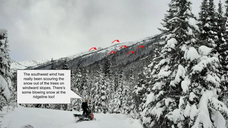
A weak system approaches from the coast. It looks to deliver a few inches of snow at most, and light to moderate westerly and southwesterly winds.
This forecast applies only to backcountry areas outside established ski area boundaries. The forecast describes general avalanche conditions and local variations always occur. This forecast expires at midnight on the posted day unless otherwise noted. The information in this forecast is provided by the USDA Forest Service who is solely responsible for its content.


