| Thursday | Thursday Night | Friday | |
|---|---|---|---|
| Cloud Cover: | Mostly Clear | Partly Cloudy | Partly Cloudy |
| Temperatures: | 18 to 24 deg. F. | 12 to 14 deg. F. | 23 to 29 deg. F. |
| Wind Direction: | West | Southwest | Southwest |
| Wind Speed: | 12 | 11 | 14G25 |
| Snowfall: | 0" in. | 0" in. | 0" in. |
| Snow Line: | 500' | 1000' | 2000' |
Whitefish Range
Swan Range
Flathead Range and Glacier National Park
How to read the forecast
Large and dangerous slabs are likely still unstable below the highest peaks and ridgelines today. Use terrain to limit your exposure to the overhead hazards from freshly-loaded starting zones and large avalanche paths. Below the most recent rain/snow line, a thick crust has locked up the snowpack and created slide-for-life conditions.

3. Considerable
?
Above 6500 ft.
2. Moderate
?
5000-6500 ft.
1. Low
?
3500-5000 ft.
- 1. Low
- 2. Moderate
- 3. Considerable
- 4. High
- 5. Extreme
-
Type ?
-
Aspect/Elevation ?
-
Likelihood ?CertainVery LikelyLikelyPossible
 Unlikely
 -
Size ?HistoricVery LargeLargeSmall

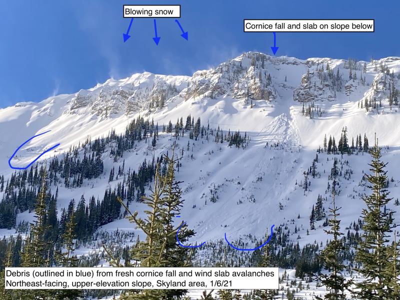
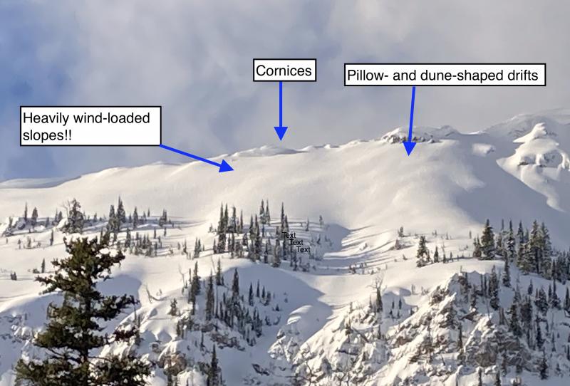
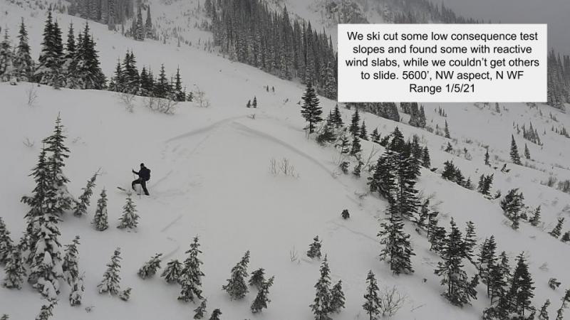
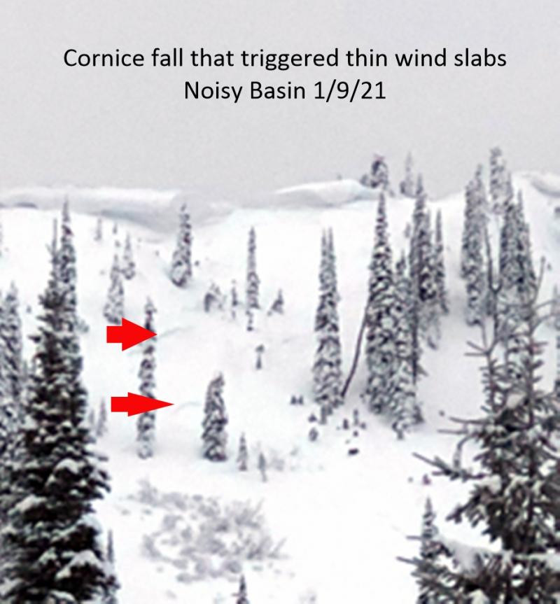
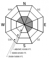
Wednesday's strong winds were no joke. They likely added to existing slabs below ridgelines and in the tops of high chutes. Extreme wind events can drift snow into unusual places. You may find the odd wind slab stretched behind stands of trees or below small rollovers. Look for round dunes and whale-shaped drifts. Eye the slopes below cornices with suspicion. They are the most likely place you’ll encounter sensitive wind slabs. They pose an overhead hazard at middle elevations where a thick crust will act as a smooth sliding surface for avalanche debris running down from upper elevation start zones.
-
Type ?
-
Aspect/Elevation ?
-
Likelihood ?CertainVery LikelyLikelyPossible
 Unlikely
 -
Size ?HistoricVery LargeLargeSmall

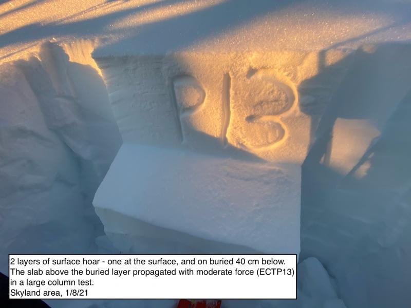
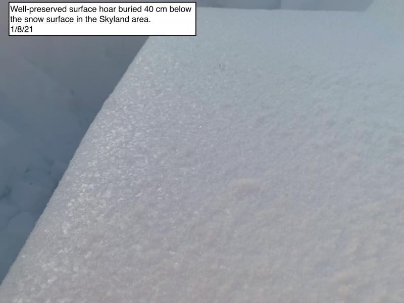
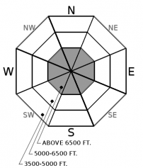
The mid-week storm has loaded and tested weak layers buried 1 to 5 feet deep. Below about 6800 feet, a thick crust has mostly shut down the possibility of avalanches failing on deeply buried weak layers. We're uncertain over how high the crust extends. Avalanches failing on deeper weak layers on the highest peaks may run down into lower elevations. On steep slopes where the crust doesn't exist rapid loading from drifted and new snow has thickened slabs sitting atop persistent weak layers. These may still release naturally today. Avoid terrain that leaves you exposed to large, steep, rocky starting zones.
The most recent storm came and went like a 12 car pile-up. Sudden, loud, with lots of carnage and whiplash left in its wake.
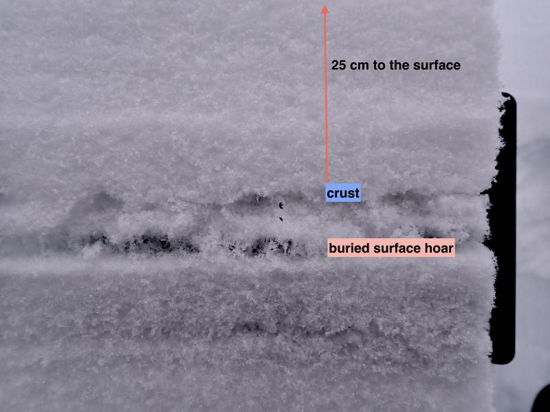
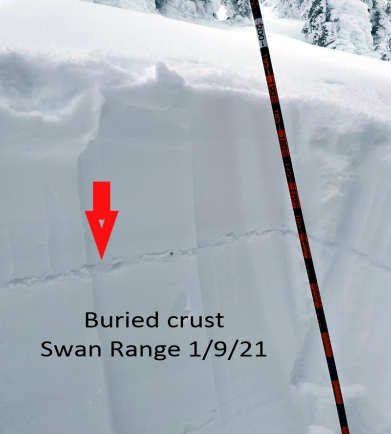
A widespread cycle of large natural avalanches occurred overnight on the 12th and ended abruptly Wednesday morning (example 1, example 2). Rain fell to around 6800 feet during the storm. The wet snow below this elevation refroze rapidly as a cold front with extreme winds passed. Below the rain/snow line, a thick, hard crust has capped the snowpack. At this point, we're uncertain about how high that crust extends. At least to 6000 feet, probably 6800 feet, and maybe higher.
Mid-elevation weather stations reported impressive storm totals during the event. Big Mountain came away with 2.6” of new water, Flattop Mountain got 2.4”, Stahl Peak totaled 2.1”, and Noisy Basin was soaked with 2.3” of snow water equivalent. Much of that precipitation likely fell as snow att the highest elevations of the Flathead Range, the northern Whitefish Range, and near the Continental Divide.
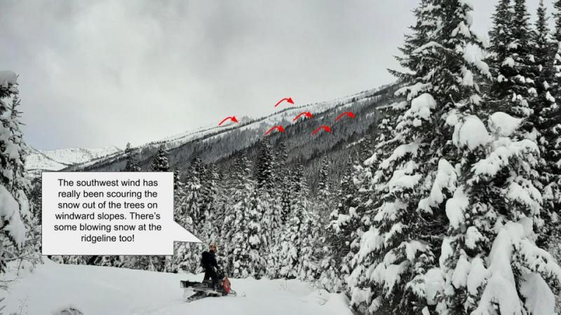
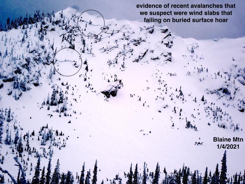
Winds gusted over 100 mph yesterday and redistributed snow onto leeward aspects. Some of it probably blew away entirely, but large slabs likely developed below alpine ridgelines and in isolated, unusual areas further down slope. These will be most likely on northerly and easterly aspects, but you may find the odd drift stretched downwind of trees or rollovers in unusual places. Wind slabs that formed quickly and recently are likely still sensitive to the weight of a person or snowmachine. If they fail in alpine starting zones, the debris will have a slick sliding surface and can run down into middle elevations.
Speaking of overhead hazards, all of that new loading has tested deep persistent weak layers buried in the snowpack. A thick new crust at the surface will make an avalanche failing on these layers very unlikely, and we’ve trimmed the distribution of persistent slabs to match. But, again, on the high peaks newly loaded slabs may be stressing faceted crusts from early winter. Avoiding exposure to steep, rocky, complex start zones and large avalanche paths is the safest way to give yourself a margin of safety.
To refresh yourself on how our weather and snowpack developed to this point, check out Mark's summary in our blog.
Cody Townsend is in town tonight! Well, virtually. He developed a presentation based on his recent effort to ski 50 Classic lines for tonight's talk.
Relatively quite weather will prevail today as brief ridging temporarily develops over the northern Rockies. The atmosphere will remain sunstable with some gusty winds at ridgetops, though nothing like yesterday. Skies should clear and alow for sunshine and seasonable temperatures. Light snow showers are expected again Firday evening.
This forecast applies only to backcountry areas outside established ski area boundaries. The forecast describes general avalanche conditions and local variations always occur. This forecast expires at midnight on the posted day unless otherwise noted. The information in this forecast is provided by the USDA Forest Service who is solely responsible for its content.


