| Monday | Monday Night | Tuesday | |
|---|---|---|---|
| Cloud Cover: | Mostly Cloudy | Mostly Cloudy | Mostly Cloudy |
| Temperatures: | 25 to 31 deg. F. | 22 to 25 deg. F. | 29 to 34 deg. F. |
| Wind Direction: | Southwest | Southwest | South |
| Wind Speed: | 16G33 | 16G31 | 23G35 |
| Snowfall: | 0" in. | 1" to 2" in. | 4" in. |
| Snow Line: | 3500' | 3500' | 3500' |
Swan Range
Flathead Range and Glacier National Park
How to read the forecast
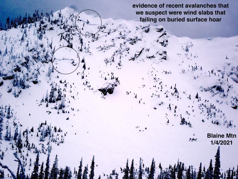
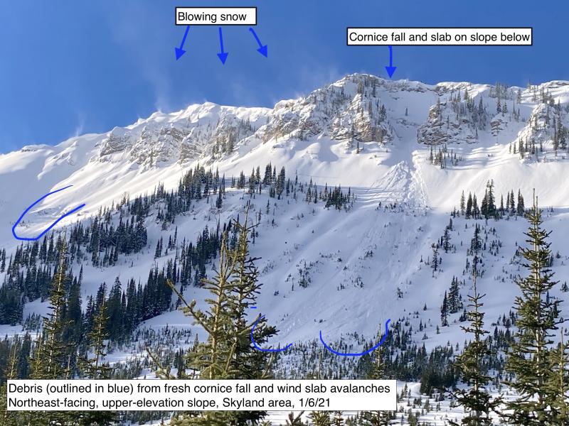
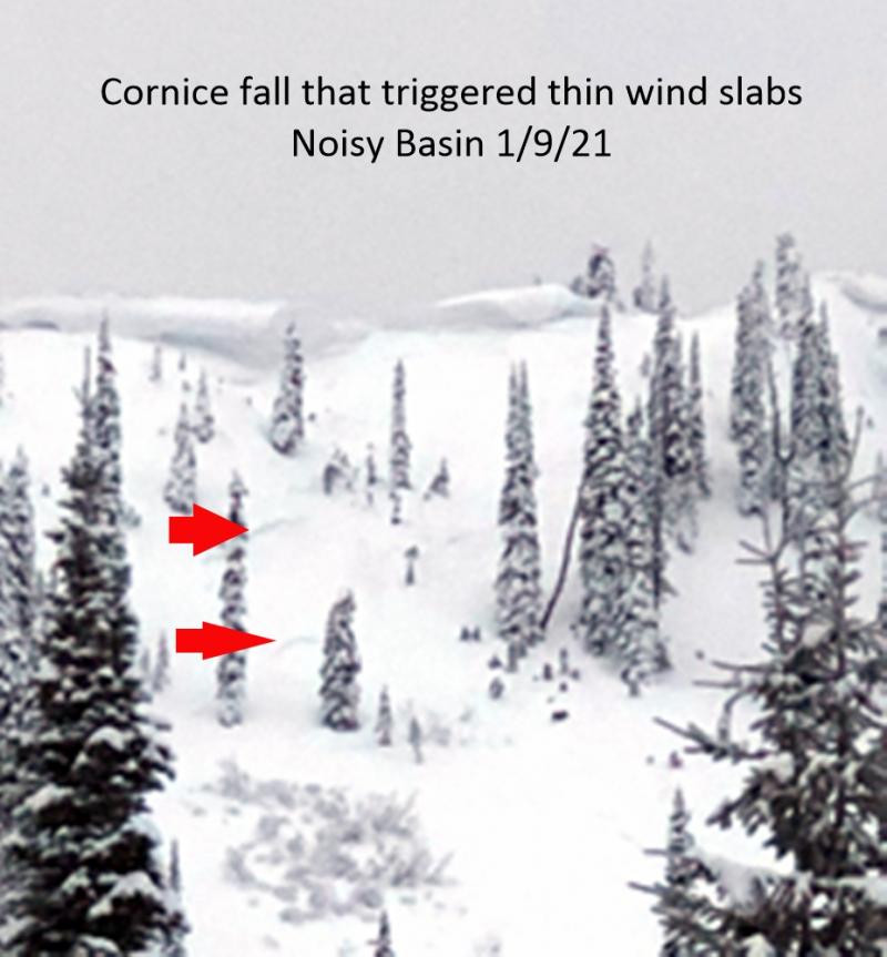
Slabs failing on persistent weak layers buried 1-4’ deep remains our primary concern. You are more likely to get into trouble where a more reactive layer of buried surface hoar exists. Choose well supported, planner, or concave slopes and avoid steep rollovers and rocky, thin alpine start zones. Avoid dawdling beneath cornices as recent failures have pulled out wind slab avalanches below.

2. Moderate
?
Above 6500 ft.
2. Moderate
?
5000-6500 ft.
1. Low
?
3500-5000 ft.
- 1. Low
- 2. Moderate
- 3. Considerable
- 4. High
- 5. Extreme
-
Type ?
-
Aspect/Elevation ?
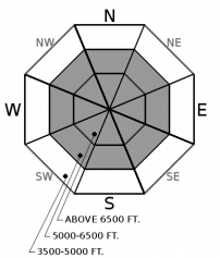
-
Likelihood ?CertainVery LikelyLikelyPossible
 Unlikely
 -
Size ?HistoricVery LargeLargeSmall

Although recent avalanche activity failing on persistent weak layers has been sparse, reactive snowpit tests continue to tell us that we are not out of the woods yet. Give yourself a margin for error if your travels take you into steeper terrain above roughly 5500 feet. Steer away from complex, rocky start zones and be cautious on steep rollovers. This is the kind of terrain where you are more likely to collapse a weak layer buried deeper in the snowpack.
-
Type ?
-
Aspect/Elevation ?
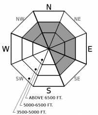
-
Likelihood ?CertainVery LikelyLikelyPossible
 Unlikely
 -
Size ?HistoricVery LargeLargeSmall

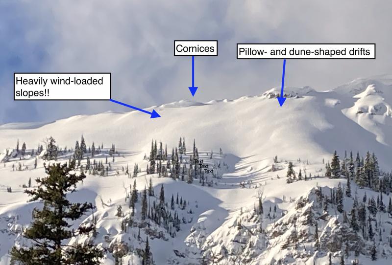
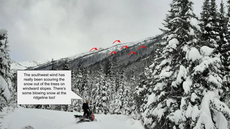
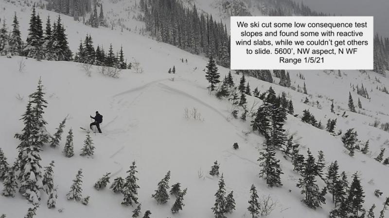
Observers continue to report recent slab avalanches on leeward facing aspects. Many of these avalanches were triggered by cornice fall. Identify and steer around areas that appear rippled, pillowy, and slopes just below corniced ridgelines. These are the areas where you are more likely to tango with a slab avalanche up to a foot thick. A safer and higher quality experience will be in terrain that is sheltered from the wind.
If you are an active reader here, you will know that the recent theme has been persistent slab and wind slab avalanche problems. Wind slabs are proving to be stubborn to unreactive and should be easy to manage. Be cautious around obviously wind loaded slopes below ridgelines and in cross-loaded terrain features. What is much less straightforward are the multiple persistent weak layers buried in the snowpack. Below I will break down each layer and what we know so far.
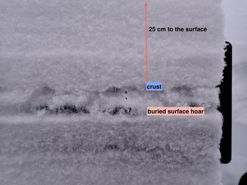
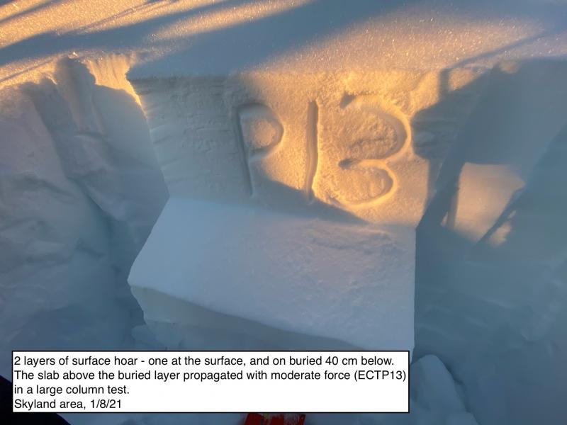
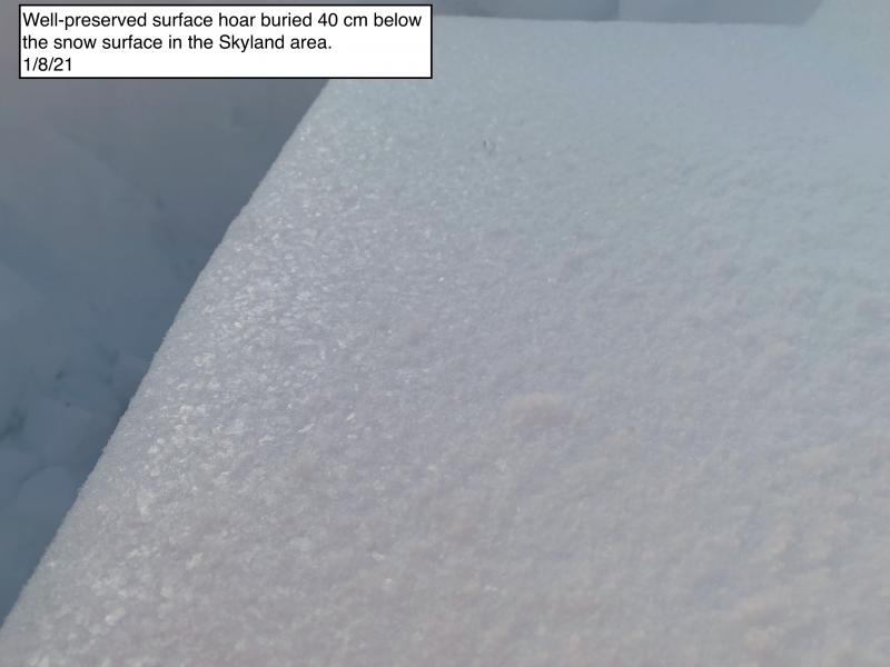
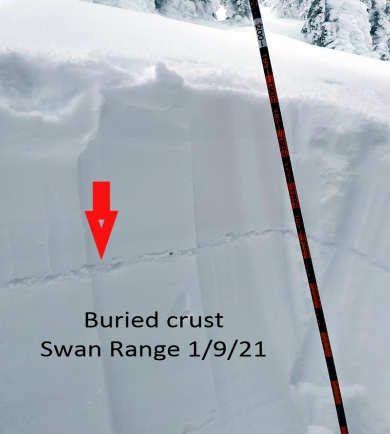
The layer of most recent concern is a reactive layer of surface hoar found roughly 2 feet below the surface. This layer is found mostly in the Swan and Flathead Ranges. In those ranges, observations continuously trickled in with people getting full propagation in extended column tests (Flathead observation, Swan observation). Last week in the Northern Whitefish Range, Clancy and Guy found avalanches that failed on a layer of buried surface hoar. This layer is likely from the same crop as the ones found in the other ranges. In the southern Whitefish Range yesterday, Jeremy and I dug on almost every aspect and could not find it. This tells us that it is likely more spotty in the Whitefish Range, and more widespread throughout the Swan and Flathead Ranges. Although there is a recent lull in reported avalanches, the structure and results in snowpit tests are enough to persuade me to choose simple terrain for the time being.
The other two layers of concern are found deep in the snowpack. They are both crust/facet combinations from December 9th and one from early November. The more problematic layer is around the December 9th crust. This layer is particularly unique because in some locations there is a well-preserved surface hoar sitting on the crust. This was the culprit of numerous human and naturally triggered avalanches throughout the forecast area, specifically in the southern Whitefish Range and the Flathead Range. The most recent action is from our friendly, yet so distant neighbors to the north. On Saturday, explosive testing near Fernie triggered several large persistent slab avalanches that failed on a crust/facet combination that was buried in early December. Though they are relatively far away, we share a strikingly similar snowpack structure.
The early November crust/facet combination has been a bit stubborn. Other than the rain event on December 22nd, we have received little feedback. One thing that is for sure, when, and if this layer fails, expect a very large avalanche. I anticipate it will take a significant loading event to cause this layer to fail. That loading event could come in the form of snow and wind, rain, a smaller avalanche, or worse of all, a rider hitting a shallow, weak spot on a slope.
We will see changing avalanche conditions with an incoming atmospheric river that is expected to impact the area Tuesday and into Wednesday. We greatly appreciate the influx of observations with helping us track persistent weak layers and surface conditions. This is the kind of “new normal” we can get used to.
Today expect mild temperatures with increasing winds as an atmospheric river makes its way into the area. No precipitation is expected during daylight hours.
This forecast applies only to backcountry areas outside established ski area boundaries. The forecast describes general avalanche conditions and local variations always occur. This forecast expires at midnight on the posted day unless otherwise noted. The information in this forecast is provided by the USDA Forest Service who is solely responsible for its content.


