| Friday | Friday Night | Saturday | |
|---|---|---|---|
| Cloud Cover: | Partly Cloudy | Mostly Cloudy | Mostly Cloudy |
| Temperatures: | 27 to 33 deg. F. | 13 to 18 deg. F. | 21 to 27 deg. F. |
| Wind Direction: | South | Southwest | West |
| Wind Speed: | 8 | 5 | 7 |
| Snowfall: | 0" in. | 0" in. | 0" in. |
| Snow Line: | 3000' | 2500' | 2500' |
Flathead Range and Glacier National Park
How to read the forecast
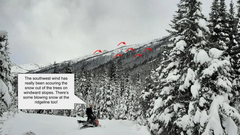
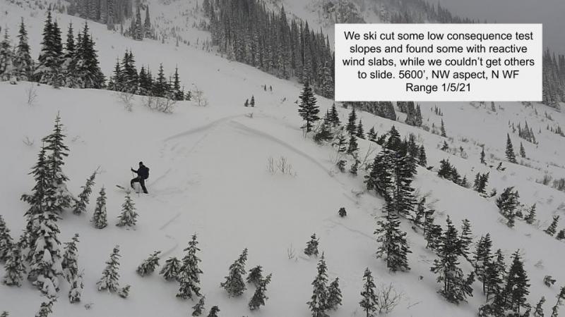
Triggering recently-formed slabs of drifted snow remains possible on steep, upper-elevation slopes. These can break 1 to 3 feet deep. Sticking to slopes sheltered from southwesterly winds goes a long way towards avoiding this hazard, and towards finding the best riding conditions. Reduce your exposure to the lingering hazard of avalanches that break on buried weak layers by riding slopes less than about 35 degrees.

2. Moderate
?
Above 6500 ft.
2. Moderate
?
5000-6500 ft.
1. Low
?
3500-5000 ft.
- 1. Low
- 2. Moderate
- 3. Considerable
- 4. High
- 5. Extreme
-
Type ?
-
Aspect/Elevation ?
-
Likelihood ?CertainVery LikelyLikelyPossible
 Unlikely
 -
Size ?HistoricVery LargeLargeSmall

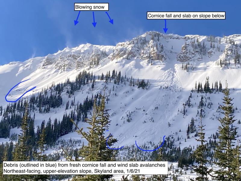
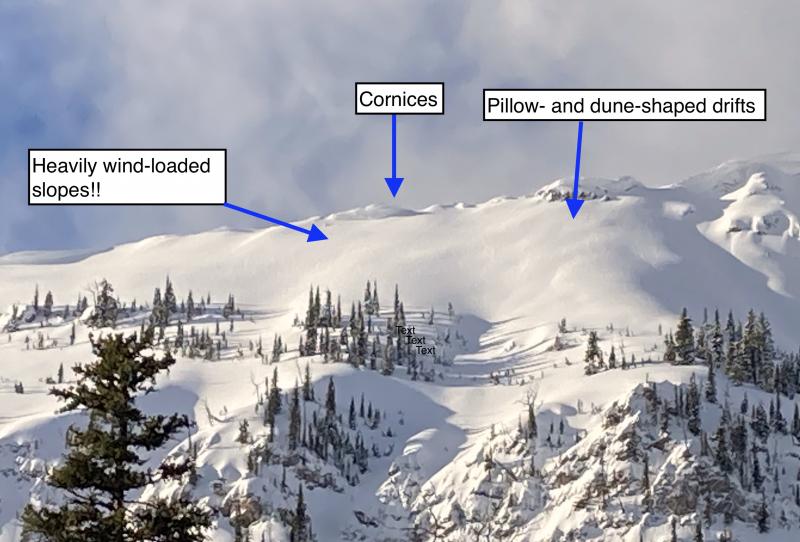
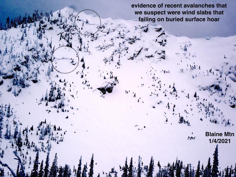
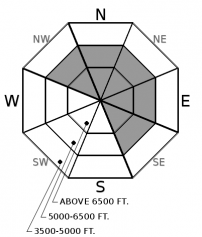
Although we'll have a respite from strong westerly winds today, you can still trigger dense slabs of recently-drifted snow on steep, leeward slopes. These can break 1 to 3 feet deep. The most recent slabs should be soft but may run fast and far on a recently-formed crust. Older generations of these slabs may, like older generations of a Mafia family, be harder, less predictable, and more dangerous. Look for dunes and whale-shaped drifts on steep slopes prone to collecting drifted snow: the downwind sides of saddles in ridges, along the leeward sides of gullies, and behind rocky outcrops. This hazard is isolated at mid-elevations, except in the windier, southeastern corner of our forecast region - Stevens Canyon, Marias Pass, and Skyland.
-
Type ?
-
Aspect/Elevation ?
-
Likelihood ?CertainVery LikelyLikelyPossible
 Unlikely
 -
Size ?HistoricVery LargeLargeSmall

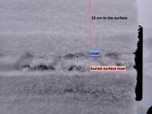
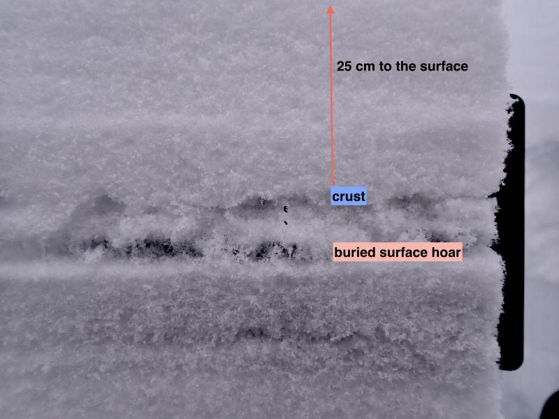
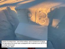
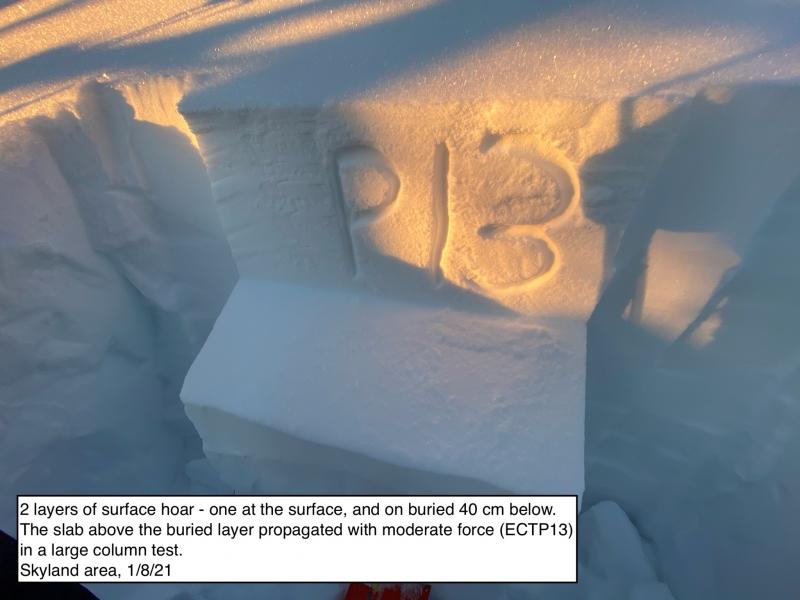
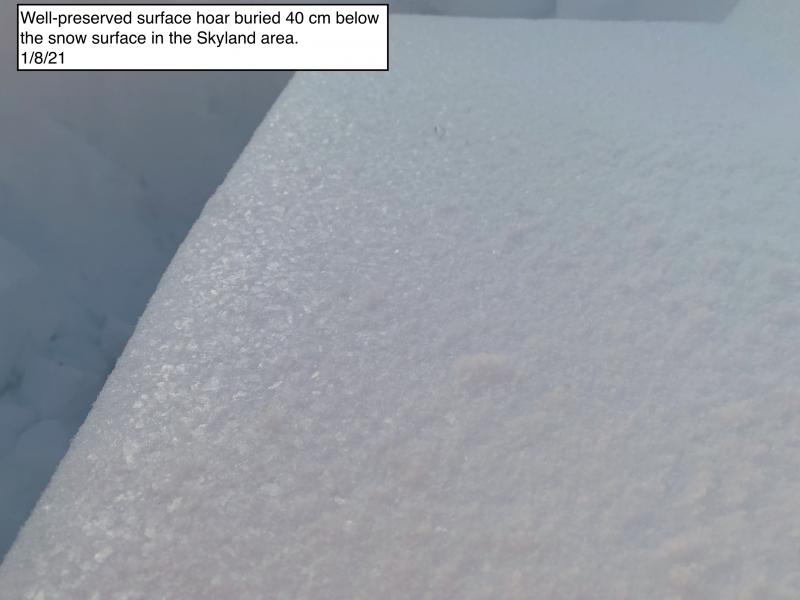
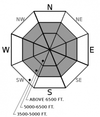
A layer of large, well-preserved surface hoar buried 40 cm below the snow surface appears more reactive in parts of this zone. It is capped with graupel and propagating with moderate force in snowpack tests on easterly slopes in the Skyland area. Sticking to slopes less than 35 degrees is the most reliable way to avoid triggering slabs that break on this layer. Or on other weak layers buried 1 to 4 feet deep and mostly associated with crusts formed by rime, rain, or warm temperatures.If you choose to ride steeper terrain, pick slopes that aren't above trees, rocks, or gullies, which can exaggerate the consequences of an avalanche. Identify potential trigger points before committing to a slope, and weave around them. Potential trigger points are anywhere a weak layer is closer to the surface or more likely to be weak. Typical candidates are windward slopes with variable snow depths, convex rollovers, and slopes where talus is the summer ground cover.
-
Type ?
-
Aspect/Elevation ?
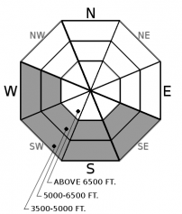
-
Likelihood ?CertainVery LikelyLikelyPossible
 Unlikely
 -
Size ?HistoricVery LargeLargeSmall

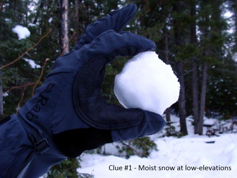
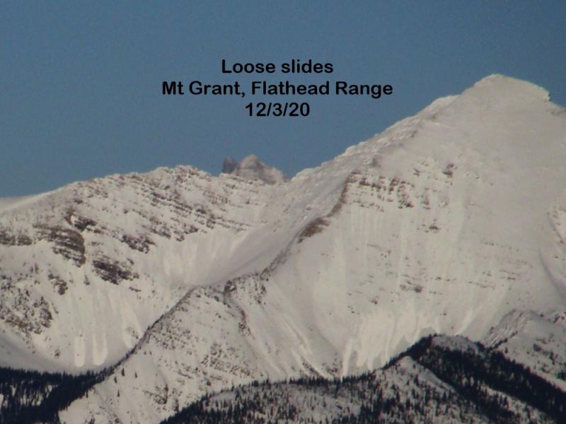
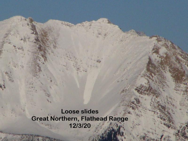
Dodge small sluffs of moist or wet snow on steep, sunny slopes by moving on when you see rollerballs fanning out and running downslope. These will be most likely on sunny, mid-elevation slopes where the surface snow remains loose. These small slides can have surprisingly large consequences above terrain traps.
Peristent slab problem description updated 09:30
Thursday, observers in the Swan Range reported triggering small, freshly-formed slabs of drifted snow. At least one similar natural avalanche occurred as well. These ran on a thin crust on northerly slopes at upper-elevations. None of the observed slides stepped down and released thicker slabs breaking on older interfaces. These slabs remain a hazard at upper elevations and on isolated slopes at mid-elevations, though with light winds the past 24 hours they're stabilizing. My tour plans today won't include steep, leeward slopes at upper elevations. At mid-elevations, my concern will be blundering onto the isolated slopes where it remains possible to trigger these slabs, so I'll stay alert for steep slopes with signs of recently-deposited drifts. These include cornices cantilevered over a slope; hard, hollow-feeling snow, and rippled uneven snow surfaces.
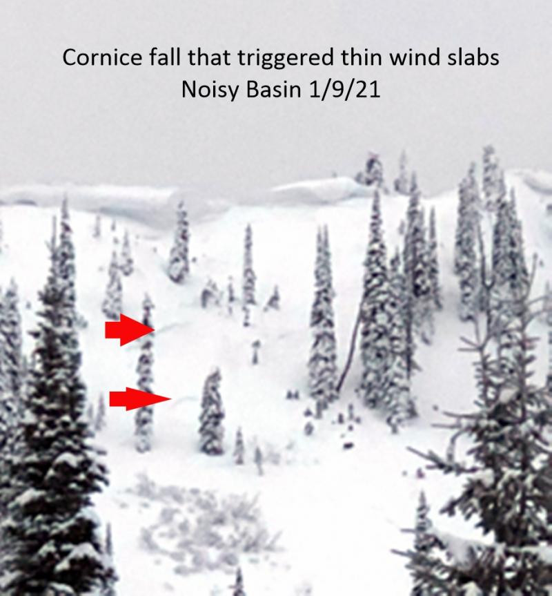
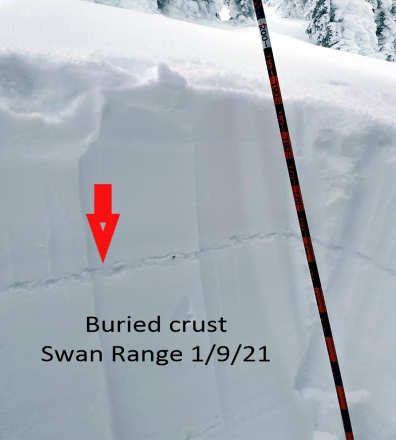
A variety of weak layers exist on the top 3 to 4 feet of our snowpack. Most are small, faceted grains above or below crusts, or thin surface hoar layers. The individual layers are distributed unevenly across the region. For instance, we've received more reports of buried surface hoar from the Swan Range, mostly buried in the top 18 inches of the snowpack. On the other hand, most reports of propagation and collapses on the Dec. 9 interface come from the southeastern corner of our region, in John F. Stevens Canyon and the Skyland area. None of these layers seems sensitive to the weight of a person; people have not reported triggering slides on buried persistent weak layers in the past week, and van-sized chunks of cornice rolling down a steep slope didn't trigger a slide on Wednesday.
However, there's still evidence that these buried weak layers can still collapse and propagate a failure. Enough evidence to continue avoiding terrain where these weak layers were more developed and thus better preserved. Or to give a wide berth to likely trigger points on a given slope. Some of the most consistent reports of propagation and collapses have come from sunny and windward slopes, where snow depths are most variable. Digging into the snow is one way to identify what particular weak layers exist in an area. Layers deep in the snowpack have the potential to produce larger, more dangerous slides. If you digging isn't your thing or you're uncertain about your results, opt-out of terrain that isn't free of rock bands, trees, gullies, and other features that make getting caught and carried in an avalanche more serious.
The window of high pressure stalls over our region, bringing partly cloudy skies, light winds and mild temperatures to mid and upper elevations. The same to low elevations, if low stratus clouds mix out. A weak weather system is dawdling our way. Sadly, it'll probably squander what moisture it's carrying on ranges to the west of us.
This forecast applies only to backcountry areas outside established ski area boundaries. The forecast describes general avalanche conditions and local variations always occur. This forecast expires at midnight on the posted day unless otherwise noted. The information in this forecast is provided by the USDA Forest Service who is solely responsible for its content.


