| Friday | Friday Night | Saturday | |
|---|---|---|---|
| Cloud Cover: | Mostly Cloudy | Mostly Cloudy | Mostly Cloudy |
| Temperatures: | 26 to 32 deg. F. | 23 to 27 deg. F. | 27 to 33 deg. F. |
| Wind Direction: | Southwest | Southwest | Southwest |
| Wind Speed: | 16G31 | 18G36 | 24G39 |
| Snowfall: | 1" in. | 2" to 3" in. | 1" to 2" in. |
| Snow Line: | 3500' | 4000' | 3500' |
Swan Range
How to read the forecast
The avalanche danger remains elevated in the Swan Range, where the snowpack adjusts to the recent heavy snowfall event. Increasing wind speeds will thicken slabs up to 2' thick below ridgelines and cross-loaded features such as gullies. Look for blowing snow as you gain elevation. Triggering an avalanche on a deeper buried weak layer remains a concern. Choosing simple terrain less than 35 degrees in steepness is a great way to start your New Year off on the right foot.

3. Considerable
?
Above 6500 ft.
3. Considerable
?
5000-6500 ft.
2. Moderate
?
3500-5000 ft.
- 1. Low
- 2. Moderate
- 3. Considerable
- 4. High
- 5. Extreme
-
Type ?
-
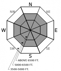
Aspect/Elevation ?
-
Likelihood ?CertainVery LikelyLikelyPossible
 Unlikely
 -
Size ?HistoricVery LargeLargeSmall

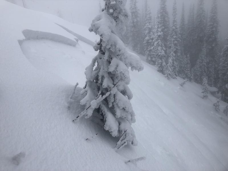
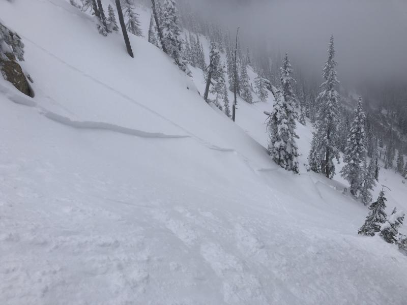
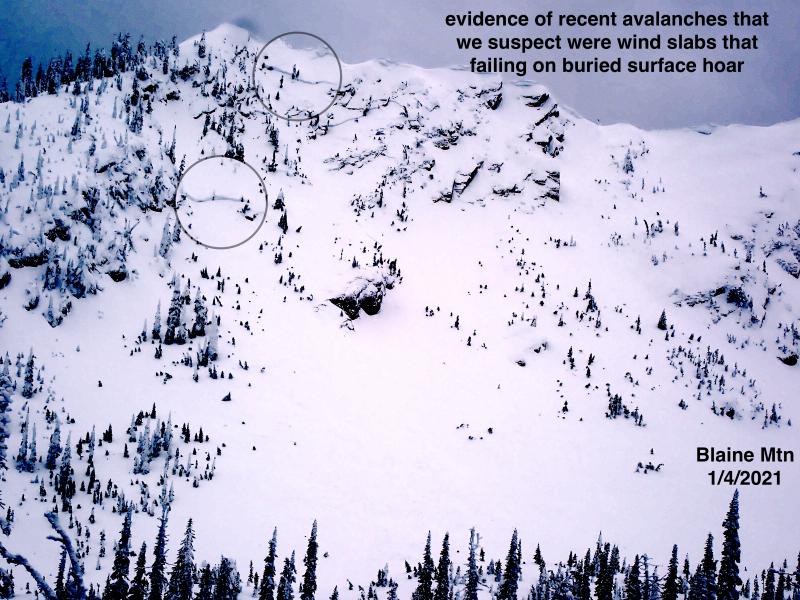
The Noisy Basin snotel station recorded 1.7" of SWE in less than 24 hours Thursday morning. This is a huge load that the snowpack is still adjusting to. Wind speeds at the Mount Aeneas weather station ramped up overnight, and transported snow will add weight to recently formed slabs. These will be up to 2' thick and most sensitive to a rider below ridgelines, summits, and on cross-loaded features such as gullies. Utilize hand pits or small test slopes to determine the bond between the surface snow and underlying layers. Look for blowing snow and monitor new snow depth as you gain elevation. On steep slopes, steer around dense, stiff snow in favor of light powder found in areas sheltered from the wind.
-
Type ?
-
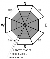
Aspect/Elevation ?
-
Likelihood ?CertainVery LikelyLikelyPossible
 Unlikely
 -
Size ?HistoricVery LargeLargeSmall

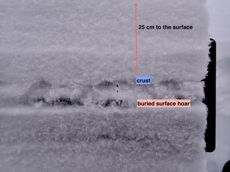
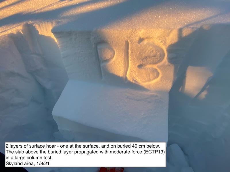
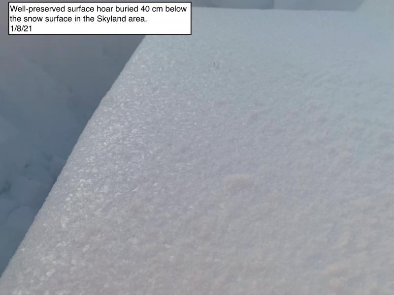
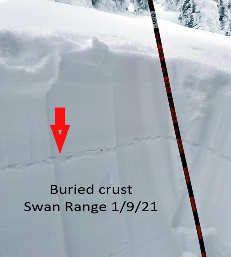
Triggering a slide on a buried weak layer remains a low likelihood but high consequence problem. Our recent storm cycle has buried layers 1-4’ below the surface, and it has become more difficult for a rider or machine to affect these layers where the snowpack is deep. View shallow areas, such as windswept or rocky starting zones, with caution as these, are the places most easily impacted by a rider. The resulting slides will be large and deep enough to bury you. The easiest and most successful way to manage this problem is through terrain selection of planar slopes less than 35 degrees in steepness.
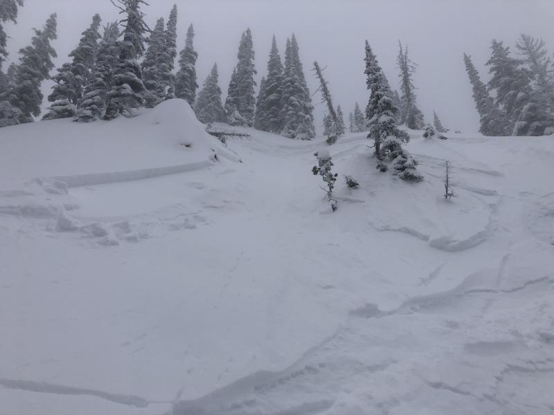
A series of potent storms have made the holiday season a joyful one for snow enthusiasts. Winter started with a bang, as an Atmospheric River inundated our area with over 1” of water and freezing levels up to 6000’ during Winter Solstice. This storm was responsible for initiating large destructive Persistent Slab avalanches on weak layers buried 1-4’ deep. This year’s Christmas present was two lovely bluebird days offering great Kodak moments of the resulting carnage that spanned all three elevation bands. After this brief respite, moisture returned in earnest, as another warm, wet storm deposited over an inch of precipitation in the Swan Range and the Whitefish Range on the 26th and 27th. Natural and skier-triggered surface slides occurred, but we do not have documentation that any of these slides triggered a larger avalanche on a buried weak layer. Holiday storm #3 arrived just in time to be considered a 2020 baby with 1.7” of water in the Swan Range and lesser amounts elsewhere. We have yet to view or receive reports regarding the snowpack's damage from this last whopper.
Looking out your window at a few measly inches of snow on the valley floor makes one assume that our mountain snowpack is suffering. Fortunately, the opposite is true. The Flathead River Basin is at 106% of average Snow Water Equivalent (SWE) with our low and mid-elevation snotel stations reporting 98-117% of average.
NW MT is in the crosshairs of several storms with abundant moisture streaming across the area leading to a relatively heavy mountain snowfall event over the weekend and unsettled weather into next week. The forecasted bountiful water will be a good test for our Persistent Slab problem. Buried weak layers may wake up and fail during a hefty storm, or perhaps incremental loading will result in failure when we least expect it. The best-case scenario is that these layers prove they have gained strength, and we can take them off our problem list, for now.
A relatively benign day of flurries, mostly cloudy conditions, and slightly above seasonal temperatures. A strong wet storm is expected Saturday night into Sunday.
This forecast applies only to backcountry areas outside established ski area boundaries. The forecast describes general avalanche conditions and local variations always occur. This forecast expires at midnight on the posted day unless otherwise noted. The information in this forecast is provided by the USDA Forest Service who is solely responsible for its content.


