| Thursday | Thursday Night | Friday | |
|---|---|---|---|
| Cloud Cover: | Mostly Clear | Mostly Clear | Mostly Cloudy |
| Temperatures: | 22 to 27 deg. F. | 12 to 18 deg. F. | 22 to 27 deg. F. |
| Wind Direction: | Southwest | Southwest | Southwest |
| Wind Speed: | 13G25 | 13 | 11 |
| Snowfall: | 0" in. | 0" in. | 0" in. |
| Snow Line: | 1500' | 2000' | 2000' |
Whitefish Range
Flathead Range and Glacier National Park
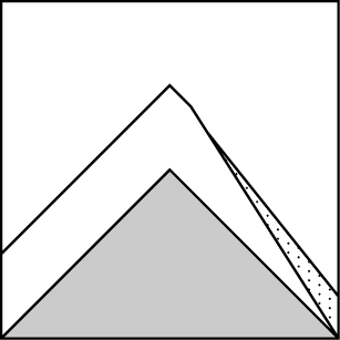
How to read the forecast
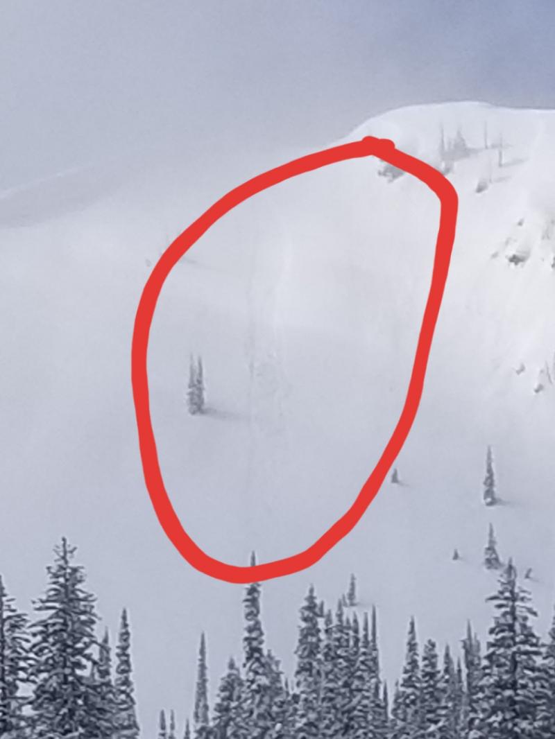
Today, the slopes where you can get into trouble are near and above treeline where recent winds have drifted new snow into dense slabs. On steep slopes at these elevations, you can trigger avalanches that break one to two feet deep where the recent snow meets the old surface or on deeper weak layers. On slopes receiving direct sun, loose avalanches are a hazard if they catch you from above or push you into a terrain trap.

2. Moderate
?
Above 6500 ft.
2. Moderate
?
5000-6500 ft.
1. Low
?
3500-5000 ft.
- 1. Low
- 2. Moderate
- 3. Considerable
- 4. High
- 5. Extreme
-
Type ?
-
Aspect/Elevation ?

-
Likelihood ?CertainVery LikelyLikelyPossible
 Unlikely
 -
Size ?HistoricVery LargeLargeSmall

Layers of surface hoar and faceted crusts are buried under 2+ feet of snow. Reports of both human triggered, and natural avalanches failing on one of these weak layers have come from across the forecast zone. Feedback from these layers has been inconsistent, so it’s important to know where you might trigger a dangerously large avalanche. Treat steep slopes with caution and you gain elevation. Specifically, avoid convex rolls where the snowpack might be shallower and recent winds have stiffened the surface into a slab. Limiting your exposure to large avalanche paths and shallow trigger points is a safer bet than waiting for a collapse or shooting cracks to tell you you’re already in trouble.
-
Type ?
-
Aspect/Elevation ?

-
Likelihood ?CertainVery LikelyLikelyPossible
 Unlikely
 -
Size ?HistoricVery LargeLargeSmall

You can expect storm slabs above treeline where recent winds have drifted snow into thicker, stiffer drifts. That’s the kind of terrain where Cam was able to trigger slabs a foot thick in the Flathead Range Wednesday. Track how the new snow has bonded to underlying surfaces before committing to steep terrain. Cracking in recent snow is a sign to stay off of slopes steeper than about 35 degrees. There is a possibility of a smaller avalanche stepping down to a more dangerous, persistent slab avalanche.
-
Type ?
-
Aspect/Elevation ?
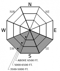
-
Likelihood ?CertainVery LikelyLikelyPossible
 Unlikely
 -
Size ?HistoricVery LargeLargeSmall

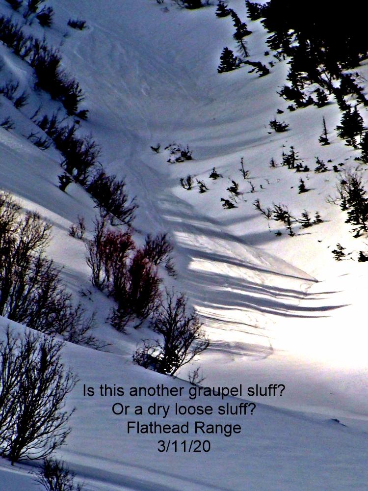
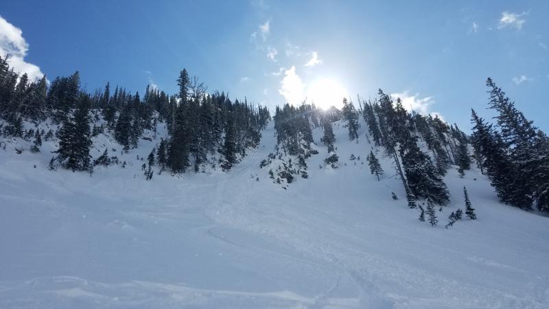
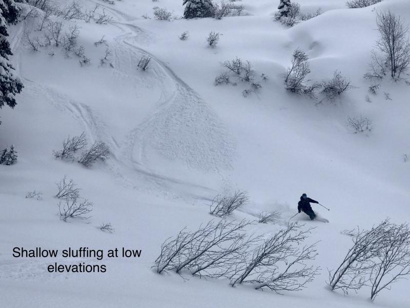
As the sun hits cold dry snow today, watch for sluffs running in very steep terrain. Be aware of what’s above you as you ascend south-facing slopes. Sluffs usually start from rocky chutes and grow in size as they fan out down the slope. As you descend, be cautious of confined terrain where you can’t let moving snow pass you by. Sluffs will likely be small, but they can knock you off balance and pull you into a terrain trap. Lower-angled, lower consequence slopes will have soft snow that is less of a hazard.
T’was the night before Christmas, and all through the house, not a creature was stirring, not even a mouse….
Your present this year is quiet, calm, bluebird weather. But don’t be tricked into thinking it’s open season for riding steep terrain. Persistent weak layers are buried 1.5 to 2+ feet deep in the snowpack. Despite inconsistent feedback, these layers are not dormant. Natural and human triggered avalanches have failed on layers of sugary facets and surface hoar were reported through Tuesday. In two cases (WMR mitigation/Snowshed), persistent slab avalanches stepped down to even deeper weak layers resulting in larger slides. Shallow areas where the snowpack is already stressed by convexities and heavy, stiff wind drifts are the most likely trigger points for large, dangerous avalanches.
Storm slabs that were stiffened by recent wind were reactive yesterday in the Flathead Range. I expect you can find them in the northern Whitefish Range and in the Swan as well. They will be increasingly stubborn, but it’s a safer bet to track how well the recent snow is bonding before committing to consequential terrain. Small test slopes can help you assess the problem before you get into trouble. Watch for shooting cracks as red flags.
The sun may tip off a round of sluffs on very steep slopes today as cold dry snow fails near rocky chutes. Watch for that overhead hazard and avoid slopes where you cannot let moving snow pass you by. Terrain traps below will amplify the consequences.
High pressure will bring some blue skies and stable conditions through Friday night when a warm front brings the next chance of accumulating snow to our area.
This forecast applies only to backcountry areas outside established ski area boundaries. The forecast describes general avalanche conditions and local variations always occur. This forecast expires at midnight on the posted day unless otherwise noted. The information in this forecast is provided by the USDA Forest Service who is solely responsible for its content.


