


For 5000 ft. to 7000 ft.
| Sunday | Sunday Night | Monday | |
|---|---|---|---|
| Cloud Cover: | Mostly Cloudy | Mostly Cloudy | Mostly Cloudy |
| Temperatures: | 25 to 31 deg. F. | 21 to 25 deg. F. | 29 to 34 deg. F. |
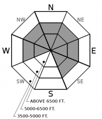
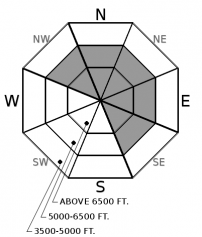
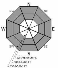
| Wind Direction: | Southwest | Southwest | Southwest |
| Wind Speed: | 27G59 | 38G63 | 45G71 |
| Snowfall: | 1" in. | 4" to 5" in. | 2" to 3" in. |
| Snow Line: | 3500' | 3500' | 4000' |


