| Monday | Monday Night | Tuesday | |
|---|---|---|---|
| Cloud Cover: | Mostly Cloudy | Mostly Cloudy | Partly Cloudy |
| Temperatures: | 31 to 37 deg. F. | 22 to 26 deg. F. | 27 to 34 deg. F. |
| Wind Direction: | West | West | West |
| Wind Speed: | 14G32 | 15G31 | 12G25 |
| Snowfall: | 2" to 4" in. | 1" to 2" in. | 0" in. |
| Snow Line: | 5500' | 5000' | 4000' |
Whitefish Range
Swan Range
Flathead Range and Glacier National Park
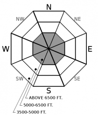
How to read the forecast
Avalanche season is knocking at the door. A layered snowpack is building at upper elevations, and with that comes the potential for slab avalanches. Avalanche hazards are generally localized to high-elevation terrain with sufficient snow coverage to ski or ride. Look for the obvious clues of danger - recent avalanches, shooting cracks, and whumpfing collapses - if you're on or below steep terrain with continuous snow cover. Conditions may worsen quickly during periods of heavy snow and strong winds.

No Rating
?
Above 6500 ft.
No Rating
?
5000-6500 ft.
No Rating
?
3500-5000 ft.
-
Type ?
-
Aspect/Elevation ?

-
Size ?HistoricVery LargeLargeSmall

Strong winds have accompanied the past week's snowfall, drifting the recent snow into slabs on leeward slopes at upper elevations. More snow and wind are forecast for midweek, with yet more on the horizon for next weekend. Slabs of wind-drifted snow are generally sitting on lower-density snow, an unstable structure. Be alert for drifts and hollow plates of dense snow below ridges, in gullies, or behind other prominent terrain features. The thin snow cover means even small slides can have nasty consequences.
-
Type ?
-
Aspect/Elevation ?

-
Size ?HistoricVery LargeLargeSmall

On isolated, northerly slopes at high elevations, weak, faceted snow may exist below recent snow. This snow can collapse, triggering surprisingly wide slides despite the shallow snow cover. This hazard is localized to steep slopes with glaciers or other year-round snow cover, and shaded slopes where the ground surface is smooth grass or bedrock. Shooting cracks or whumpfing collapses are clear signs you've found these conditions. If you exerience these phenomena, retreat to lower-angled slopes with no steep slopes overhead.
Avalanche season is knocking at the door. A series of cold, snowy storms has left 10-24 inches of snow above about 5500 feet in all three forecast zones. Strong westerly winds accompanied all but the last bout of snow (Sunday night). After a cooling trend, air temperatures have warmed, with temperatures hovering near freezing at upper elevations. You can see recent trends on our Snowpack Tracker. More snow and bitterly cold temperatures are forecast for midweek and this weekend.
So a layered snowpack is building at upper elevations, and with a layered snowpack comes the potential for slab avalanches. That potential is confined to steep slopes where the snow is deep enough to cover anchors like rocks and brush. Picture slopes near ridgelines where the surface is year-round snow or firn, low bushes and grass, or smooth, exposed bedrock. At lower elevations, the snow is shallow and the bush is deep. Keep in mind that the shallow snow cover creates non-avalanche dangers, like hitting rocks, stumps, and logs. These can have harsh and even tragic consequences.
The most widespread avalanche hazard involves slabs of wind-drifted snow sitting on lighter density snow. Expect these on the lee (downwind) sides of exposed ridges and saddles. Those will generally be easterly slopes, but wind directions have swung through the compass as Arctic air poured over the Continental Divide and then retreated. Another shot of blustery easterly winds is in the forecast for midweek. Be suspicious of any steep slope with a dense or hard layer of snow over light, soft snow.
The snow hasn't been on the ground long enough for weak layers to develop. However, it has been unseasonably cold and more cold weather is approaching midweek, with near-record low temperatures possible this coming weekend. The recent and upcoming cold will promote faceting in the relatively shallow snowpack, so persistent weak layers may develop quickly.
FAC staff will monitor conditions through the fall and post updates as conditions warrant. We anticipate daily forecasts and full operations to begin in December. Your observations would be very helpful in the meantime.
Now is the time to tune up your avalanche knowledge. The 2020 Northern Rockies Snow and Avalanche Workshop will be held virtually from Nov. 12-14. The details are here and registration is open! Stay tuned for our upcoming avalanche class schedule later this fall.
The Missoula office of the NWS is producing automated mountain weather forecasts during the fall season here. We will be producing weather forecasts to accompany daily avalanche forecasts during regular operations.
This forecast applies only to backcountry areas outside established ski area boundaries. The forecast describes general avalanche conditions and local variations always occur. This forecast expires at midnight on the posted day unless otherwise noted. The information in this forecast is provided by the USDA Forest Service who is solely responsible for its content.


