| Wednesday | Wednesday Night | Thursday | |
|---|---|---|---|
| Cloud Cover: | Mostly Cloudy | Mostly Clear | Mostly Clear |
| Temperatures: | 26 to 32 deg. F. | 7 to 12 deg. F. | 22 to 30 deg. F. |
| Wind Direction: | West | Northwest | West |
| Wind Speed: | 20G38 | 12G35 | 12G23 |
| Snowfall: | 5" to 8" in. | 0" to 1" in. | 0" in. |
| Snow Line: | 3500' | 500' | 0' |
Flathead Range and Glacier National Park
How to read the forecast
Looking for trouble? You can find it where new snow and wind are building drifts on leeward terrain. You can trigger fresh slabs that break up to 18 inches deep and slide on slick crusts. You'll find them on steep, exposed areas below growing cornices, and on cross-loaded features. Blowing snow and shooting cracks are red flags that you’ve found the most dangerous slopes. If safer and better riding conditions are more your thing, stick to sheltered, lower-angled terrain.

2. Moderate
?
Above 6500 ft.
2. Moderate
?
5000-6500 ft.
1. Low
?
3500-5000 ft.
- 1. Low
- 2. Moderate
- 3. Considerable
- 4. High
- 5. Extreme
-
Type ?
-
Aspect/Elevation ?

-
Likelihood ?CertainVery LikelyLikelyPossible
 Unlikely
 -
Size ?HistoricVery LargeLargeSmall

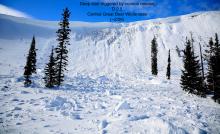
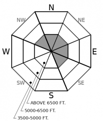
Wind slabs are a developing problem today as new snow provides ammo for westerly winds. They will be larger and more dangerous as you gain elevation, or if we see the upper end of forecasted snow totals. Watch for blowing snow onto leeward slopes. At upper elevations, growing cornices will point to fresh slabs below. At middle elevations, sensitive drifts will develop on the sidewalls of gullies and down-wind of trees. Snow will be blowing onto the slopes you should avoid. Wind slabs will be denser than the snow in sheltered terrain and can have a scalloped texture. You can test these rounded drifts on small, harmless test slopes before venturing into bigger terrain. Snow that cracks around you means you could trigger a slab on steep leeward slopes. Choose low slope angles and sheltered terrain to avoid the problem.
-
Type ?
-
Aspect/Elevation ?
-
Likelihood ?CertainVery LikelyLikelyPossible
 Unlikely
 -
Size ?HistoricVery LargeLargeSmall

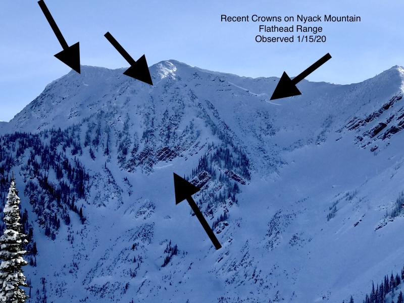
Although slides breaking on weak layers near the ground have become increasingly difficult to trigger, the consequences are unsurvivable. The pattern of deep slabs avalanches this winter has been confined to high alpine bowls and faces in the Flathead Range and Glacier Park on northerly and easterly aspects. Cornice falls are the most likely triggers. Choose routes that reduce your exposure to overhead hazards, including runout zones, and be cautious of alpine slopes with thin or variable snow coverage.
Winds have been moderate to strong since Monday when observers in Glacier Park described small drifts developing on top of crusts left from last weekend’s warm up. Yesterday, in the Swan Range, observers noted isolated pockets of drifted snow on top of – you guessed it – slick crusts (example 1, example 2). Around Marion Lake, Mark found moderate blowing snow and 1-2 inch thick wind slabs on top of – wait for it – melt-freeze crusts! In sheltered areas, a few inches of softer snow and graupel sits on top of those crusts.
Westerly winds have maintained more or less perfect snow blowing speeds and will continue moving snow into this evening. New snow will give winds more ammo to fire at leeward terrain. Snow started falling in the northern half of our area last night with Stahl Peak and Flattop Mountain both reporting a little over half an inch of new water (~3 to 5 inches of new snow) by early this morning. Moisture looks to spread south this morning and could drop between 3 to 6 inches in the Flathead and Swan ranges by early afternoon. The northern Whitefish Range may see another 3 to 4 inches. New slabs will not bond well to slick crusts and loose graupel. I expect them to be sensitive as they grow larger.
Freezing levels rose overnight and will hover around 5,000’ today. Where rain falls on loose dry snow at lower elevations you can expect rollerballs and small wet snow sluffs in steep terrain.
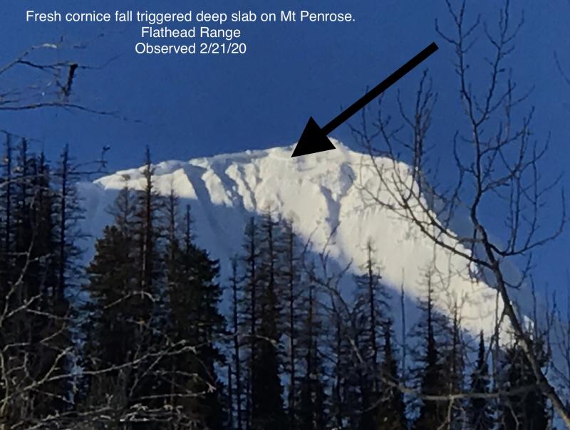
Cornices remained frozen and hard yesterday. They will grow again with new snow and wind. I’ll continue to give the slopes below them a wide margin, and I’ll be standing far back from the edge as I travel on alpine ridges. If they fail under the new load, or under my weight, they’ll be a hazard all on their own. Big chunks of hard snow that fall on the slopes below can trigger wind slabs. More worrisome is the off chance of a very big cornice fall in the Flathead or in Glacier Park. Cornices triggered deep slab avalanches in the Bob Marshall and on Mt. Penrose over the past few weeks. An avalanche that size would be unsurvivable.
A quick disturbance drops into the northern Rockies from Canada. Winds will be moderate to strong as the front passes. Skies clear overnight allowing temperatures to drop below freezing down to the valley floors. Another bout of winter weather arrives Friday morning.
This forecast applies only to backcountry areas outside established ski area boundaries. The forecast describes general avalanche conditions and local variations always occur. This forecast expires at midnight on the posted day unless otherwise noted. The information in this forecast is provided by the USDA Forest Service who is solely responsible for its content.


