| Monday | Monday Night | Tuesday | |
|---|---|---|---|
| Cloud Cover: | Mostly Clear | Mostly Clear | Mostly Cloudy |
| Temperatures: | 21 to 28 deg. F. | 11 to 17 deg. F. | 25 to 32 deg. F. |
| Wind Direction: | West | Southwest | Southwest |
| Wind Speed: | 10G25 | 10G25 | 16G37 |
| Snowfall: | 0" in. | 0" in. | 0" in. |
| Snow Line: | 500' | 500' | 1000' |
Flathead Range and Glacier National Park
How to read the forecast
Isolated pockets of danger can be found on leeward slopes where the wind has drifted snow into freshly formed wind slabs. These slabs will be most common below ridgelines and on crossloaded terrain features further downslope. Continue to be wary of overhead cornice hazard as a cornice fall alone can be consequential. Keep it simple, avoid being directly below cornices, and steer around the pillowy looking slabs of drifted snow.

2. Moderate
?
Above 6500 ft.
1. Low
?
5000-6500 ft.
1. Low
?
3500-5000 ft.
- 1. Low
- 2. Moderate
- 3. Considerable
- 4. High
- 5. Extreme
-
Type ?
-
Aspect/Elevation ?

-
Likelihood ?CertainVery LikelyLikelyPossible
 Unlikely
 -
Size ?HistoricVery LargeLargeSmall

Yesterday's new snow and southwesterly winds formed today’s wind slab hazard. You can find these thin, small slabs on leeward slopes below ridgelines and cross-loaded terrain features like gullies and sub ridges further downslope. They can prove to be consequential if they drag you into a terrain trap. Look and feel for cracking and be cautious of the bulbous, hollow drifts as they are clues to seek wind-sheltered terrain.
-
Type ?
-
Aspect/Elevation ?
-
Likelihood ?CertainVery LikelyLikelyPossible
 Unlikely
 -
Size ?HistoricVery LargeLargeSmall

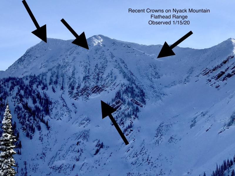
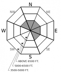
Although slides breaking on weak layers near the ground have become increasingly difficult to trigger, the consequences are unsurvivable. The pattern of deep slabs avalanches this winter has been confined to high alpine bowls and faces in the Flathead Range and Glacier Park on northerly and easterly aspects. Cornice falls are the most likely triggers. Choose routes that reduce your exposure to overhead hazards, including runout zones, and be cautious of alpine slopes with thin or variable snow coverage.
Yesterday, observers reported up to 5 inches of new snow at 6000 feet and roughly an inch at 4500 feet in the Flathead Range and Glacier National Park. Also noteworthy was moderate wind transport and developing wind slabs. Sustained winds with strong gusts held on for roughly 4 hours during the late afternoon hours and then diminished overnight. Expect to find isolated pockets of wind slabs on north through east-facing slopes above roughly 6000, with some slabs crossloaded onto other aspects. Slabs of drifted snow will be more common closer to the divide, in the Flathead Range and Glacier National Park, where more snow fell. The Swan and Whitefish Ranges were showing little to no snow accumulations as of last night, though many remote weather stations are down early this morning.
Although we haven't listed cornice fall as a problem today, cornices themselves and the slopes they lurk over will continue to concern us for the remainder of the season. While we highlight times of greater likelihood, they can spontaneously fail at any time, so don’t dilly dally below them. Resist the urge to walk to the edge of ridgelines until you confirm what you are standing on is in fact ground and not a giant overhanging block of snow.
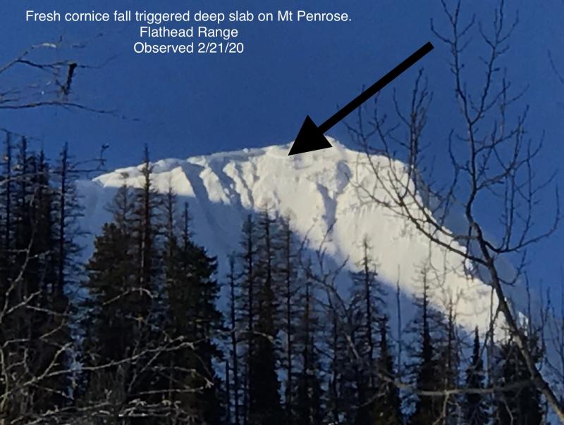
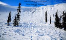
Recent cornice fall has also triggered deep slab avalanches in the past few weeks (observation). Think of falling cornices as “backcountry bombs;” their impact can collapse weak layers deep in the snowpack more readily than the weight of a rider or machine. Stay diligent in your travels if you seek out colder snow on the north side of the compass. If you feel a sense of uncertainty, select windward or south-facing slopes where cornices are less common and weak layers buried near the ground melted out during the fall.
If the sun does in fact show itself this afternoon, expect to see small sluffs on south- and west-facing slopes at mid and upper elevations. These will likely be dry. However, if temperatures exceed forecast, they will likely quickly turn to small wet loose avalanches. If you begin to see rollerballs or the snow begins to feel wet, seek out shaded slopes and move quickly through and out of sunny aspects.
Enjoy clearing skies and temperatures in the mid-20s today. Winds will be light gusting to moderate out of the west at the highest ridgelines. Northwest flow aloft will bring mild weather for the remainder of the workweek.
This forecast applies only to backcountry areas outside established ski area boundaries. The forecast describes general avalanche conditions and local variations always occur. This forecast expires at midnight on the posted day unless otherwise noted. The information in this forecast is provided by the USDA Forest Service who is solely responsible for its content.


