| Sunday | Sunday Night | Monday | |
|---|---|---|---|
| Cloud Cover: | Partly Cloudy | Mostly Cloudy | Mostly Cloudy |
| Temperatures: | 20 to 28 deg. F. | 16 to 20 deg. F. | 24 to 31 deg. F. |
| Wind Direction: | West | West | Southwest |
| Wind Speed: | 11G26 | 18G32 | 19G35 |
| Snowfall: | 0" in. | 0" in. | 0 to 1" in. |
| Snow Line: | 1500' | 1500' | 1500' |
Flathead Range and Glacier National Park
How to read the forecast
Adjust your riding to avoid surprises from today's isolated avalanche hazards. At upper elevations, slabs of drifted snow pose the primary hazard. These are most common in the terrain that harbors good riding conditions, so temper your ready-set-go by assessing conditions and consequences before climbing or dropping into gullies and bowls with leeward start zones. Falling cornices can pose a hazad in themselves, or trigger very large slides on the slopes below.

2. Moderate
?
Above 6500 ft.
1. Low
?
5000-6500 ft.
1. Low
?
3500-5000 ft.
- 1. Low
- 2. Moderate
- 3. Considerable
- 4. High
- 5. Extreme
-
Type ?
-
Aspect/Elevation ?
-
Likelihood ?CertainVery LikelyLikelyPossible
 Unlikely
 -
Size ?HistoricVery LargeLargeSmall

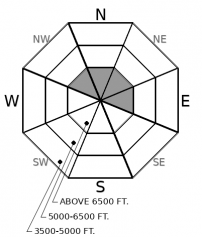
Approach terrain that collects wind-blown snow with caution, eyes peeled for dune-shaped drifts and dense, hollow-feeling snow. These can break a foot or so deep, and can be dangerous above terrain that magnifies the likelihood of deep burials, like gullies, or injury, like cliffs and trees. You're most likely to find these above about 7000 feet and near the Continental Divide.
-
Type ?
-
Aspect/Elevation ?
-
Likelihood ?CertainVery LikelyLikelyPossible
 Unlikely
 -
Size ?HistoricVery LargeLargeSmall

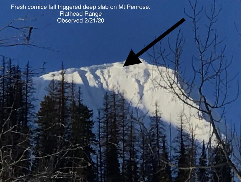
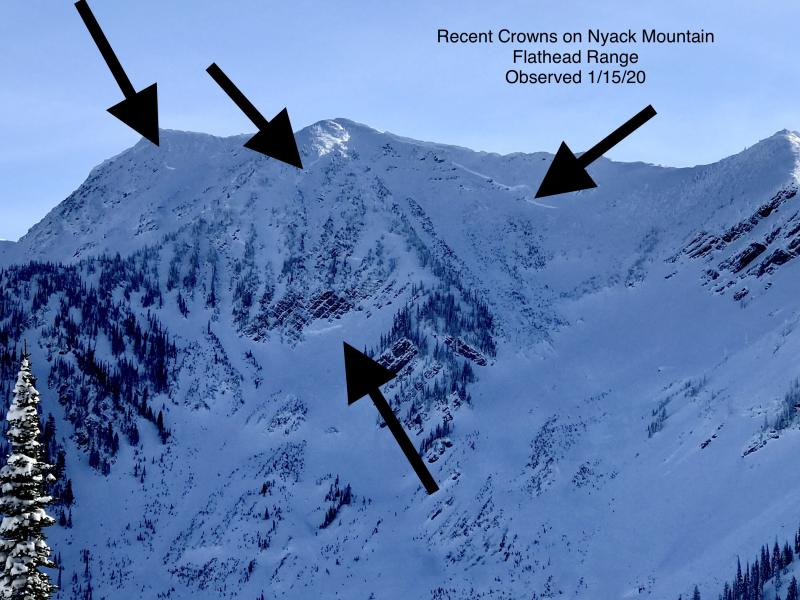
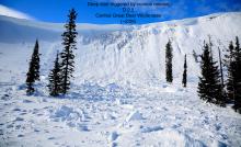
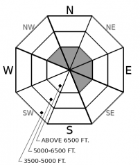
Cornice fall triggered a large avalanche on a northeast-facing slope on Mt. Penrose last week. This slide is a good reminder of the lingering danger of large avalanches breaking on weak snow near the ground in high alpine bowls and on steep, snowy faces in the Flathead Range and Glacier National Park. Cornice fall is the most likely trigger for these unsurvivable avalanches. Even though deep slab avalanches are unlikely today, it’s good policy to limit your time under steep northerly and easterly start zones.
Yesterday's forecasted snow didn't arrive, except near the Continental Divide, where stations are showing 1-4" of snow. The gusty winds of the past two days diminished after sunset Saturday. Today's forecast calls for cool temperatures and light to moderate winds. And sadly, no snow.
Under this benign weather, the avalanche danger is diminishing. How fast and how consistently is a little uncertain. The Persistent Slab avalanche problem listed the past few days does not appear to be a widespread hazard. The weak snow buried early last week (2/23 surface hoar and near-surface facets) looks to have gone dormant, though that could be a lack of observations and/ or spotty distributions when it was buried. I did not find surface hoar in terrain likely to harbor it (north through east facing slopes at mid elevations) yesterday east of the Swan crest. The BNSF forecasters did report propagation in tests on Friday, on a near-surface layer that might be slightly older. I suspect a few booby traps lurk on steep, convex, mid-elevation slopes that get little sun or wind. These might be well below ridge crests, on small, open slopes that appear innocuous. Maintaining safe travel protocols, like riding one at a time and keeping your partners in sight, is insurance that can reduce the consequences of surprises.
Gusty winds the past few days haven't had much snow to blow around, except above 7000 feet or so. Below that elevation, the snow surfaces on windward slopes are mostly melt-freeze crusts or watermelon-sized roller balls. On Friday, a party in the Flathead Range Friday reported plumes of snow off the higher peaks, and I saw some blowing snow at and below the crest of the Swan Range yesterday. I expect slabs up to a foot thick in upper elevation terrain that collects wind-blown snow, like the tops of chutes, the lee sides of gullies, and the downwind side of saddles and passes. I'd approach terrain like this cautiously, looking for these pockets of dense or hard snow.
Bus-sized cornices hang from many exposed ridgelines. Though today's weather isn't accelerating their eventual trip to the ocean, they pose an unlikely but serious hazard. Getting hit with the hard debris from falling cornices would have outsized consequences. That debris can trigger older wind slabs on slopes below, or, in rare instances, trigger slides that break near the ground and involve the entire season's snowpack. Probably best not to dally under these white whales.
Expect cool temperatures near ridges, with light and variable winds this morning. Winds will pick up this afternoon, though they'll remain moderate at most locations. Skies will be partly to mostly cloudy, with a better chance for sun this afternoon. Our next chance for snow is late Monday. Models are currently showing warm, sunny weather late in the week.
This forecast applies only to backcountry areas outside established ski area boundaries. The forecast describes general avalanche conditions and local variations always occur. This forecast expires at midnight on the posted day unless otherwise noted. The information in this forecast is provided by the USDA Forest Service who is solely responsible for its content.


