| Saturday | Saturday Night | Sunday | |
|---|---|---|---|
| Cloud Cover: | Mostly Cloudy | Mostly Cloudy | Partly Cloudy |
| Temperatures: | 23 to 30 deg. F. | 12 to 16 deg. F. | 23 to 30 deg. F. |
| Wind Direction: | Southwest | West | Northwest |
| Wind Speed: | 15 to 20G40 | 17G41 | 10G22 |
| Snowfall: | 2" to 3" in. | 1" to 2" in. | 0" in. |
| Snow Line: | 2000' | 1500' | 1000' |
Flathead Range and Glacier National Park
How to read the forecast
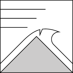
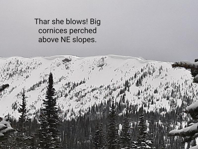
Cooling temperatures and strong winds will help refreeze the snow surface and reduce the hazard of wet snow avalanches. Steer around wind drifts and avoid areas of active wind loading as strong winds continue to transport snow into fresh slabs. Give corniced ridgelines and slopes they hang over a wide berth due to the increased likelihood of cornice falls today.

2. Moderate
?
Above 6500 ft.
2. Moderate
?
5000-6500 ft.
2. Moderate
?
3500-5000 ft.
- 1. Low
- 2. Moderate
- 3. Considerable
- 4. High
- 5. Extreme
-
Type ?
-
Aspect/Elevation ?
-
Likelihood ?CertainVery LikelyLikelyPossible
 Unlikely
 -
Size ?HistoricVery LargeLargeSmall

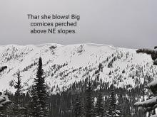
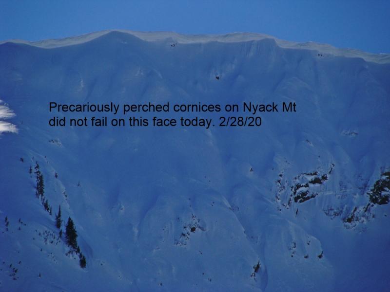
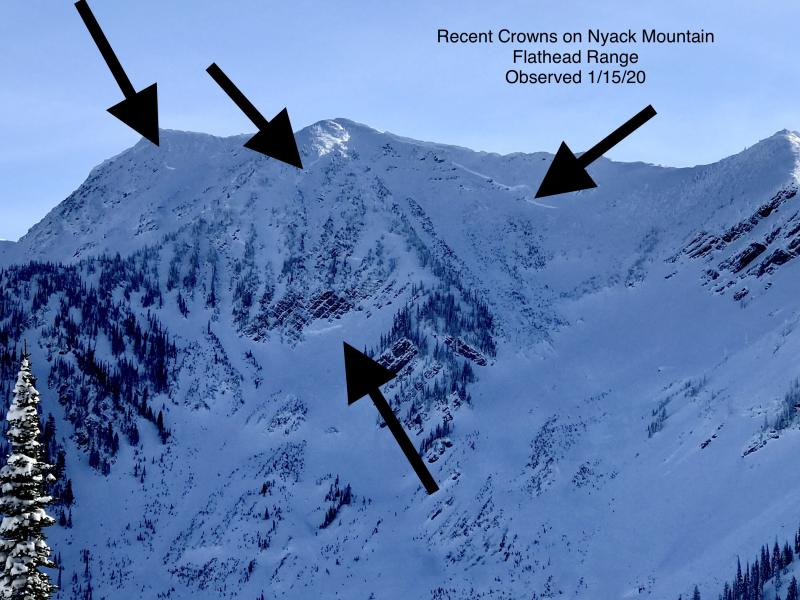
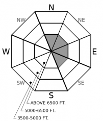
We continue to get reports of falling cornices and large cracks near ridgelines. Strong winds and recent warm temperatures will keep cornice falls a heightened concern for us today. Manage your exposure by avoiding areas beneath overhanging cornices, as well as giving ridgelines a wide berth.
-
Type ?
-
Aspect/Elevation ?
-
Likelihood ?CertainVery LikelyLikelyPossible
 Unlikely
 -
Size ?HistoricVery LargeLargeSmall

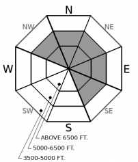
Expect new and recent drifting snow to build firm slabs up to 10 inches deep on leeward aspects. Slabs will form near ridgelines and on cross-loaded terrain features well below ridgelines, thanks to moderate to strong winds. Blowing snow and pillow-shaped drifts are cues to seek wind-sheltered terrain. While fresh wind slabs today should be relatively small, they could get you in trouble if they drag you into a terrain trap or step down to a larger persistent slab avalanche.
-
Type ?
-
Aspect/Elevation ?
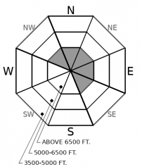
-
Likelihood ?CertainVery LikelyLikelyPossible
 Unlikely
 -
Size ?HistoricVery LargeLargeSmall

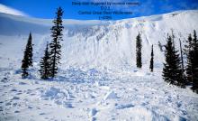
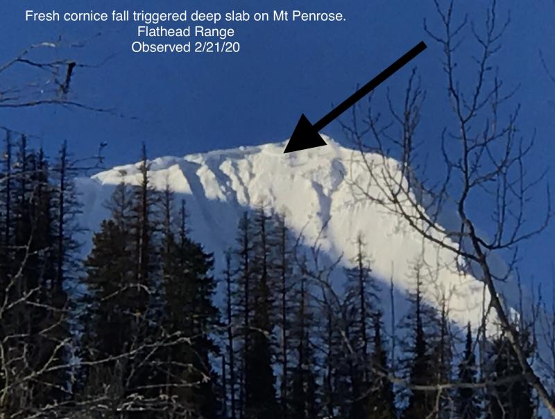
Cornice fall triggered a large avalanche on a northeast-facing slope on Mt. Penrose last week. This slide is a good reminder of the lingering danger of large avalanches breaking on weak snow near the ground in high alpine bowls and faces in the Flathead Range and Glacier National Park. Cornice fall is the most likely trigger for these unsurvivable avalanches. Even though deep slab avalanches are unlikely today, it’s good policy to limit your time under steep northerly and easterly start zones.
Yesterday’s warm, sunny skies took its toll on sunny aspects. Observers reported thousands of rollerballs, numerous D1 to D2 size wet loose avalanches, and a few cornice falls. Temperatures are currently dropping, a trend that will help refreeze yesterday's wet snow. However, there's some uncertainty with how high and how soon this refreeze will occur. In your travels this morning, if the snow still feels wet with little to no crust formed at the surface, keep slope angles low while minimizing overhead hazard. Wet avalanches may still pose a threat in this scenario. However, if you find a supportable melt-freeze crust, expect that refreezing has put the wet snow avalanche hazard to bed for the day.
A fast-moving cold front will shift our focus to dry snow hazards. Forecasts are calling for 1 to 5 inches of new snow, with the Swan and Flathead Ranges catching the upper end of snow totals. Moderate to strong southwest winds will drift the new snow. The drifted snow will bond poorly to underlying crusts, creating small wind slabs that can be sensitive to your weight. That hazard should be obvious and easy to manage; stick to sheltered locations away from areas of blowing snow. These will be the zones you want to be in anyway, unless you are the kind of person that enjoys a thorough beating by strong winds.
The catch 22 of seeking wind-sheltered, north-facing slopes is the uncertain distribution of buried surface hoar in the Whitefish and Swan Ranges. So far, we have found it in the Central Swan Range and the Southern Whitefish Range, and expect it in more locations. If you want to play it safe, stick to low angle terrain. If you want to tip the slope angles a little steeper, do your homework and dig in safe locations that are representative of the slope you want to ride, looking for a thin grey stripe one to two feet below the snow surface. If you find that stripe, feel collapses, or get shooting cracks, seek out low angle terrain.
A quick-hitting cold front pushes through the area today and into tomorrow. 2 to 4 inches of snow is likely to fall in favored areas of the Swan Range and the Flathead Range. Winds will be Moderate with gusts to 40 mph. Temperatures continue to drop, bringing the freezing level down to roughly 4500 feet.
This forecast applies only to backcountry areas outside established ski area boundaries. The forecast describes general avalanche conditions and local variations always occur. This forecast expires at midnight on the posted day unless otherwise noted. The information in this forecast is provided by the USDA Forest Service who is solely responsible for its content.


