| Friday | Friday Night | Saturday | |
|---|---|---|---|
| Cloud Cover: | Partly Cloudy | Mostly Cloudy | Mostly Cloudy |
| Temperatures: | 33 to 41 deg. F. | 19 to 23 deg. F. | 23 to 29 deg. F. |
| Wind Direction: | Southwest | Southwest | Southwest |
| Wind Speed: | 10 to 15 G25 | 19G39 | 25G40 |
| Snowfall: | 0" in. | 0 to 1" in. | 1" in. |
| Snow Line: | 5000' | 5000' | 2000' |
Flathead Range and Glacier National Park
How to read the forecast
Our warmest day of the year will cause dangerous avalanche conditions. The avalanche hazard will rise throughout the day due to warming temperatures and clearing skies. Avoid sun-baked slopes where the snow will become wet, causing avalanches large enough to bury, injure or kill you. Give cornices and the slopes they hang over a wide berth due to the increased likelihood of them failing and potentially triggering a deep slab avalanche below.

3. Considerable
?
Above 6500 ft.
3. Considerable
?
5000-6500 ft.
3. Considerable
?
3500-5000 ft.
- 1. Low
- 2. Moderate
- 3. Considerable
- 4. High
- 5. Extreme
-
Type ?
-
Aspect/Elevation ?
-
Likelihood ?CertainVery LikelyLikelyPossible
 Unlikely
 -
Size ?HistoricVery LargeLargeSmall

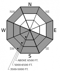
Sun baked terrain will produce wet avalanches large enough to bury, injure, or kill you. Today’s sunny weather and warm temperatures will wet the surface snow, causing destructive avalanches. Rollerballs or pinwheels are signs that conditions are ripe for wet loose avalanches. To reduce your risk to this problem, seek out shaded, northerly facing slopes. Plan your day to avoid crossing below south and west-facing avalanche paths, especially later in the day.
-
Type ?
-
Aspect/Elevation ?
-
Likelihood ?CertainVery LikelyLikelyPossible
 Unlikely
 -
Size ?HistoricVery LargeLargeSmall

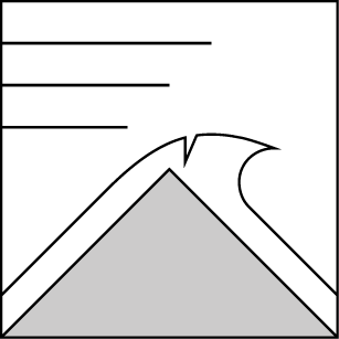
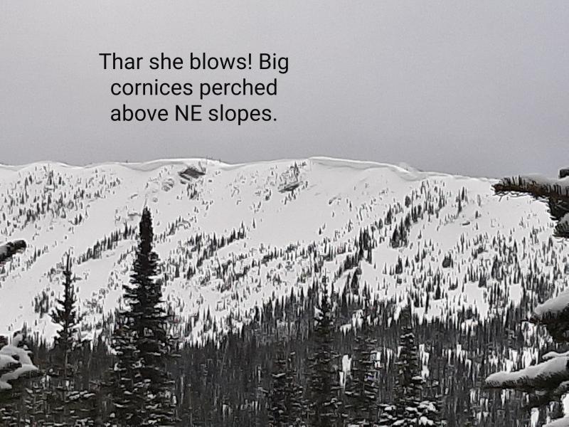
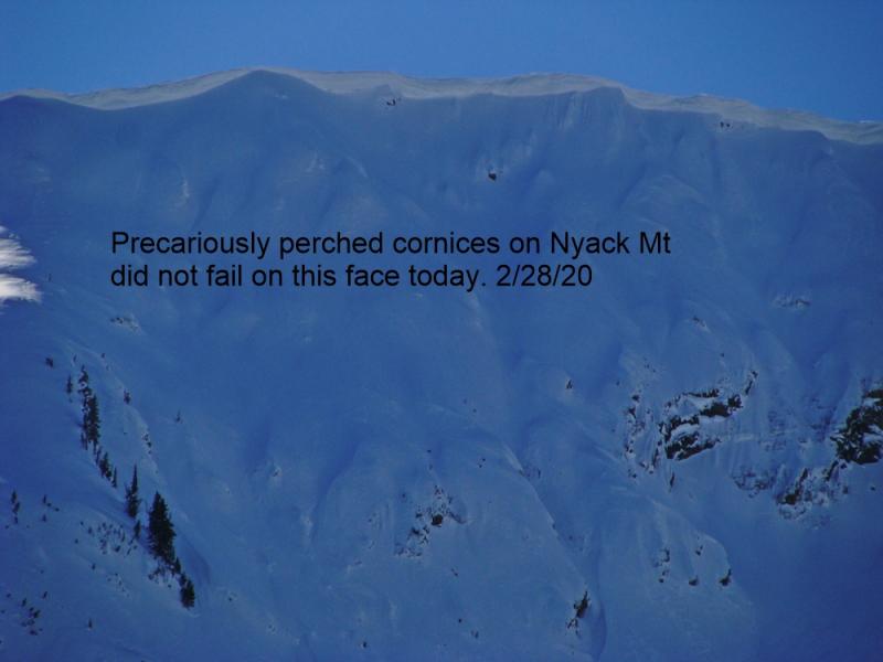
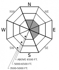
Warm temperatures and sunshine will up the likelihood of cornice failures today. Manage your exposure by avoiding areas beneath overhanging cornices, as well as giving ridgelines a wide berth. There is a lingering possibility that a cornice fall could trigger a slab avalanche causing a more destructive outcome.
-
Type ?
-
Aspect/Elevation ?
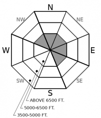
-
Likelihood ?CertainVery LikelyLikelyPossible
 Unlikely
 -
Size ?HistoricVery LargeLargeSmall

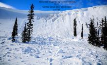
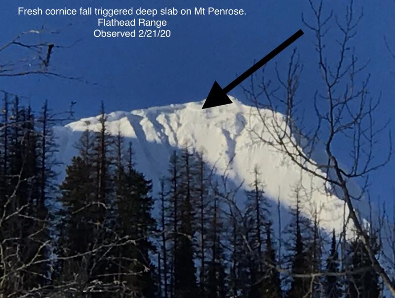
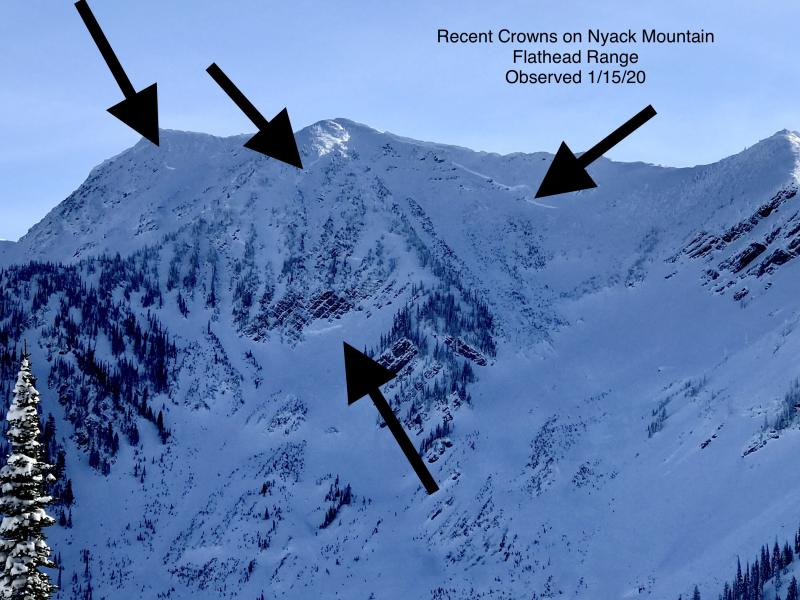
Cornice fall triggered a large avalanche on a northeast-facing slope on Mt. Penrose last Thursday or Friday. The slide is a good reminder of the lingering danger of large avalanches breaking on weak snow near the ground in high alpine bowls and faces in the Flathead Range and Glacier National Park. Warm, sunny weather today will up the likelihood of cornice falls, which are the most likely trigger for deep slab avalanches. Even though deep slab avalanches are unlikely, it’s good policy, especially today, to limit your time under steep northerly and easterly start zones.
Keep it simple and manage your terrain carefully today. Warm temperatures and sunny skies are going to complicate problems on both sides of the compass. Wet loose avalanches are going to be the primary concern on southerly facing aspects. Currently, 10 to 18 inches of recent snow is sitting on a stout sun crust. This snow will become wet and slide easily in steep terrain exposed to the sun. Your best bet is to avoid this terrain altogether once the surface snow has become wet. The second piece of terrain to worry about is on the north side of the compass, where large cornices overhang suspicious snowpacks. Today is the kind of day to treat every cornice as if it was going to come crashing down the mountain. This mindset will steer you in the direction that will keep you out from underneath the primary hazard. The possible byproduct of a cornice fall will be a triggered deep slab or wind slab, causing a more dangerous outcome. You will notice we removed wind slab from the problem list. This is due to a lack of sensitivity and other, more likely problems. Continue to assess wind loaded terrain and look for cracking in recently drifted snow.
For snow quality and hazard reasons, your best bet is to seek out shaded aspects. However, the snowpack is more challenging this week on northerly facing terrain. On some sheltered north aspects, the foot or two of recent snow fell on surface hoar and near-surface facets. Slabs overlying surface hoar may continue to cause instabilities. So far, we have found and received unstable feedback in parts of the Swan Range and in the southern Whitefish Range. A high degree of uncertainty remains since it was challenging to map the surface hoar before snowfall. Your best bet in managing this problem is to expect that it is there until you prove otherwise. Confirm that by digging down to the new/old interface and look for a grey, feathery stripe. If you find it, stick to low angle terrain.
Today, expect clearing skies and unseasonably warm temperatures. Temperatures will reach into the upper 30s at 6000 feet. Winds will be light, increasing to moderate by late afternoon as a cold front sweeps into the area.
This forecast applies only to backcountry areas outside established ski area boundaries. The forecast describes general avalanche conditions and local variations always occur. This forecast expires at midnight on the posted day unless otherwise noted. The information in this forecast is provided by the USDA Forest Service who is solely responsible for its content.


