| Monday | Monday Night | Tuesday | |
|---|---|---|---|
| Cloud Cover: | Mostly Cloudy | Partly Cloudy | Mostly Cloudy |
| Temperatures: | 22 to 28 deg. F. | 11 to 14 deg. F. | 22 to 28 deg. F. |
| Wind Direction: | West | West | Southwest |
| Wind Speed: | 13G24 | 11G22 | 11G22 |
| Snowfall: | 1" to 2" in. | 0" in. | 0" in. |
| Snow Line: | 2000' | 1500' | 1000' |
Flathead Range and Glacier National Park
How to read the forecast
Dangerous avalanche conditions will develop in areas that see 8 inches or more of new snow. Old snow surfaces may prevent new slabs from bonding. Expect sensitive slabs on steep, northerly slopes where surface hoar and facets were preserved as the snow started to fall. They will be largest where westerly winds have thickened the slabs on leeward slopes. Don’t dawdle in the runouts of alpine start zones. Choose simple terrain with low slope angles to limit your risk.

3. Considerable
?
Above 6500 ft.
2. Moderate
?
5000-6500 ft.
1. Low
?
3500-5000 ft.
- 1. Low
- 2. Moderate
- 3. Considerable
- 4. High
- 5. Extreme
-
Type ?
-
Aspect/Elevation ?

-
Likelihood ?CertainVery LikelyLikelyPossible
 Unlikely
 -
Size ?HistoricVery LargeLargeSmall

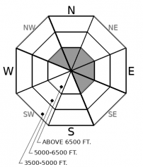
New snow is falling and drifting into fresh slabs on top of a variety of old, weak snow. Crusts found on southerly slopes can act as good sliding surfaces. On northerly slopes, weak layers of faceted snow and surface hoar will prevent new slabs from bonding and may cause them to break in surprising ways – further than you expect or in unlikely places. Expect conditions to be most dangerous where 8 inches or more of new snow accumulates. Slabs will be thickest on leeward slopes where westerly winds have drifted the new snow. You can limit your risk by avoiding steep terrain with deeper snow totals and trigger points like convexities and unsupported slopes. Shooting cracks, blowing snow, and heavy snowfall rates are red flags.
-
Type ?
-
Aspect/Elevation ?
-
Likelihood ?CertainVery LikelyLikelyPossible
 Unlikely
 -
Size ?HistoricVery LargeLargeSmall

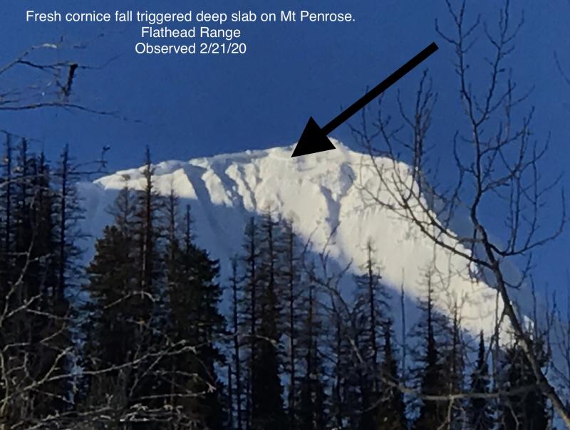
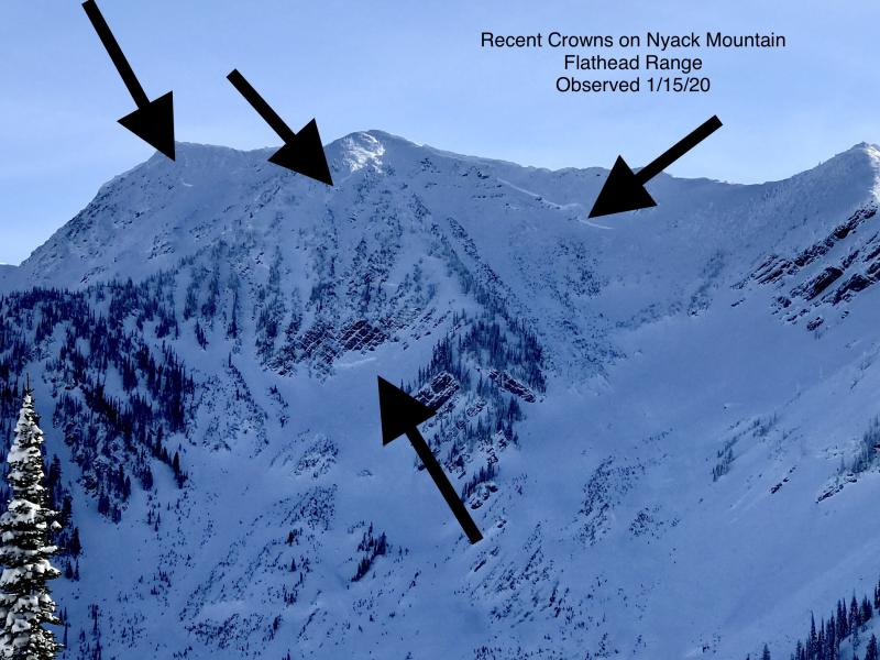
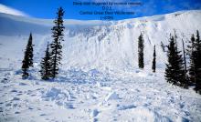
Cornice fall triggered a large avalanche on a northeast-facing slope near Mt. Penrose last Thursday or Friday. The slide is a good reminder of the lingering danger of large avalanches breaking on weak snow near the ground in high alpine bowls and faces in the Flathead Range and Glacier Park on northerly and easterly aspects. While these slides are unlikely, it's good policy to limit your time under steep northerly and easterly start zones near ridges, particularly those with large cornices and active loading. Plumes of snow at ridges are a good sign of the latter.
The moderate winds that observers reported over the past two days haven’t had a lot of new snow to play with, until now. Snowfall picked up late yesterday and winds continued through the night. More of the same is on tap for today, though there is some uncertainty in the weather forecast. Models diverge on the amount of new snow today. The Swan Range appears to be favored with around 8 inches or more. The Noisy Basin SNOTEL started recording heavy snowfall rates of and inch per hour early this morning. The Flathead Range and the Divide have picked up between 4 and 8 inches in the past 24 hours and could see another 3 to 5 inches today. The Whitefish Range has seen 3 to 5 inches so far and will most likely miss out on the bulk of the precip today. Wind sensors across the region continue to show moderate southwest winds ideal for redistributing snow onto leeward slopes.
New and drifting snow is accumulating on a variety of old snow surfaces that will inhibit bonding. Crusts and old hard wind drifts can act as sliding surfaces for fresh slabs. What scares me most is the weak faceted snow and surface hoar that has been reported from the Flathead and Whitefish ranges over the weekend. Skiers triggered small but touchy slabs that broke on surface hoar in the Whitefish Range over the past two days. Persistent weak layers like that will not only make new slabs more sensitive, but will prevent them from healing as quickly as they normally would. Because the troubling layers were best preserved at the margins of typically wind loaded slopes it will be harder to spot likely trigger points. Slabs can break from above you or from sheltered terrain nearby. You’ll need to give yourself an extra wide berth around new slabs today.
Bands of snow showers will continue today with the Swan Range favored. Conditions dry up tomorrow as a ridge builds to our west. A shortwave trough Wednesday may bring a shot of additional snow before condtions become calm and warm later this week.
This forecast applies only to backcountry areas outside established ski area boundaries. The forecast describes general avalanche conditions and local variations always occur. This forecast expires at midnight on the posted day unless otherwise noted. The information in this forecast is provided by the USDA Forest Service who is solely responsible for its content.


