| Friday | Friday Night | Saturday | |
|---|---|---|---|
| Cloud Cover: | Mostly Clear | Partly Cloudy | Partly Cloudy |
| Temperatures: | 25 to 32 deg. F. | 14 to 19 deg. F. | 28 to 34 deg. F. |
| Wind Direction: | Southwest | Southwest | Southwest |
| Wind Speed: | 15G25 | 14G28 | 16G32 |
| Snowfall: | 0" in. | 0" in. | 0" in. |
| Snow Line: | 2000' | 2500' | 2500' |
Flathead Range and Glacier National Park
How to read the forecast
Today the avalanche danger may rise to Moderate as the sun warms southerly aspects. Slopes that are not cooled by increasing southwesterly winds will be of most concern. Seek out cold powder on shady slopes while keeping alert for pockets of recently-drifted snow.

2. Moderate
?
Above 6500 ft.
2. Moderate
?
5000-6500 ft.
2. Moderate
?
3500-5000 ft.
- 1. Low
- 2. Moderate
- 3. Considerable
- 4. High
- 5. Extreme
-
Type ?
-
Aspect/Elevation ?
-
Likelihood ?CertainVery LikelyLikelyPossible
 Unlikely
 -
Size ?HistoricVery LargeLargeSmall

Loose wet avalanches remain a concern on sun-exposed aspects that are not getting brushed by southwesterly winds. Though we expect most to be relatively small, they may be large in long, continuously steep paths. Wet snow sluffs of any size can be dangerous if they push you into a terrain trap. Snow falling out of trees and rocky cliff bands exposed to the sun are the initial signs of natural avalanche activity. This instability is easy to recognize and avoid: if you see rollerballs, pinwheels, or natural sluffs, move towards cold, dry snow on shady aspects.
-
Type ?
-
Aspect/Elevation ?

-
Likelihood ?CertainVery LikelyLikelyPossible
 Unlikely
 -
Size ?HistoricVery LargeLargeSmall

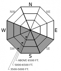
Thursday, riders reported gusty winds and moderate wind transport on the highest ridgelines. Sustained winds out of the southwest and west this afternoon will transport more snow onto leeward aspects. Expect wind slabs to be isolated below ridgelines and on cross-loaded terrain features further downslope. While most will not be large enough to bury a person, they still pack enough punch to knock you off your feet or push you into a terrain trap. Seek out sheltered slopes if you see active wind loading. Cornice fall from wind or sun will likely trigger lurking wind slab below.
-
Type ?
-
Aspect/Elevation ?
-
Likelihood ?CertainVery LikelyLikelyPossible
 Unlikely
 -
Size ?HistoricVery LargeLargeSmall

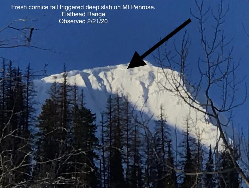
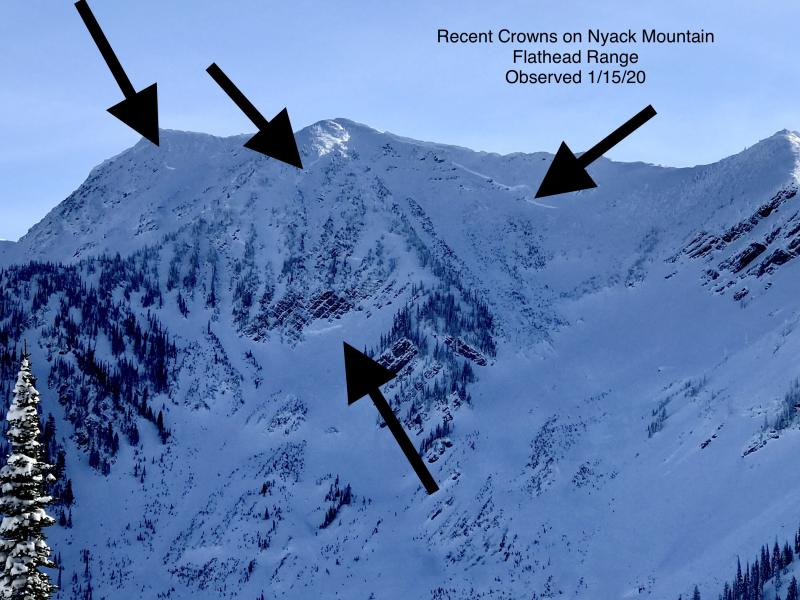
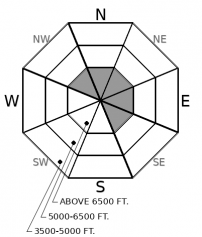
Deep slab activity has waned since a flurry of natural releases in early February. Although slides breaking on weak layers near the ground have become increasingly difficult to trigger, the consequences are unsurvivable. The pattern of deep slabs avalanches this winter has been confined to high alpine bowls and faces in the Flathead Range and Glacier Park on northerly and easterly aspects. Cornice falls are the most likely triggers. Choose routes that reduce your exposure to overhead hazards, including runout zones, and be cautious of alpine slopes with thin or variable snow coverage.
Riders continue to find mostly stable avalanche conditions with isolated areas of concern (observation 1). Yesterday, stronger-than-forecast south winds kept the snow surface cool during peak hours of solar input, thus making loose wet avalanches less of a concern. Today you can expect the snow surface to behave similarly. Winds are forecast to reach 15 mph with gusts up to 25 mph out of the southwest. Solar aspects that are getting swept by this wind will remain cool and pose no threat. Areas that are sheltered by the wind will likely heat up and begin to rollerball and potentially entrain snow below. The most significant concern is if you get caught and pushed into a gully, stand of trees, or off a cliff band.
Wind speeds yesterday gained enough strength to transport snow at the highest ridgelines. One report came in of a large soft slab triggered by cornice fall that likely occurred within the past few days. As mentioned above, winds will gain strength today and reach speeds capable of transporting snow. If winds do form slabs below ridge crests or at the tops couloirs, expect them to be relatively small and isolated. This will be an easy problem to manage today - look for snow blowing off ridgelines and seek powder snow in wind-sheltered terrain.
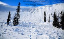
Cornice fall is a continued concern for us. Riders reported large cracks on ridge lines where cornices have begun to un-root themselves. Each of the past two days, observers have found recent cornice fall. These can be triggered by both wind-transported snow and by the warm sun beating down on them. Be mindful of what is above you and stay out from underneath these large, destructive features. Cornices currently lurk over the kind of terrain that has produced very large and deadly avalanches in areas of the Flathead Range and Glacier National Park. We received an observation yesterday of two, very large natural avalanches that occurred on the Rocky Mountain Front outside our forecast area. Both likely failed on October and November facet crust combinations. Although this happened outside our forecast area, the snowpack structure has similar characteristics and tells us that we are not out of the woods yet.
Upcoming Classes
Ladies Intro to Avalanche Class • This class, for skiers and snowboarders, is geared to help you recognize and understand obvious avalanche hazards through both a classroom and a field session. The course provides a brief introduction to avalanche statistics and human factors, terminology, terrain, snowpack and weather factors, trip planning and preparation, simple decision-making tools and backcountry travel protocols.
Thursday, February 27 from 6:00 to 9:00 PM and Saturday, February 29 from 9:30 AM to 4:00 PM. Sign up here.
Companion Rescue Clinic • A rescue clinic that focuses on avalanche rescue skills for small recreational groups.
Saturday, March 7 from 10:00 AM to 4:00 PM. Sign up here.
Motorized Level One Class • The Level 1 avalanche course is an interactive program covering the fundamentals of avalanche hazards including awareness and stability assessments. During this three day class, gain a basic understanding of slab mechanics, terrain, snowpack and weather, decision support tools and rescue.
March 6-8 from 9:00 AM to 5:00 PM. Sign up here.
High pressure will begin to weaken this afternoon, bringing mid and high-level cloud cover during the evening hours. Today, temperatures will hover in the upper 20s and low 30s at 6000 feet with mostly clear skies. Expect gusty winds out of the SW. The next round of precipitation will enter our region late Sunday and into Monday.
This forecast applies only to backcountry areas outside established ski area boundaries. The forecast describes general avalanche conditions and local variations always occur. This forecast expires at midnight on the posted day unless otherwise noted. The information in this forecast is provided by the USDA Forest Service who is solely responsible for its content.


