| Tuesday | Tuesday Night | Wednesday | |
|---|---|---|---|
| Cloud Cover: | Mostly cloudy | Mostly Clear | Mostly Clear |
| Temperatures: | 15 to 20 deg. F. | -1 to 4 deg. F. | 20 to 25 deg. F. |
| Wind Direction: | Northwest | Northwest | Southwest |
| Wind Speed: | 0 to 10 | 0 to 10 | 0 to 10 |
| Snowfall: | 1 to 3" in. | 0" in. | 0" in. |
| Snow Line: | 0' | 0' | 0' |
Flathead Range and Glacier National Park
How to read the forecast
Storm snow from the weekend is stabilizing. If there are any lingering slab instabilities, they are most likely to be found on the highest, most heavily windloaded slopes. Otherwise, be mindful of shallow sluffing in the top few inches of snow, especially as the sun comes out this afternoon. Continue to give sagging cornices and alpine faces below them caution.

1. Low
?
Above 6500 ft.
1. Low
?
5000-6500 ft.
1. Low
?
3500-5000 ft.
- 1. Low
- 2. Moderate
- 3. Considerable
- 4. High
- 5. Extreme
-
Type ?
-
Aspect/Elevation ?
-
Likelihood ?CertainVery LikelyLikelyPossible
 Unlikely
 -
Size ?HistoricVery LargeLargeSmall

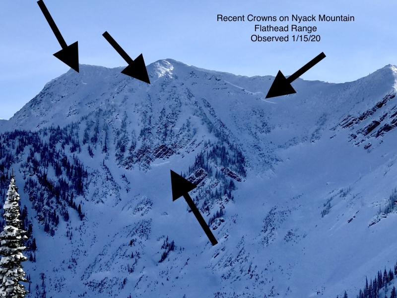
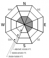
Deep slab activity has waned since a flurry of natural releases in early February. Although slides breaking on weak layers near the ground have become increasingly difficult to trigger, the consequences are unsurvivable. The pattern of deep slabs avalanches this winter has been confined to high alpine bowls and faces in the Flathead Range and Glacier Park on northerly and easterly aspects. Cornice falls are the most likely triggers. Choose routes that reduce your exposure to overhead hazards, including runout zones, and be cautious of alpine slopes with thin or variable snow coverage.
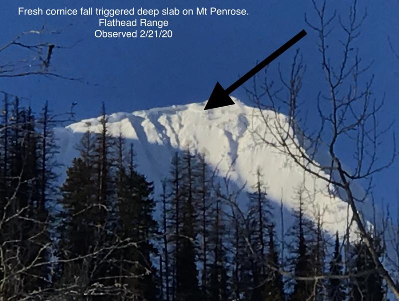
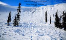
Observers yesterday reported the snowpack continuing its trend towards stability under the current mild weather pattern. Most observations highlighted a lack of cracking, unstable pit results, or avalanche activity. A notable exception was a cornice fall triggered avalanche on Mt. Penrose sometime in the last day or two. Continue to give cornices a healthy amount of space. Not only are they dangerous in and of themselves, but in isolated areas, we remain leery for the potential for a cornice fall to trigger a much larger deep slab avalanche in the alpine terrain of the Flathead and Glacier Park.
The low-density snow at the surface, and new snow that falls this morning, will continue to produce shallow sluffs in very steep terrain. These could occur naturally if the sun comes out this afternoon. With today's relatively cool temperatures and a decent amount of cloud cover, we expect solar-triggered sluffs to be harmless in size and not a widespread issue. Tomorrow is a different story, with plenty of direct sunshine under a warming temperature trend. Pay attention for changing surface conditions.
A high-pressure ridge is staging its entrance along the BC Coastline this morning. Today, we remain in unsettled northwest flow ahead of the ridge. A weak shortwave will bring flurries and cloud cover this morning, favoring the southern ranges. Winds will remain light. Clouds should start to dissipate north to south this afternoon, starting with the Whitefish Range. High pressure moves overhead tomorrow bringing warming temperatures and sunny skies.
This forecast applies only to backcountry areas outside established ski area boundaries. The forecast describes general avalanche conditions and local variations always occur. This forecast expires at midnight on the posted day unless otherwise noted. The information in this forecast is provided by the USDA Forest Service who is solely responsible for its content.


