| Monday | Monday Night | Tuesday | |
|---|---|---|---|
| Cloud Cover: | Mostly Cloudy | Partly Cloudy | Partly Cloudy |
| Temperatures: | 19 to 26 deg. F. | 5 to 9 deg. F. | 17 to 24 deg. F. |
| Wind Direction: | West | West | West |
| Wind Speed: | 10 | 10 | 11 |
| Snowfall: | 0 to 1" in. | 0" in. | 0" in. |
| Snow Line: | 500' | 0' | 0' |
Whitefish Range
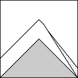
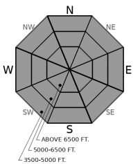
How to read the forecast
Though the avalanche danger is trending downward, you can still get into trouble today. The most obvious hazard is recently drifted slabs on leeward slopes. These may be stubborn, but don’t expect them to be safe. Start small and use test slopes before venturing onto steep, open terrain. Shooting cracks are signs you should step back from wind loaded terrain. Cohesionless snow will sluff on very steep slopes. If you want to avoid any problems, seek low angled, sheltered terrain.

2. Moderate
?
Above 6500 ft.
2. Moderate
?
5000-6500 ft.
1. Low
?
3500-5000 ft.
- 1. Low
- 2. Moderate
- 3. Considerable
- 4. High
- 5. Extreme
-
Type ?
-
Aspect/Elevation ?
-
Likelihood ?CertainVery LikelyLikelyPossible
 Unlikely
 -
Size ?HistoricVery LargeLargeSmall

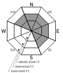
Southwest winds built slabs on leeward slopes into yesterday evening. Cam saw wind loading on most upper and middle elevation slopes near the resort. The most new snow has accumulated in the northern part of the range, and slabs could be larger there. You can still get into trouble today on steep leeward terrain, and on wind loaded slopes above terrain traps. Watch for rounded drifts below ridgelines and on the sidewalls of chutes. Small test slopes that crack under your boards or machine are a clue that you should avoid bigger wind loaded terrain.
-
Type ?
-
Aspect/Elevation ?
-
Likelihood ?CertainVery LikelyLikelyPossible
 Unlikely
 -
Size ?HistoricVery LargeLargeSmall

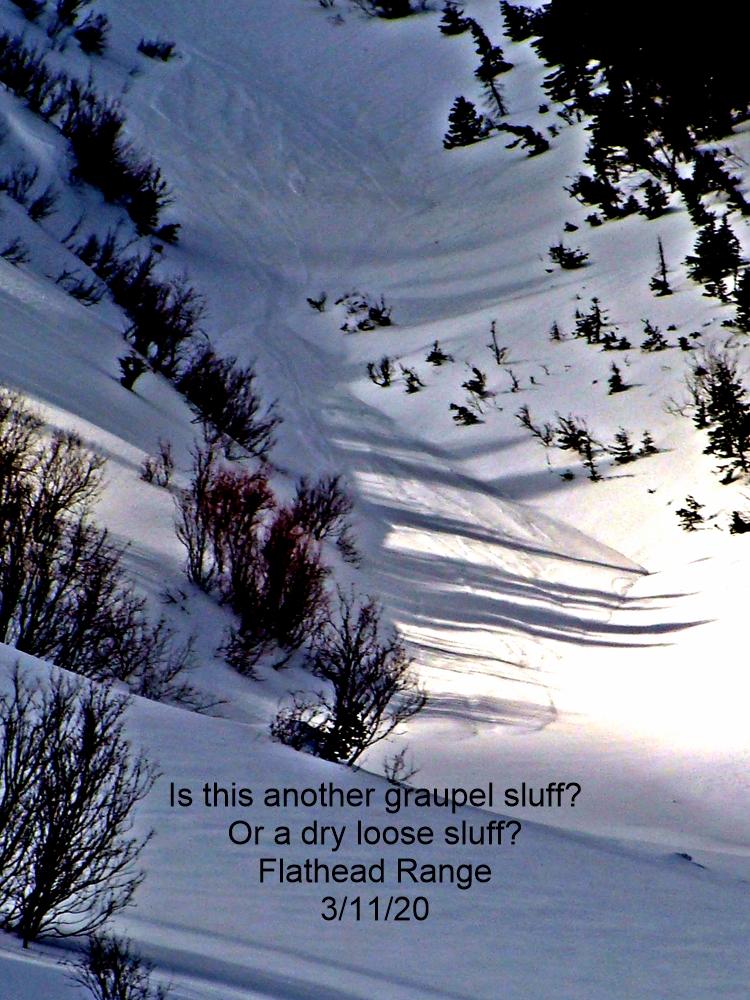
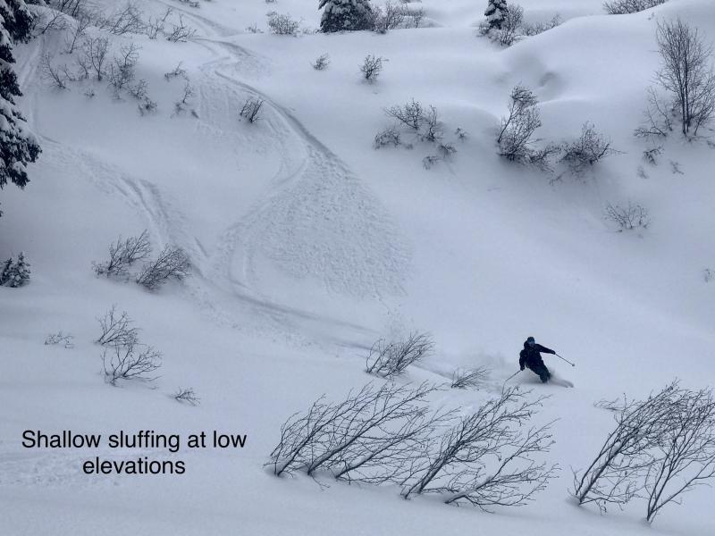
Loose dry avalanches will be most dangerous where more snow has accumulated – in the norther part of the range - and above terrain traps where debris can pile up deeply. If the sun comes out, new snow may shed on solar aspects. Avoid steep, confined terrain where you can’t escape your sluff. Watch for loose fanning out and running down above you on very steep slopes.
There is an old saying: “The more that changes, the more that stays the same...”
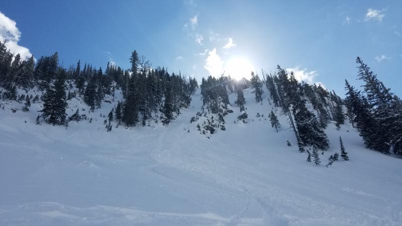
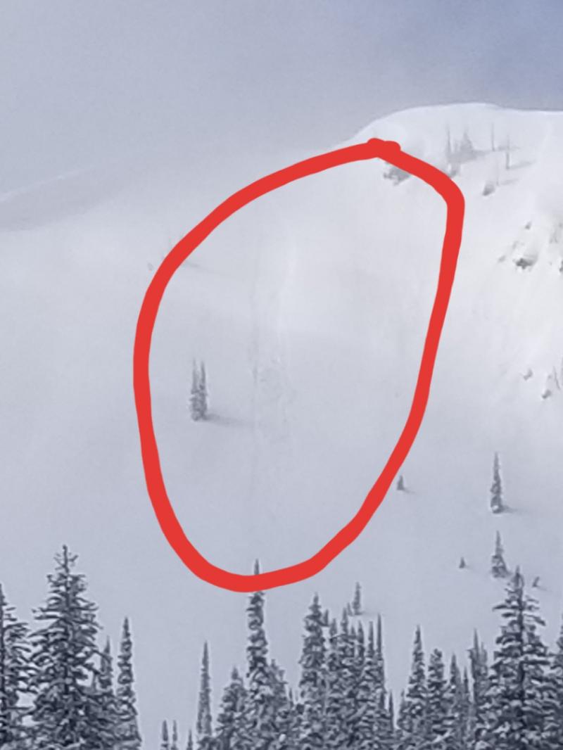
Yesterday, a few storm slab avalanches ran on steep leeward slopes in the Flathead Range. One was triggered by skiers on the sidewall of a gully. A larger slide ran naturally as a result of cornice fall or sluffing from above. Both slides involved wind drifted snow. Observers also reported small sluffs running on very steep slopes. There were some intense convective snow showers with graupel pounding down from the sky in the Flathead, and light showers in the Whitefish Range. Moderate winds loaded leeward slopes with fresh drifts and fragile cornices.
Today, the weather forecast is calling for a few inches of new snowfall for the Flathead and Swan Ranges. New snow should arrive during brief convective bursts in the morning and late afternoon, and may come as graupel. The Whitefish Range will see much less snow with a light shower or two. Light new snow can sluff in steep terrain. Sound familiar?
The primary difference today is the lack of wind. The atmosphere will be calmer today. There may even be periods of blue sky. So while the avalanche problems remain the same, there are a few critical differences today. The storm snow from the past two days is settling. Small instabilities involving fresh slabs of recent or drifted snow will be fewer and further between. Older, harder slabs, the result of previous winds, will be stubborn yet can be large and break in unexpected ways. The danger is on a downward trend, but you can still get into trouble if you step out too quickly without assessing for lingering instabilities first. Use small test slopes before committing to bigger terrain. Use safe travel practices and ride one at a time. If you’re not comfortable evaluating and managing the problems, then seek out wind-sheltered slopes less than about 40 degrees with no terrain traps below.
The National Weather Service has issued a Winter Weather Advisory for our area through 11am due to brief bursts of heavy snow. Otherwise the day should be calm until late afternoon. Temperatures should be a few degrees cooler today and winds much lighter after the most recent cold front passed us by last night. Cold air slips down the east side of the Divide tomorrow bringing a few more snow showers. High pressure builds overhead by mid week.
This forecast applies only to backcountry areas outside established ski area boundaries. The forecast describes general avalanche conditions and local variations always occur. This forecast expires at midnight on the posted day unless otherwise noted. The information in this forecast is provided by the USDA Forest Service who is solely responsible for its content.


