| Sunday | Sunday Night | Monday | |
|---|---|---|---|
| Cloud Cover: | Mostly Cloudy | Mostly Cloudy | Mostly Cloudy |
| Temperatures: | 21 to 27 deg. F. | 10 to 15 deg. F. | 18 to 24 deg. F. |
| Wind Direction: | Southwest | West | West |
| Wind Speed: | 10 to 15, gusting to 30 | 5 to 10 | 5 to 10 |
| Snowfall: | 3" to 6" in. | 2" to 5" in. | 1 to 2" in. |
| Snow Line: | 2500' | 1000' | 500' |
Flathead Range and Glacier National Park
How to read the forecast
More snow and wind will increase the danger of near-surface avalanche problems. Your risk of triggering slides will be greater in steeper, more consequential terrain. Start small and use safe test slopes before venturing onto steep, open terrain. Shooting cracks and long running sluffs are clues to dial back your slope angles. Watch for drifts of snow under cornices and in exposed areas.

2. Moderate
?
Above 6500 ft.
2. Moderate
?
5000-6500 ft.
2. Moderate
?
3500-5000 ft.
- 1. Low
- 2. Moderate
- 3. Considerable
- 4. High
- 5. Extreme
-
Type ?
-
Aspect/Elevation ?
-
Likelihood ?CertainVery LikelyLikelyPossible
 Unlikely
 -
Size ?HistoricVery LargeLargeSmall

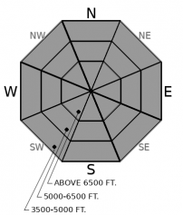
Moderate winds and heavy snowfall overnight have created soft slabs of new and drifted snow. They will become more dangerous – larger and more sensitive to a rider's weight - as more snow accumulates. The same trend will be true if you move onto steeper-angled slopes or climb higher. Use small test slopes to assess the danger before committing to more consequential terrain. Shooting cracks in wind-thickened slabs are the surest sign of danger. Unconsolidated snow can sluff in very steep terrain and the consequences can be magnified by terrain traps below. The safest terrain is sheltered from the wind with slope angles less than 40 degrees.
-
Type ?
-
Aspect/Elevation ?
-
Likelihood ?CertainVery LikelyLikelyPossible
 Unlikely
 -
Size ?HistoricVery LargeLargeSmall

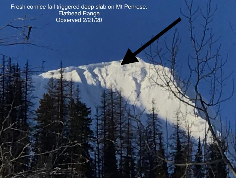
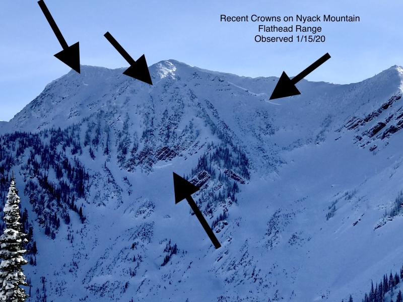
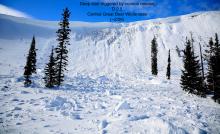
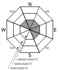
Deep slab activity has waned since a flurry of natural releases in early February. Although slides breaking on weak layers near the ground have become increasingly difficult to trigger, the consequences are unsurvivable. The pattern of deep slabs avalanches this winter has been confined to high alpine bowls and faces in the Flathead Range and Glacier Park on northerly and easterly aspects. Southwest winds and new snow continue to load the most suspect starting zones, especially in the interior of Glacier Park near the Divide. Cornice falls are the most likely triggers. Choose routes that reduce your exposure to overhead hazards, including runout zones, and be cautious of alpine slopes with thin or variable snow coverage.
Observers across the region reported all the signs of growing wind slabs yesterday. Big cornices got bigger. Moderate southwest winds built reactive new drifts below ridglines. We triggered wind slabs, new and old, in the Swan Range. Shooting cracks were a common occurrence along the crest of the Apgars. Though new slabs were small Saturday, the winds maintained their steady howl through about midnight. Moderate to heavy snowfall began yesterday afternoon and continued into the early hours this morning. Today, be especially alert for signs of instability and danger in areas prone to collecting drifted snow. The combination of recently-formed wind slabs and stiffening of today's new snow by wind will make this terrain the most likely spots for finding trouble.
In sheltered areas, today's light to moderate snowfall will accumulate on a variety of snow surfaces, including low density snow that sluffed Saturday in sheltered areas. New snow will also cover rime crusts and wind board on windward slopes, and leftover hard wind slabs near ridgelines. Below the snow surface, two crusts from early February are separated a few inches of soft, weak snow. Where the upper crust from 2/5 is thinnest, slabs could break between the crusts and propagate further than expected. This variability makes it important to assess slope-specific conditions before stepping out into consequential terrain.
Northwest flow continues across the region. Light to moderate snow showers are expected ahead of a Pacific cold front passing overhead this afternoon. The heaviest snowfall thus far has been in Glacier Park. The Swan Range looks favored today. Temperatures remain seasonable and steady. Winds will be less than yesterday, but gusty at ridgetops. Snowfall tapers into the early week as high pressure settles in by Wednesday.
This forecast applies only to backcountry areas outside established ski area boundaries. The forecast describes general avalanche conditions and local variations always occur. This forecast expires at midnight on the posted day unless otherwise noted. The information in this forecast is provided by the USDA Forest Service who is solely responsible for its content.


