| Friday | Friday Night | Saturday | |
|---|---|---|---|
| Cloud Cover: | Overcast | Mostly Cloudy | Mostly Cloudy |
| Temperatures: | 19 to 26 deg. F. | 17 to 23 deg. F. | 26 to 35 deg. F. |
| Wind Direction: | West | West | West |
| Wind Speed: | 10 to 15, gusting to 30 | 10 to 15, gusting to 30 | 20G36 |
| Snowfall: | 7" to 11" in. | 1 to 4" in. | 2 to 5" in. |
| Snow Line: | 1500' | 1500' | 1500' |
Flathead Range and Glacier National Park
How to read the forecast
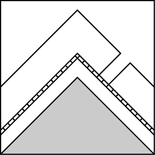
Today's avalanche danger depends on snowfall, with the greatest danger on steep slopes where more than about 8 inches of new and/ or drifted snow has accumulated since Thursday. These conditions will be most widespread near upper elevation ridges and peaks, where winds can gather new snow into thick, dense slabs. Keep it simple by sticking to slopes less than 35 degrees if you find these conditions. Avoid the runouts of large avalanche paths that start below overhanging cornices.

2. Moderate
?
Above 6500 ft.
2. Moderate
?
5000-6500 ft.
1. Low
?
3500-5000 ft.
- 1. Low
- 2. Moderate
- 3. Considerable
- 4. High
- 5. Extreme
-
Type ?
-
Aspect/Elevation ?

-
Likelihood ?CertainVery LikelyLikelyPossible
 Unlikely
 -
Size ?HistoricVery LargeLargeSmall

You can trigger avalanches that involve slabs of new and/ or drifted snow today. More new and/ or drifted snow today equals wider slabs and more danger. Slabs thickened and stiffened by the wind will be the most sensitive to the weight of a rider or snowmachine. Slabs that build quickly due to high snowfall rates or drifting may also be more reactive. Pay careful attention to new snow totals and slope angles today, balancing higher snowfall with lower slope angles.
-
Type ?
-
Aspect/Elevation ?
-
Likelihood ?CertainVery LikelyLikelyPossible
 Unlikely
 -
Size ?HistoricVery LargeLargeSmall

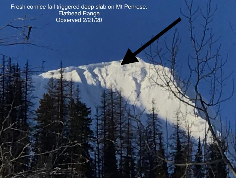
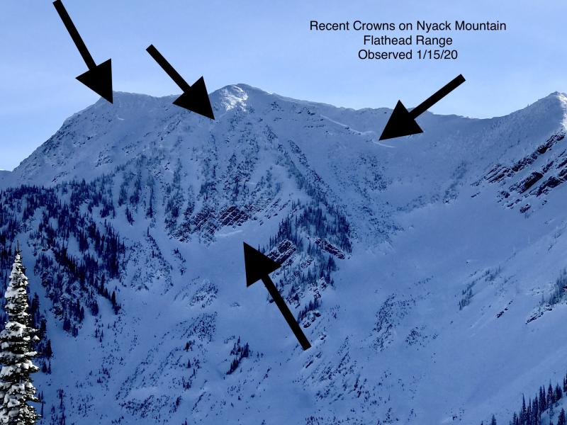
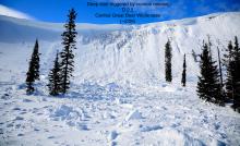
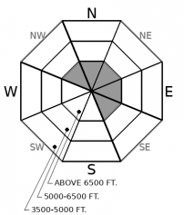
Deep slab activity has waned since a flurry of natural releases in early February. Although slides breaking on weak layers near the ground have become increasingly difficult to trigger, the consequences are unsurvivable. The pattern of deep slabs avalanches this winter has been confined to high alpine bowls and faces in the Flathead Range and Glacier Park on northerly and easterly aspects. Cornice falls are the most likely triggers. Choose routes that reduce your exposure to overhead hazards, including runout zones, and be cautious of alpine slopes with thin or variable snow coverage.
One thing about which I have little uncertainty this morning: there are few, if any, weak layers above the 2/1 rain crust, which is now buried 15-25 inches below the snow surface. Some slabs of drifted snow from Tuesday's strong winds might remain unstable near upper elevation ridgelines and summits.
There's also not much uncertainty about snow surfaces Thursday afternoon: loose, dry snow or melt-freeze crusts. You can find the former on shady slopes at mid and upper elevations. The crusts are most widespread on southerly slopes at mid and low elevations; they're patchy in the same terrain at upper elevation.
Things about which I have significant uncertainty this morning: snowfall amounts and distribution. Output from weather models has totals ranging from a trace to 10 inches or more, with the models contradicting each other about what areas are favored. Some output shows the Swan Range winning the jackpot with up to a foot of new snow, while other output shows the area skunked.
That's kind of a big deal, because with few or no near-surface weak layers, the avalanche danger depends on the amount of new and drifted snow that accumulates. Fortunately, identifying potentially dangerous slopes will be relatively straightforward. They'll be steeper, with thicker, stiffer slabs. They may give themselves away with cracks around your boards or skis. Active tests, like stomping above a skin track or sled cuts on steep slopes above roads, can give reliable feedback about the thickness and sensitivity of slabs. Near ridges, you may need to probe or dig deeper, to check for slabs of drifted snow that formed earlier this week and can remain unstable.
With only a few inches of snow accumulating in most areas, lower-angled slopes may offer the best riding, particularly where the new snow accumulates above Thursday's melt-freeze crust. And if you find a freezing rain crust at the snow surface, the avalanche danger will be less acute.
The fast-moving system sweeping through the region will bring snow showers that taper off this afternoon. Snow accumulations will be spotty, with some locations getting skunked while others wring out 5-10". The southern part of the forecast region and the Continental Divide look favored. Sorta. Expect gusty westerly winds near ridge crests. With continued northwesterly flow, we should see intermittent periods of snow through the weekend.
This forecast applies only to backcountry areas outside established ski area boundaries. The forecast describes general avalanche conditions and local variations always occur. This forecast expires at midnight on the posted day unless otherwise noted. The information in this forecast is provided by the USDA Forest Service who is solely responsible for its content.


