| Friday | Friday Night | Saturday | |
|---|---|---|---|
| Cloud Cover: | Mostly Cloudy | Mostly Cloudy | Overcast |
| Temperatures: | 24 to 30 deg. F. | 25 to 30 deg. F. | 15 to 25 deg. F. |
| Wind Direction: | West | Southwest | West |
| Wind Speed: | 5 to 10, gusting to 15 | 10 to 15, gusting to 25 | 15 to 20, gusting to 30 |
| Snowfall: | 0-1 in. | 3" to 6" in. | 3" to 6" in. |
| Snow Line: | 2000' | 3000' | 2000' |
Flathead Range and Glacier National Park
How to read the forecast
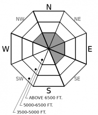
Avoid being on or under steep, shady, upper-elevation slopes where the snowpack is broken by rocks, small cliffs, or convexities. In this terrain, the potential for natural and triggered slides that break near the ground lingers. The potential for triggered slides involving snow near the surface is isolated to very steep terrain with recently-formed slabs of drifted snow, or more than 10 inches of loose dry snow.

2. Moderate
?
Above 6500 ft.
1. Low
?
5000-6500 ft.
1. Low
?
3500-5000 ft.
- 1. Low
- 2. Moderate
- 3. Considerable
- 4. High
- 5. Extreme
-
Type ?
-
Aspect/Elevation ?
-
Likelihood ?CertainVery LikelyLikelyPossible
 Unlikely
 -
Size ?HistoricVery LargeLargeSmall

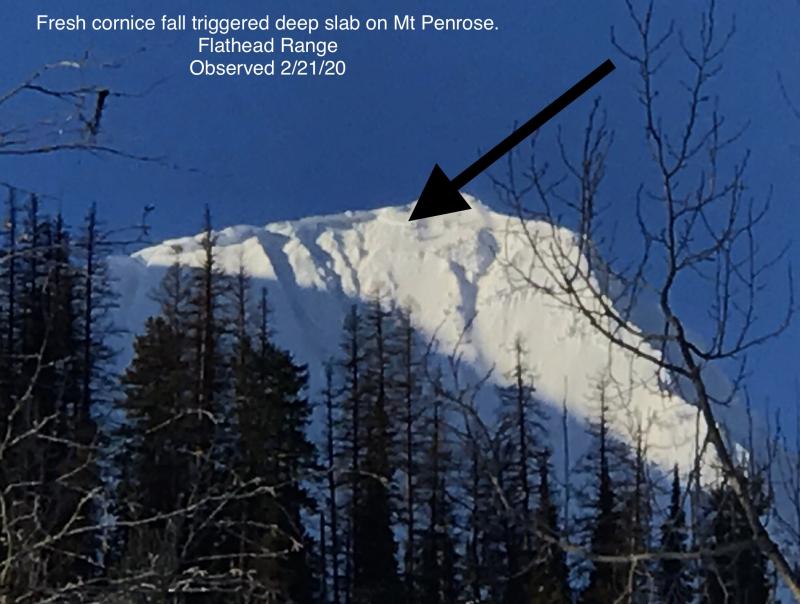
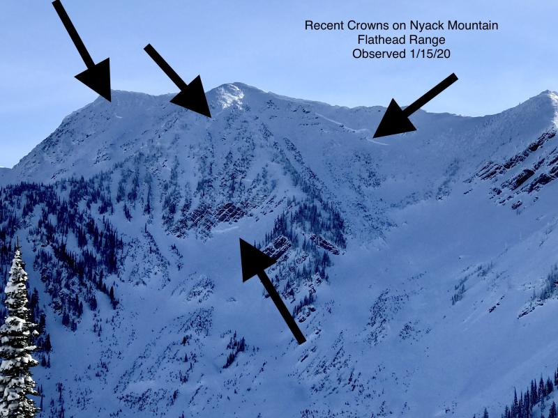
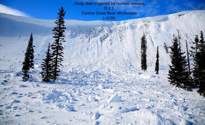
With avalanches leaving 20 foot crowns near Mt. Grant as recently as this past weekend, it remains critical to limit your exposure to steep, upper-elevation slopes that harbor weak facets and crusts near the ground. That means avoiding the runouts of these start zones, as well as choosing planar slopes with relatively uniform snow depths. I'd also avoid being under slopes like this that have large cornices cantilevered over them, as falling cornices may be a large enough load to trigger a slide that breaks near the ground and involves the entire season's snowpack.
Some people tag a phrase onto to the end when they read fortune cookies aloud, to give the messages context. Something like "You'll have nothing but the best...in the mountains." Or "It's gonna get wild...." For the rest of the winter, add the caveat "...unless an ice crust is capping the snow, in which case surface avalanche problems will be less acute" to our descriptions of surface dry snow avalanche hazards.
On Thursday, yet another freezing rain episode left a crust that capped recent snow in the Swan Range and parts of the Flathead Range. It's crust #4356, if you're keeping score. You can mark it on your list as the 2/5 crust, or the "Chocolate Fondue Day Crust." Or the "Shower with a Friend Day" crust. Observers found it to at to least 6500 feet on the western side of the Swan Range, where it was a few millimeters to a centimeter thick. Zach reported it in the Nyack area of the Flathead Range, though it was thin and didn't affect the riding. I didn't find it John F. Stevens Canyon, nor did Cam, in the northern Whitefish Range. Citizen Scientists, send us some data. Find it? Not present? Please let us know.
The 2/5 crust limits the amount of snow available for wind transport or sluffing today. And with light winds and a few snow showers in the forecast today, there won't be much of either anyway. Reports indicate that recently-formed wind slabs are unreactive, so we've removed them from the problem list. With a well-consolidated midpack capped by the 2/1 crust to at least 7000 feet and isolated dry snow avalanche hazards at all elevations, we dropped the danger to Low or Level 1 in most of the region. That doesn't mean you can't get into trouble; it means it should be easy to avoid the isolated pockets where it exists. Those will be steep, mostly leeward start zones with more than 10 inches of loose recent snow or cohesive drifted snow sitting above the 2/1 crust. Or the same where the 2/1 crust doesn't exist, which be near ridges and peaks above about 7000 feet.
The notable exception is upper elevations in the Flathead Range and Glacier National Park. A crust/ facet combination that formed early season still exists at the base of the snowpack, and the danger of avalanches breaking there and releasing the entire season's snowpack lingers. These are low probability/ high consequences events. Given that, my ascent and descent routes will reduce my exposure to overhead avalanche hazards. Be alert as you climb above 7000 feet in this zone, since many of the peaks in this zone extend above that elevation. If the 2/1 crust thins out or isn't present, do some homework before committing to steep start zones.
We'll get some splashes of precipitation from the atmospheric river flooding areas to our south, in the form of snow showers today and more sustained snow tonight and tomorrrow morning. Expect a trace to 2" today and 3 to 6 inches by midday tomorrow. Winds will be light today but increase overnight and tomorrow as a cold front passes. The precipitation should remain all snow, though "pockets of light freezing rain are still possible in isolated valleys that remain under inversions."
This forecast applies only to backcountry areas outside established ski area boundaries. The forecast describes general avalanche conditions and local variations always occur. This forecast expires at midnight on the posted day unless otherwise noted. The information in this forecast is provided by the USDA Forest Service who is solely responsible for its content.


