| Tuesday | Tuesday Night | Wednesday | |
|---|---|---|---|
| Cloud Cover: | Partly Cloudy | Mostly Cloudy | Mostly Cloudy |
| Temperatures: | 12 to 18 deg. F. | 8 to 14 deg. F. | 21 to 26 deg. F. |
| Wind Direction: | Southwest | Southwest | Southwest |
| Wind Speed: | 15G30 | 22G36 | 19G32 |
| Snowfall: | 0" in. | 1" to 2" in. | 2" to 6" in. |
| Snow Line: | 0' | 0' | 1000' |
Flathead Range and Glacier National Park
How to read the forecast
A solid melt-freeze crust, cold temperatures, and lack of significant wind loading are contributing to mostly stable avalanche conditions. If you ascend above 7000 feet, choose terrain with a deep uniform snowpack away from rock bands and slopes that face north through east. Overburdened weak layers near the ground produced very destructive avalanches this weekend. These weak layers are slow to adjust and carry huge consequences.

2. Moderate
?
Above 6500 ft.
1. Low
?
5000-6500 ft.
1. Low
?
3500-5000 ft.
- 1. Low
- 2. Moderate
- 3. Considerable
- 4. High
- 5. Extreme
-
Type ?
-
Aspect/Elevation ?

-
Likelihood ?CertainVery LikelyLikelyPossible
 Unlikely
 -
Size ?HistoricVery LargeLargeSmall

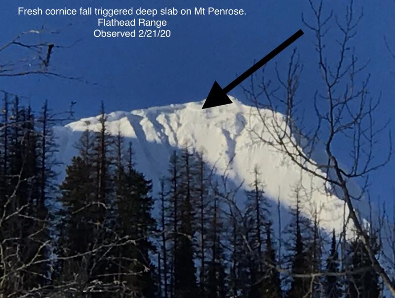
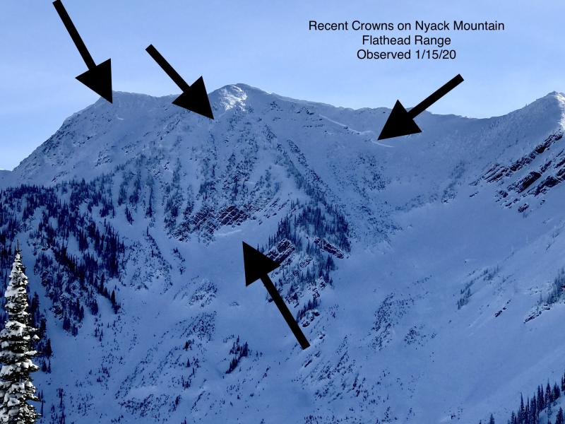
The weekend highlight reel was a destructive Deep Slab avalanche cycle that produced crowns up to 20 feet thick that cascaded debris piles down large enough to destroy buildings or derail trains. Due to this kind of recent avalanche activity, remain cautious around upper elevation, rocky slopes that face north through east. A large cornice fall or triggering from a shallow spot on a slab where wind scouring, rocks, or small cliff bands have brought weak layers closer to the surface, remains a concern. At upper elevations, reduce your chances of triggering a very large avalanche by selecting planar slopes away from cliff bands where snow depths are typically more uniform.
-
Type ?
-
Aspect/Elevation ?
-
Likelihood ?CertainVery LikelyLikelyPossible
 Unlikely
 -
Size ?HistoricVery LargeLargeSmall

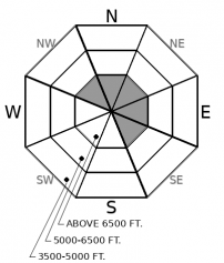
Any soft snow above the crust will be available for transport today with increasing winds. Watch for new and recent snow to drift in leeward terrain features; this may form small slabs of wind drifted snow that are reactive to the weight of a person's body or machine. Fresh wind drifts will cover up older, more stubborn wind slabs that formed on Saturday. Though we expect fresh drifts to be small, they can be consequential if they drag you into a stand of trees or over a cliff band. Drifting snow and denser, pillowy surfaces are your cues to seek wind-sheltered terrain.
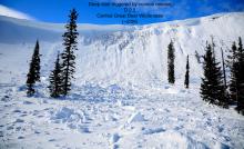
On Saturday, upper elevations of the Flathead Range and Glacier National Park saw snow accumulations reach 7 inches with winds strong enough to transport into isolated pockets of wind slabs. Today, as winds pick up again, any new or recent soft snow will be transported onto stout crusts or older wind affected surfaces. Fresh wind slabs will be small and inconsequential as long as you avoid riding above terrain traps. Clues should be obvious by looking at surface textures as shown in the picture here, or by observing snow blowing off ridgelines. There isn't enough transportable snow in the Whitefish or Swan Ranges for this problem to be much a concern.
Each significant load of water and wind this season has consistently overburdened weak layers near the ground, producing large to historic size avalanches on leeward aspects in upper elevations of the Flathead Range and Glacier National Park. Recent cold temperatures and a lack of wind loading have allowed the snowpack to adjust from Saturday’s smack of warm, wet, windy weather. Today, we expect Deep Slab avalanches to be unlikely to trigger, especially areas where a supportable crust reaches; however, this is no soft slab or loose dry avalanche problem. If triggered, one of these avalanches will be unsurvivable, that is for certain. If you are just tuning in now, take a moment to look at pictures from Saturday’s impressive Deep Slab cycle (Example A, Example B, Example C)
We can thank a thick, stout melt-freeze crust that formed on February 1st for giving us a mostly stable snowpack. This crust reaches all elevations in the Swan and the Whitefish Range and reported up to 7800 feet in the Flathead Range. We expect that the low-density snow above this crust has been faceting, and will continue to facet today with cold temperatures. Moving forward, it will likely be our next persistent weak layer and problem child.
Today, winds will be moderate gusting to strong with temperatures in the high teens and low twenties. An active pattern will impact our area during the evening hours and continue through the week.
This forecast applies only to backcountry areas outside established ski area boundaries. The forecast describes general avalanche conditions and local variations always occur. This forecast expires at midnight on the posted day unless otherwise noted. The information in this forecast is provided by the USDA Forest Service who is solely responsible for its content.


