| Saturday | Saturday Night | Sunday | |
|---|---|---|---|
| Cloud Cover: | Mostly Cloudy | Mostly Cloudy | Mostly Clear |
| Temperatures: | 33 to 39 deg. F. | 9 to 12 deg. F. | 19 to 24 deg. F. |
| Wind Direction: | Southwest | West | West |
| Wind Speed: | 45G82 | 31G76 | 12 |
| Snowfall: | 5" to 7" in. | 3" to 8" in. | 0" in. |
| Snow Line: | 5000' | 1500' | 0' |
Flathead Range and Glacier National Park
How to read the forecast
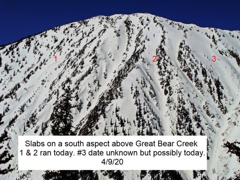
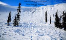
We have issued a Special Avalanche Bulletin for the Flathead Range and Glacier Park through 8 PM tonight. Wind slabs, wet snow avalanches, and the possibility of monster deep slabs are creating very dangerous avalanche conditions. Travel on, or below steep avalanche terrain is not recommended, especially at upper elevations. Dangers are most pronounced on steep slopes with saturated wet snow or drifting snow. Avoid traveling in the tracks or runouts of terrain with overhead exposure, even at low elevations.

4. High
?
Above 6500 ft.
3. Considerable
?
5000-6500 ft.
2. Moderate
?
3500-5000 ft.
- 1. Low
- 2. Moderate
- 3. Considerable
- 4. High
- 5. Extreme
-
Type ?
-
Aspect/Elevation ?
-
Likelihood ?CertainVery LikelyLikelyPossible
 Unlikely
 -
Size ?HistoricVery LargeLargeSmall

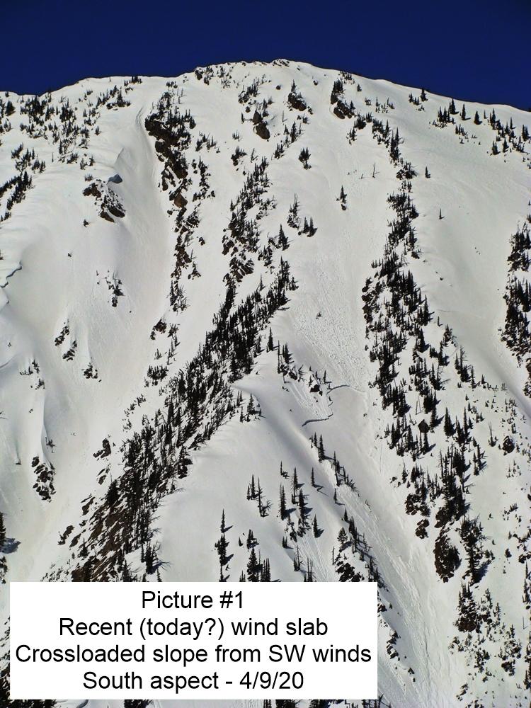
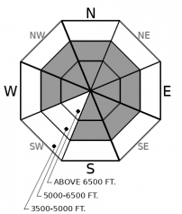
Winds have been moderate to strong overnight and will pick up throughout the day. Expect freshly-formed wind slabs at upper elevations where the snow stayed dry overnight. The problem will become more widespread to middle elevations as new snow accumulates today. Strong winds may build drifts in unusual places and further down slope than expected. Identify leeward terrain features: below ridges, gullies, and openings with blowing snow as areas to avoid. Large cornices may develop and fall with more loading and warm temperatures. Dense snow that cracks around you is a warning that you are already on drifted snow.
-
Type ?
-
Aspect/Elevation ?
-
Likelihood ?CertainVery LikelyLikelyPossible
 Unlikely
 -
Size ?HistoricVery LargeLargeSmall

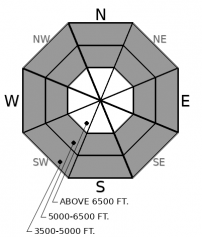
More than half an inch of rain fell overnight with temperatures above freezing into the upper elevations. Yesterday, WMR ski patrol reported shallow wet slabs that were very easy to trigger in the early evening. Water is percolating down deeper into the snowpack where it may pool on recent crusts and cause larger wet slabs. Where only the surface is wet, loose wet avalanches can sluff in steep terrain. Avoid slopes steeper than about 35 degrees with wet snow. Wet snow the cracks underneath of you is a warning to move to even lower slope angles.
-
Type ?
-
Aspect/Elevation ?
-
Likelihood ?CertainVery LikelyLikelyPossible
 Unlikely
 -
Size ?HistoricVery LargeLargeSmall

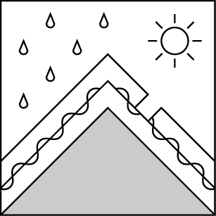
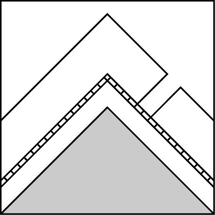
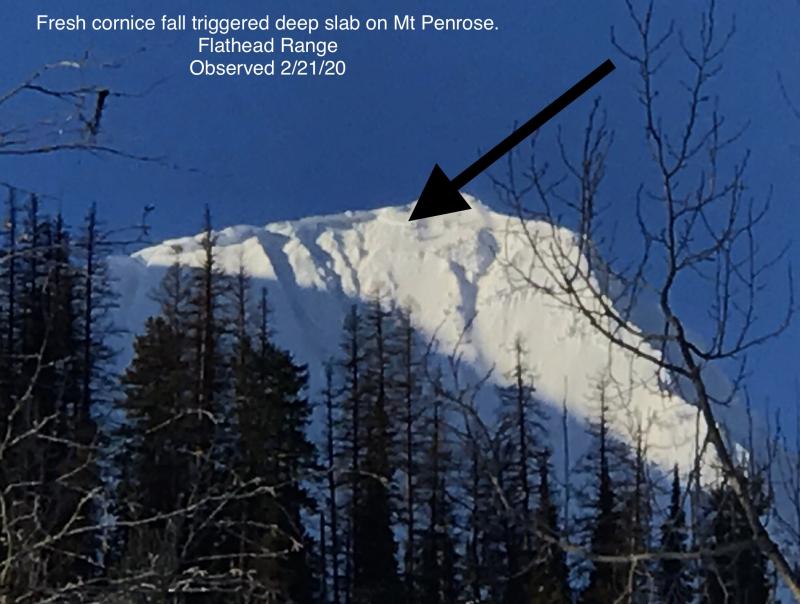
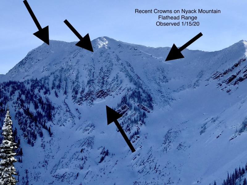
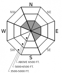
Rain weakened the snowpack into the upper-elevation band overnight. Moderate to strong winds will continue to load alpine start zones with new snow and build on cornices perched precariously below ridges. Crusts and weak facets buried deeply in the snowpack have released very large or historic avalanches with each warm storm this season. Some of these slides destroyed swaths of mature timber in the Flathead Range, where the problem is most widespread. The layers of concern also exist in the higher peaks of the northern Whitefish Range. Keep it simple today: Avoid avalanche terrain at upper-elevations and the runouts of avalanche paths down low.
Freezing levels spiked to above 6,500’ around 11 pm last night causing rain on snow. Temperatures are only nominally cooler this morning and will remain high until around sunset. Wet snow avalanches became touchy around Whitefish Mountain Resort by yesterday evening. The northern Whitefish Range, the Swan Range, and Glacier Park all received more water that WMR. Readings from weather stations show that some of that water may have percolated through the snowpack. If it pools in weak snow on top or the January crusts, wet slabs could be bigger and more dangerous below the rain/snow line. Even where just the surface is wet, loose wet avalanches can sluff in steep terrain.
At higher elevations the snow remained dry and available for strong south and west winds to redistribute it onto leeward slopes. Precarious cornices and hard wind slabs can form during warm wet storms. Hard slabs can break above you and propagate further than expected. Winds will only increase throughout the day as more snow falls. The Flathead Range and the Continental Divide are favored for the most new snow today with the northern Whitefish Range taking second place. New dry snow means more ammo for fresh wind slabs. Gusty winds at lower elevation can create erratic drifts where you least expect it. Any slope with blowing snow should be eyed with suspicion.
At the bottom of the snowpack, weak layers that developed early in the season have released very large avalanches in the Flathead Range with almost every warm storm this season. A few have failed on a similar structure in the northern Whitefish Range. Rain has weakened the snow into upper elevations. Wind loading is intense in alpine start zones. Cornices can fail during warm temperatures and tip the scales for destructive avalanches.
Freezing level this morning is around 6500 feet. Conditions will change fast today with an approching cold front. The National Weather Service has issued a Wind Advisory for our area beginning at 1 PM. Snow levels will fall after frontal passage tonight into Sunday. Drier conditions will develop early next week.
This forecast applies only to backcountry areas outside established ski area boundaries. The forecast describes general avalanche conditions and local variations always occur. This forecast expires at midnight on the posted day unless otherwise noted. The information in this forecast is provided by the USDA Forest Service who is solely responsible for its content.


