| Thursday | Thursday Night | Friday | |
|---|---|---|---|
| Cloud Cover: | Partly Cloudy | Mostly Cloudy | Mostly Cloudy |
| Temperatures: | 26 to 31 deg. F. | 19 to 23 deg. F. | 33 to 38 deg. F. |
| Wind Direction: | Southwest | Southwest | Southwest |
| Wind Speed: | 14G25 | 23G39 | 24G43 |
| Snowfall: | 0" in. | 0" in. | 1" to 5" in. |
| Snow Line: | 2500' | 2500' | 5500' |
Flathead Range and Glacier National Park
How to read the forecast
On steep, upper-elevation, leeward slopes, you can trigger freshly-formed slabs of drifted snow. In this same terrain, the danger of very large avalanches that break near the ground lurks. At low elevations and in sunny, mid-elevation terrain, warm temperatures and sun make triggering dense sluffs of wet snow possible. Careful trip planning and group management can help you dodge these hazards and enjoy good riding.

2. Moderate
?
Above 6500 ft.
2. Moderate
?
5000-6500 ft.
2. Moderate
?
3500-5000 ft.
- 1. Low
- 2. Moderate
- 3. Considerable
- 4. High
- 5. Extreme
-
Type ?
-
Aspect/Elevation ?
-
Likelihood ?CertainVery LikelyLikelyPossible
 Unlikely
 -
Size ?HistoricVery LargeLargeSmall

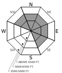
Cracks around your skis, snowboard or snowmachine are a clear sign you've found freshly-drifted snow. Check slope angles and consequences. More than 35 degrees? Above a terrain trap? Those factors make triggering slabs of drifted snow more likely and more dangerous. This hazard will be most common near peaks and ridgelines today, and isolated at mid-elevations. Shady, sheltered slopes offer plenty of alternatives with soft snow and good riding today.
-
Type ?
-
Aspect/Elevation ?
-
Likelihood ?CertainVery LikelyLikelyPossible
 Unlikely
 -
Size ?HistoricVery LargeLargeSmall

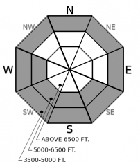
On and below steep slopes where the surface snow is wet, natural and triggered sluffs of dense wet snow pose a hazard today. These can be hard to escape and dangerous above terrain traps like gullies or cliffs. The hazard will be most acute where the surface snow is wetting for the first time. Expect those conditions on sun-exposed slopes at mid elevations if the clouds break for extended intervals. Fan-shaped releases of rollerballs indicate these conditions have developed, and that it's time to retreat to lower-angled slopes or slopes where the surface snow remains dry.
-
Type ?
-
Aspect/Elevation ?
-
Likelihood ?CertainVery LikelyLikelyPossible
 Unlikely
 -
Size ?HistoricVery LargeLargeSmall

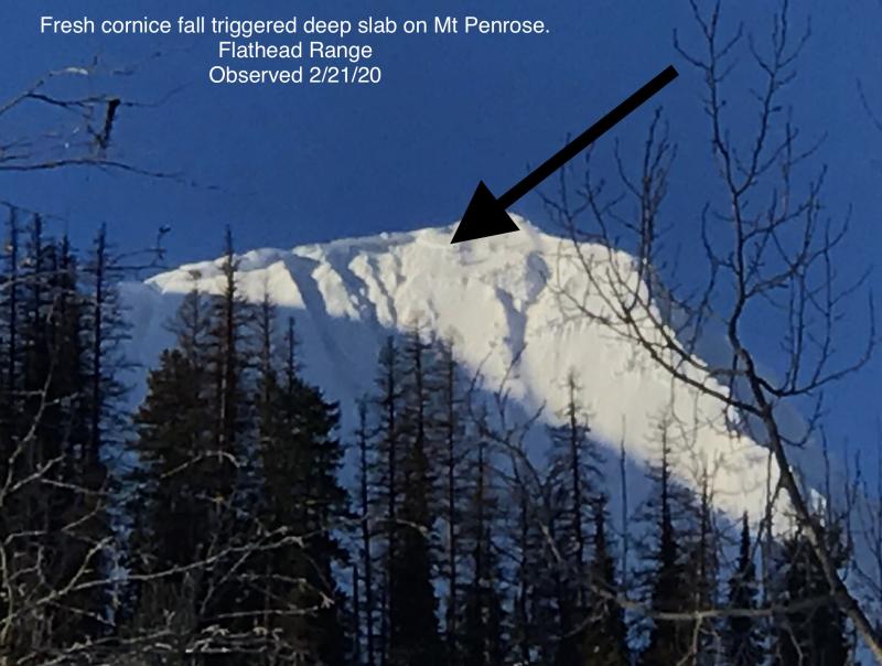
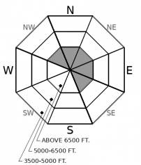
Falling corncies or a person's weight can still trigger destructive avalanches that break near the ground and involve the entire season's snowpack. The slopes where this potential lingers are isolated but easy to recognize and avoid. They're generally steeper than about 35 degrees, at upper elevations on the eastern and northerly sides of peaks in the Flathead Range and Glacier National Park, and have a snowpack that's pockmarked with thin spots, either due to wind scouring or rocks and small cliff bands. Since it's difficult to thread your way through these unseen thin spots, avoid this terrain.
Wind and warm temperatures. I wish that were news. But at the tail end of a month dominated by those weather factors, it's not. They remain the drivers for today's avalanche concerns.
Wind speeds ticked up late Wednesday and continued blowing from the southwest at moderate speeds overnight, with some strong gusts. That's enough to move snow around in exposed terrain. Expect to find freshly-formed slabs of drifted snow in terrain that collects wind-blown snow: the tops of chutes and couloirs near ridges, steep slopes downwind of passes and saddles, and the lee sides of cross-loaded gullies. They'll be more widespread at upper elevations, though you might find some isolated slabs at mid-elevations. Winds should die down today, so I don't expect continued slab development.
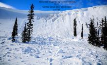
Warm temperatures and sun could prompt some wet snow avalanches today. Recent warm temperatures and rain have left the snow surface at low elevations wet, and Cam reported isothermal snow at low elevations in the Middle Fork Wednesday. Breaks in the clouds today should allow some radiation input on steep, solar slopes at mid elevations today, causing recent snow to fall from trees and rocks and in turn trigger loose wet point releases. These could entrain enough snow to be dangerous in and below steep gullies or where they gouge down to recently-buried crusts.
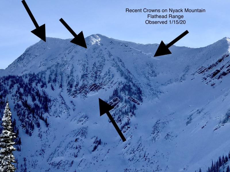
The warming and wind have likely built fragile cornices or weakened existing cornices. Though those wouldn't pose much danger in themselves, many sit above the terrain that harbors weak snow near the ground. Large sections of falling cornices could trigger natural avalanches that involve the entire season's snowpack, like those that ran in mid January in the Flathead Range. The low probability of that happening is tempered by the high consequences of it actually occurring. Move quickly out from under steep, upper-elevation leeward slopes in the Flathead Range. The warm temperatures forecast for Friday and Saturday will up the chances of these monsters awakening.
The fast parade of storms in recent weeks has limited the formation of persistent weak layers in the top meter or so of the snowpack. We've received some reports of small triggered slabs breaking near crusts, a few large natural avalanches in the Flathead Range, and tests producing planar failures and occasional propagation near crusts or on interfaces between layers. For the most part, however, evidence indicates these layers are unreactive, so we've removed the Storm Slab problem from advisories. Any exceptions should give clear feedback: cracking or small slides on test slopes, propagating results in large column tests, or sudden failures in small column tests. The Swan Range has seen significantly more snow the past week, so expect any slabs there to be thicker.
Partly sunny skies, mild temperatures, light winds - today will be a good day to be high in the mountains. Things change overnight and then again this weekend, as dramatic warm and cold fronts sweep across the area.
This forecast applies only to backcountry areas outside established ski area boundaries. The forecast describes general avalanche conditions and local variations always occur. This forecast expires at midnight on the posted day unless otherwise noted. The information in this forecast is provided by the USDA Forest Service who is solely responsible for its content.


