| Wednesday | Wednesday Night | Thursday | |
|---|---|---|---|
| Cloud Cover: | Mostly Cloudy | Mostly Cloudy | Mostly Clear |
| Temperatures: | 26 to 32 deg. F. | 18 to 21 deg. F. | 26 to 31 deg. F. |
| Wind Direction: | Southwest | Southwest | Southwest |
| Wind Speed: | 10 to 15, gusting to 25 | 15 to 20, gusting to 35 | 10 to 15, gusting to 20 |
| Snowfall: | 0 in. | 2 to 4" in. | 0" in. |
| Snow Line: | 3500' | 3000' | 2000' |
Flathead Range and Glacier National Park
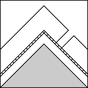
How to read the forecast
Today you can trigger freshly-formed slabs of wind-blown snow on steep slopes downwind of ridges and saddles at upper elevations. Many of these slopes also harbor weak layers that formed early in the season and produced destructive avalanches in mid January. Steer clear of this terrain if you want to keep it simple. If you are willing to acknowledge uncertainty and accept bigger risks, use all your tools and tricks before committing to upper elevation, leeward terrain.

2. Moderate
?
Above 6500 ft.
2. Moderate
?
5000-6500 ft.
1. Low
?
3500-5000 ft.
- 1. Low
- 2. Moderate
- 3. Considerable
- 4. High
- 5. Extreme
-
Type ?
-
Aspect/Elevation ?
-
Likelihood ?CertainVery LikelyLikelyPossible
 Unlikely
 -
Size ?HistoricVery LargeLargeSmall

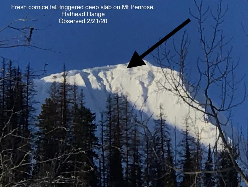
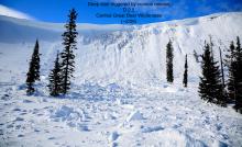
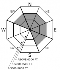
Blowing snow is a clear sign that a Wind Slab avalanche problem is developing. Look for snow that feels thicker, cakier and more cohesive on the downwind side of ridges, particularly in the tops of chutes and saddles. Freshly-formed drifts will be reactive to a person's weight today and dangerous on steep slopes above terrain traps. New cornices may be fragile, though dropping chunks of cornice may give you an idea whether slabs of drifted snow extend across start zones and can be triggered by your weight. Triggered slabs of drifted snow could release slabs that break on or near recently-buried crusts and ice lenses.
-
Type ?
-
Aspect/Elevation ?
-
Likelihood ?CertainVery LikelyLikelyPossible
 Unlikely
 -
Size ?HistoricVery LargeLargeSmall

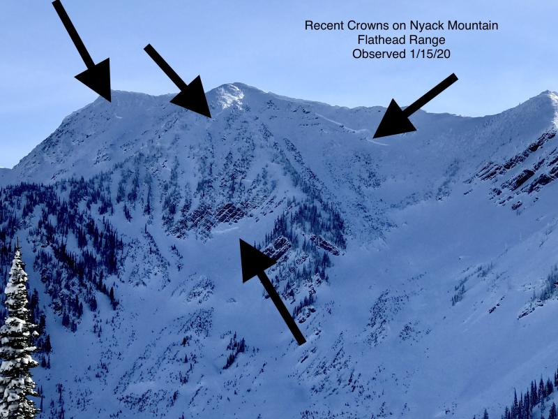
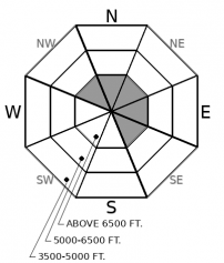
A person's weight can still trigger destructive avalanches that break near the ground and involve the entire season's snowpack. The slopes where this potential lingers are isolated but easy to recognize and avoid. They're generally steeper than about 35 degrees, at upper elevations on the eastern and northerly sides of peaks in the Flathead Range and Glacier National Park, and have a snowpack that's pockmarked with thin spots, either due to wind scouring or rocks and small cliff bands. Since you can't see these thin spots without xray goggles, avoid this terrain. And with winds drifting snow into these same slopes today, scoot out from under them as you approach or descend from your objectives.
Observers Tuesday reported small, stubborn sluffs of loose dry snow in the Whitefish Range. These were harmless and similar slides today should be as well. Don't let these fool you into thinking there's no slab avalanche hazard, however.
The hot-cold weather pattern of the past week has created a near-surface snowpack that's a stack of crusts, ice lenses, storm snow, and graupel. With snow accumulations varying across the region, it's hard to track the layers, even when digging - is that the crust formed on the MLK holiday or on National Beer Can Appreciation Day (1/24)? The good news is that the fast parade of storms has limited the formation of persistent weak layers. We've received some reports of small slabs breaking near crusts on small facets and tests producing planar failures on interfaces between storms. Generally, though, these failure planes are within the top two feet of the snowpack, more sensitive to a person's weight on steeper slopes, and give clear feedback when unstable: cracking or small slides on test slopes, propagating results in large column tests, or sudden failures in small column tests. The Swan Range has seen significantly more snow the past week, so expect thicker slabs there.
Winds today should increase in advance of a fast-moving system tonight, and there's plenty of soft, dry snow at upper elevations for the winds to move around. Expect small slabs of drifted snow to form on steep, leeward slopes near ridges and downwind of saddles and passes that channel winds. These will be more widespread the higher you go, and they'll be the primary near-surface hazard in the Flathead Range and Glacier National Park.
The crust/facet combinations buried near the ground have been mostly quiet since the very large slides that ran during the mid-January cold snap. With no dramatic weather today, I expect them to remain quiet and well behaved. Nonetheless, I wouldn't ride upper-elevation terrain with convex, unsupported slopes that are littered with half-buried rockbands or shallow, wind-scoured patches. Too many spots where those early-season facets are close enough to the surface to be triggered by a person's weight. And those basal facets are the one layer in the snowpack that reminds me of Colorado's typically weak snowpack.
A weak, high pressure ridge today will bring mostly dry conditions. Winds will increase during the day in advance of a fast-moving system overnight. Expect gusty winds near ridges today, perhaps mixing down into mid-elevations where funneled by terrain. Snow showers tonight will bring another few inches of snow to most of the region, though the Swan Range may wring out 4 to 7 inches.
This forecast applies only to backcountry areas outside established ski area boundaries. The forecast describes general avalanche conditions and local variations always occur. This forecast expires at midnight on the posted day unless otherwise noted. The information in this forecast is provided by the USDA Forest Service who is solely responsible for its content.


