| Thursday | Thursday Night | Friday | |
|---|---|---|---|
| Cloud Cover: | Mostly Cloudy | Mostly Cloudy | Mostly Cloudy |
| Temperatures: | 30 to 35 deg. F. | 28 to 32 deg. F. | 31 to 37 deg. F. |
| Wind Direction: | Southwest | Southwest | South |
| Wind Speed: | 10 to 15 gusting to 30 | 15 to 20 gusting to 35 | 10 to 15 gusting to 25 |
| Snowfall: | 0" to 4" in. | 0" to 3" in. | 0" to 4" in. |
| Snow Line: | 4000' | 5500' | 5000' |
Whitefish Range
Flathead Range and Glacier National Park
How to read the forecast
At higher elevations, be wary of steep, leeward slopes. That’s where you can find wind slabs that can crack and slide under your weight. It’s also the terrain most likely to harbor trigger points for unpredictable deep persistent slabs. At middle and low elevations, rising temperatures and rain on snow may cause loose wet avalanches on steep slopes. Rollerballs are the first warning of wet snow avalanches.

2. Moderate
?
Above 6500 ft.
2. Moderate
?
5000-6500 ft.
2. Moderate
?
3500-5000 ft.
- 1. Low
- 2. Moderate
- 3. Considerable
- 4. High
- 5. Extreme
-
Type ?
-
Aspect/Elevation ?
-
Likelihood ?CertainVery LikelyLikelyPossible
 Unlikely
 -
Size ?HistoricVery LargeLargeSmall

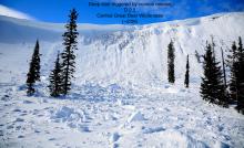
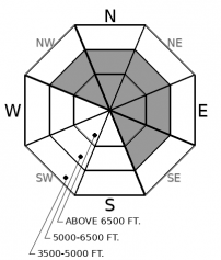
Moderate westerly winds created sensitive wind slabs yesterday (example 1, example 2). Winds are expected to increase again into this evening with a few more inches of new snow to play with. So expect wind slabs or two flavors today – older slabs that are growing stubborn, and newer slabs that may be smaller, but more reactive. You’ll find bigger slabs in exposed terrain above treeline, just below ridges and cornices. Cross loaded features, like gullies, may also hold drifted snow. Watch for blowing snow and rounded, textured, drifts. Shooting cracks are a sign of unstable wind slabs.
-
Type ?
-
Aspect/Elevation ?
-
Likelihood ?CertainVery LikelyLikelyPossible
 Unlikely
 -
Size ?HistoricVery LargeLargeSmall

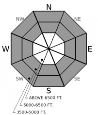
Warm temperatures and the potential for rain on snow should reach into the middle elevations today. Loose dry snow could become wet and slide on top of the ice crust deposited early in the week. Watch for rollerballs or small sluffs on steep slopes. Rocky areas will warm first and most. There is more snow to slide above about 5,000 feet. Sluffs will be bigger at middle elevations if freezing levels climb higher, or we receive more rain, than forecast. Even small wet sluffs can be hard to escape and can have big consequences when combined with terrain traps.
-
Type ?
-
Aspect/Elevation ?
-
Likelihood ?CertainVery LikelyLikelyPossible
 Unlikely
 -
Size ?HistoricVery LargeLargeSmall

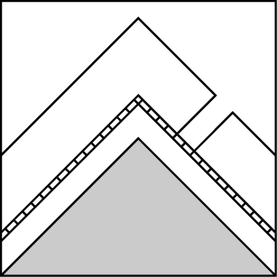
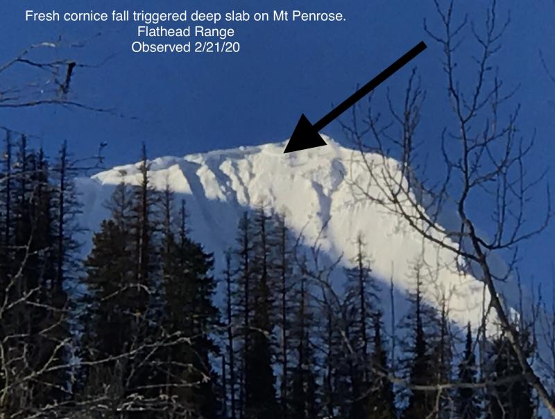
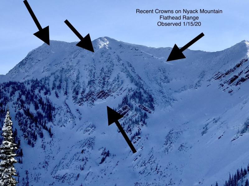
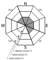
We’ve transitioned the persistent slab problem to deep persistent slabs. That means the hazard is difficult to predict - the weak layers are buried so deeply that they're unaffected by a rider's weight - but dangerously large. Shallow spots, where the snowpack is thin and weak layers are closer to the surface, are potential trigger points for deep slabs. You can find that kind of variable snow cover on rocky, leeward, alpine terrain. Convexities and unsupported slopes ending in rock bands are also suspicious. Small avalanches may suddenly overload deeply buried weak layers. And cornice falls may trigger larger avalanches on slopes below, as reported from the Flathead Range recently. The snowpack structure we’re worried about is most common in that zone, though it also exists in Glacier National Park and the northern Whitefish Range.
On Thursday, observers found reactive wind slabs up to a foot thick in the Flathead and Whitefish ranges. They also reported pillows and blowing snow below corniced ridges and smaller, cross-loaded slabs further down slope. Soft drifts failed above very low density snow from earlier this week and slid on top of the most recent rain crusts.
Those crusts, which formed early this week, extend to 7,000 feet in some areas, and they make an excellent sliding surface for shallow slab avalanches. There is plenty of low density snow below the crusts. Where flowing debris is able to break through the crusts, it may entrain more snow than expected. If warm temperatures or rain break down the crust at lower elevations, the loose snow below may sluff on very steep slopes.
Weak layers at the middle and bottom of the snowpack have become a deep slab problem: difficult to predict, but very dangerous if triggered. The most recent reports of avalanches on these layers come from the Flathead Range, but the layers of concern exist in Glacier National Park and in the northern Whitefish range as well.
Snow levels will continue to rise throughout the day as the region remains under southwesterly flow. Snow showers will linger throughout the day favoring the Swan and Whitefish ranges. More snow is expected tomorrow as a weak cold front passes over the region.
This forecast applies only to backcountry areas outside established ski area boundaries. The forecast describes general avalanche conditions and local variations always occur. This forecast expires at midnight on the posted day unless otherwise noted. The information in this forecast is provided by the USDA Forest Service who is solely responsible for its content.


