| Wednesday | Wednesday Night | Thursday | |
|---|---|---|---|
| Cloud Cover: | Mostly Cloudy | Mostly Cloudy | Overcast |
| Temperatures: | 11 to 23 deg. F. | -3 to 9 deg. F. | 25 to 36 deg. F. |
| Wind Direction: | Southwest | Southeast | South |
| Wind Speed: | 7-13G24 | 9-13G25 | 6-12G28 |
| Snowfall: | 0" in. | 0" to 1" in. | 0" in. |
| Snow Line: | 0' | 500' | 2000' |
Flathead Range and Glacier National Park
How to read the forecast
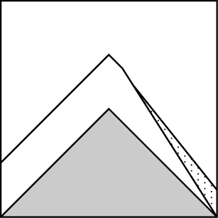
Expect wind-stiffened slabs below leeward ridgelines and on unusually cross-loaded features. Avoid rounded drifts. Snow that cracks around you spells trouble. Sluffs can be hazardous on steep, wind sheltered slopes with terrain traps below. In bigger terrain, smaller avalanches stepping down to deeper weak layers remain a concern. Shallower, rocky areas or convex break-overs are potential trigger points. The resulting avalanche could be large.

3. Considerable
?
Above 6500 ft.
2. Moderate
?
5000-6500 ft.
2. Moderate
?
3500-5000 ft.
- 1. Low
- 2. Moderate
- 3. Considerable
- 4. High
- 5. Extreme
-
Type ?
-
Aspect/Elevation ?
-
Likelihood ?CertainVery LikelyLikelyPossible
 Unlikely
 -
Size ?HistoricVery LargeLargeSmall

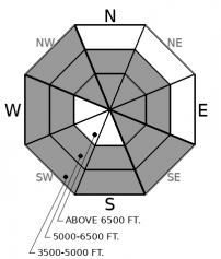
Winds continue to move the light new snow onto leeward slopes. Identify soft, rounded drifts below ridgelines and on exposed, atypical cross-loaded features. Expect slabs to be larger and more sensitive on easterly aspects as you gain elevation. Below about 6,000 feet, look for drifts on the west sides of ridges. Shooting cracks and recent natural avalanches mean unstable wind slabs. Seek sheltered, lower-angled slopes for better and safer riding.
-
Type ?
-
Aspect/Elevation ?
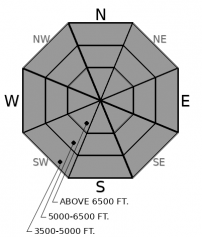
-
Likelihood ?CertainVery LikelyLikelyPossible
 Unlikely
 -
Size ?HistoricVery LargeLargeSmall

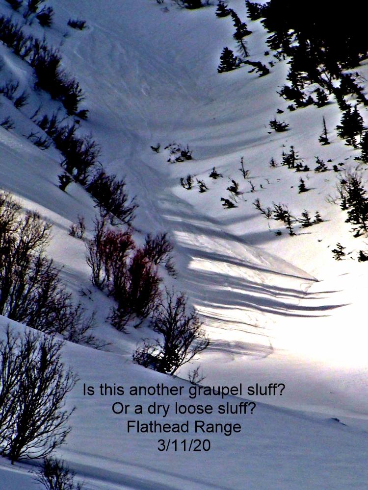
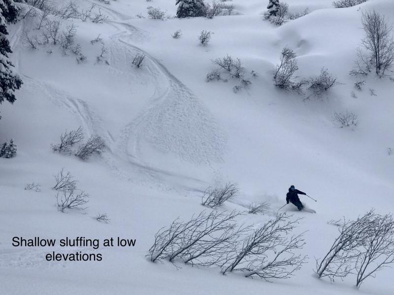
Soft snow can sluff on very steep, wind-sheltered slopes. It can be dangerous above terrain traps like tree wells or gullies. Avoid confined chutes where it’s hard to move over and let the sluff pass you by. Avoid parking yourself directly below your partner.
-
Type ?
-
Aspect/Elevation ?

-
Likelihood ?CertainVery LikelyLikelyPossible
 Unlikely
 -
Size ?HistoricVery LargeLargeSmall

Crusts and weak layers buried around the holidays are now under a lot of soft newer snow. They are deeper, and it’s less likely you can trigger them in the Swan and Whitefish Ranges. The main concern in those areas is that a smaller avalanche could suddenly overload them and create a much larger slide. In the Flathead Range and nearer the Divide, these layers are nearer to the surface. Rocky alpine slopes and convex break-overs are potential trigger points for very large persistent slabs.
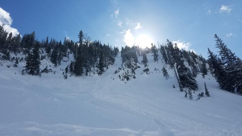
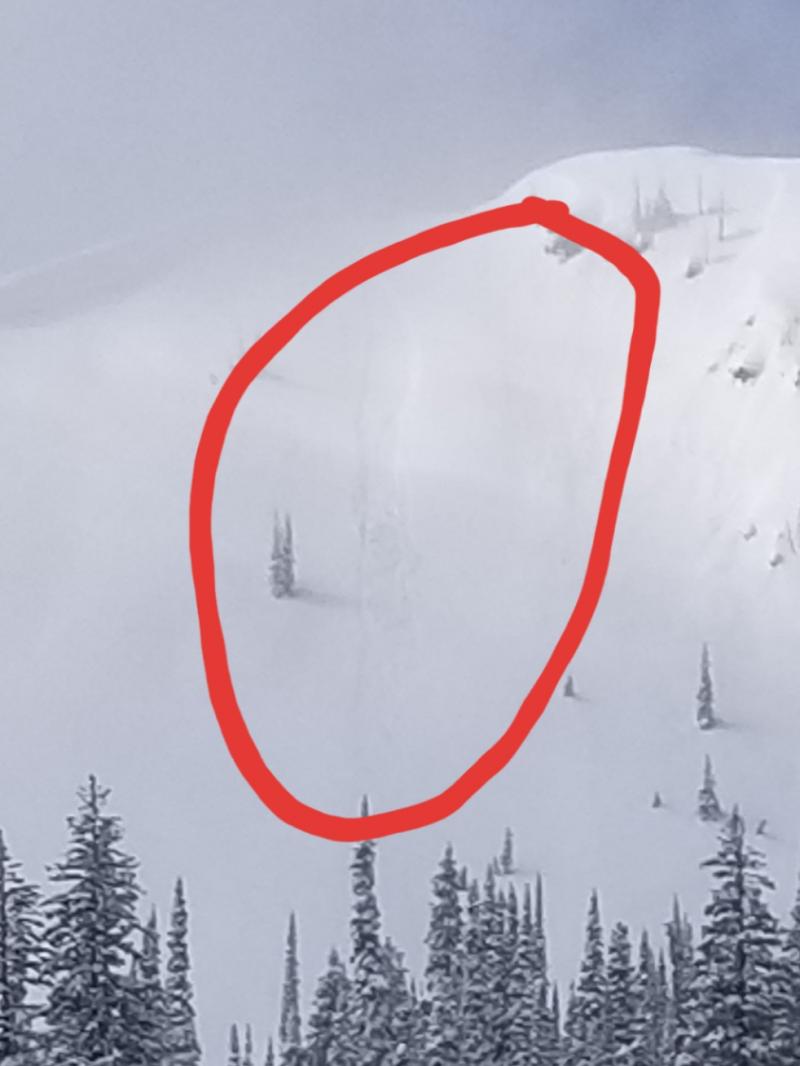
Low-density, right-side up snow has fallen almost continuously for the past five days. Cold temperatures have kept the new snow fluffy, creating loose dry and soft slab avalanche conditions. Observers yesterday noted continued sluffing in the most recent new snow (example 1, example 2, example 3), though the trend was for smaller, shorter-running slides than in previous days. Small sluffs of dry snow will remain the most common problem in the mountains. Terrain traps, especially tree wells, will amplify the hazard.
Meanwhile, the intrusion of arctic air from the northeast, combined with upper level (relatively) warm air from the southwest, has created a complex pattern of wind drifting. At upper elevations, winds have thickened the storm snow on typical leeward aspects. The Hornet weather station in the northern Whitefish Range has been the most consistent example of upper elevation, southwest wind. In the Middle Fork corridor and John F. Stevens Canyon, upper elevation winds have also been typically from the southwest. However, drifting blizzard conditions have been reported below 6,000 feet in that area, because of easterly winds channeled down the valley. While less common than loose snow avalanches, wind slabs will be more difficult to manage and more dangerous.
Crusts and persistent weak layers buried around the holidays are now buried under substantial amounts of soft, right side up snow. These layers have failed in snowpack tests, but haven’t given us any other recent feedback. They are buried deepest in the Swan range and are closest to the surface near the Continental Divide.
Today will be relatively calm with decreasing snow showers, slightly warmer temperatures, and a few peeks at clear sky. More snow moves across the area by Thursday morning.
This forecast applies only to backcountry areas outside established ski area boundaries. The forecast describes general avalanche conditions and local variations always occur. This forecast expires at midnight on the posted day unless otherwise noted. The information in this forecast is provided by the USDA Forest Service who is solely responsible for its content.


