| Tuesday | Tuesday Night | Wednesday | |
|---|---|---|---|
| Cloud Cover: | Overcast | Mostly Cloudy | Mostly Cloudy |
| Temperatures: | 5 to 15 deg. F. | -8 to 2 deg. F. | 10 to 16 deg. F. |
| Wind Direction: | Northwest | West | Southwest |
| Wind Speed: | 8 to 12 gusting to 20 | 8 to 12 gusting to 25 | 10 to 15 gusting to 25 |
| Snowfall: | 2" to 3" in. | 2" to 3" in. | 0" in. |
| Snow Line: | 0' | 0' | 0' |
Flathead Range and Glacier National Park
How to read the forecast
You can trigger avalanches that break 2 feet thick where winds have drifted the recent snow into soft slabs. The distribution of these slabs is complex, thanks to arctic air pouring over Marias Pass and southwesterly winds at upper elevations. Triggered sluffs of recent snow pose a serious danger on very steep slopes where the wind hasn't affected the surface snow. Pay close attention to surface conditions, so you can adjust your riding to match the hazard.

3. Considerable
?
Above 6500 ft.
2. Moderate
?
5000-6500 ft.
2. Moderate
?
3500-5000 ft.
- 1. Low
- 2. Moderate
- 3. Considerable
- 4. High
- 5. Extreme
-
Type ?
-
Aspect/Elevation ?
-
Likelihood ?CertainVery LikelyLikelyPossible
 Unlikely
 -
Size ?HistoricVery LargeLargeSmall

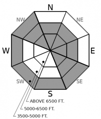
Paying close attention to surface snow conditions can help you identify where winds have stiffened the recent snow into soft slabs that will be sensitive to the weight of a person or snowmachine. These soft slabs of drifted snow can be dangerous on steep slopes where they're a foot or more thick. Look for snow that feels more cohesive and cracks around you as you travel. You may find these conditions midslope, thanks to cross-loading, as well as near ridges and summits. Or near valley bottoms, where strong easterly winds may have drifted snow onto southerly slopes and into unusual places. It won't take much wind to form fresh slabs today, so avoid traveling under steep start zones with active wind loading.
-
Type ?
-
Aspect/Elevation ?
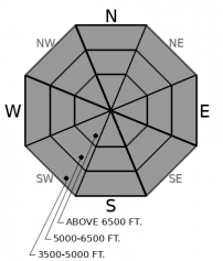
-
Likelihood ?CertainVery LikelyLikelyPossible
 Unlikely
 -
Size ?HistoricVery LargeLargeSmall

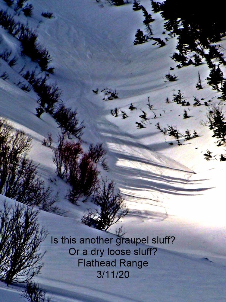
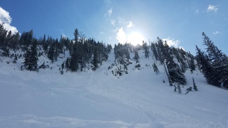
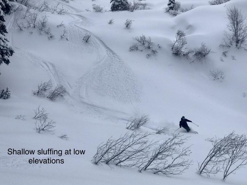
Triggered sluffs of loose, dry snow remain a danger on steep slopes above terrain traps, where the soft debris can pile up and bury a person. Consider tree wells terrain traps today. It'll probably take slopes near 40 degrees to get these going today. Once moving, they can entrain dangerous amounts of debris on open slopes with continuous pitches of terrain near or above 35 degrees. The simplest way to avoid this hazard is to avoid this terrain. If you're willing to risk getting knocked off your feet and carried into trouble, ride so that sluff debris passes you instead of catches you.
-
Type ?
-
Aspect/Elevation ?

-
Likelihood ?CertainVery LikelyLikelyPossible
 Unlikely
 -
Size ?HistoricVery LargeLargeSmall

The high-elevation rain and warming before the holidays left crusts and facets that are now buried by 3 to 5 feet of mostly soft snow. They do not seem to have grown more reactive as the recent storms have loaded them, though they are still propagating in some recent tests. Stick to the good riding on planar slopes and avoid convexities with variable snow depths, where the crust/ facet layers may be closer to the surface and easier to trigger.
Monday's danger du jour was sluffs of dry loose snow that posed a serious danger on steep slopes above treewells, benches, or other features that allowed the debris to pile up. With snowfall easing Monday afternoon and overnight, the soft surface snow has settled, though probably not enough for the recent snow to consolidate into slabs without the added influence of wind. More on that below. So Loose Dry avalanches continue to pose a danger today, though they'll be harder to trigger and may not entrain as much snow. Expect this hazard on any slope steeper than around 38 degrees, even gladed slopes. Keep your partners in sight so you can get to anyone knocked over into a tree well as quickly as possible.
The low density snow is easily stiffened into slabs where winds moving across the surface can lightly pack the snow or drift it into soft slabs. So today's wind slabs aren't hard, hollow sounding plates of firm snow plastered near ridgelines. Today's wind slabs are more subtle - just a little stiffer and more cohesive than the surface snow elsewhere, and brushed onto midslope convexities and other spots where winds might speed up just enough to move snow. Because they can break wider and be harder to escape, they're today's primary avalanche concern. They'll be thickest near ridgelines, and in the higher, more exposed terrain of the Flathead Range and Glacier National Park. The arctic air wasn't able to muscle its way too far west Sunday night and Monday, so winds remained light and southerly or southwesterly at mid and upper elevations Monday. That means northerly slopes were leeward in most of the forecast region. Between Marias Pass and Essex, you'll find them in unusual spots, thanks to the strong, easterly winds blasting down the John F. Stevens Canyon.
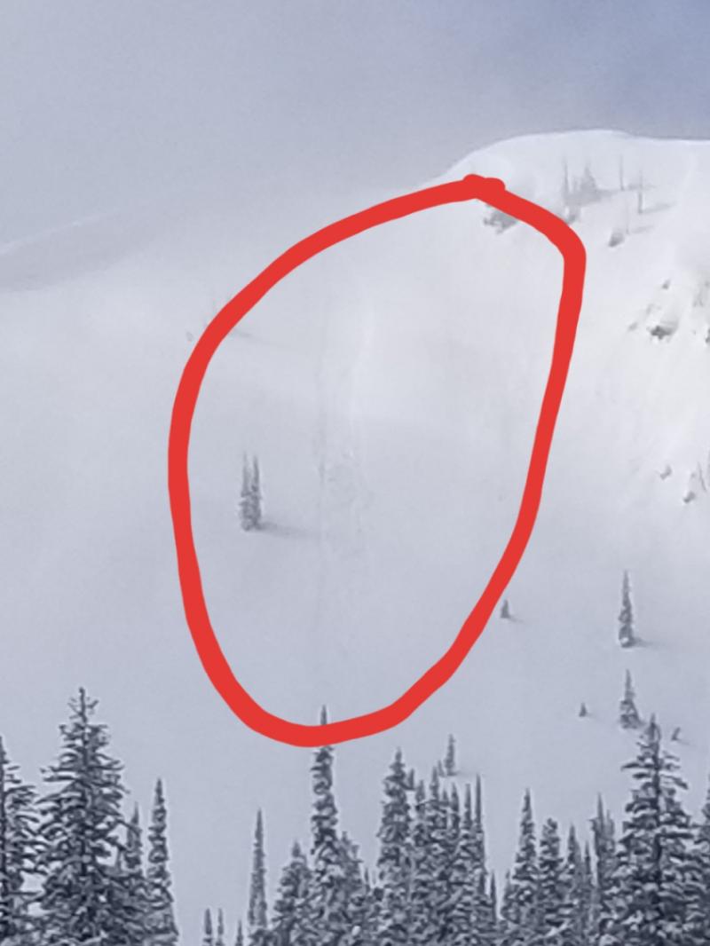
The facet and crust combinations that developed in the warm weather before Christmas remain a lingering hazard. These are buried deeply and haven't been producing many signs of instability. Some propagation in large column tests, as in Jewel Basin before the storm. These may reactivate as the storm snow consolidates into a stiffer slab, though there's little evidence yet that's happening. Avoiding the slopes where these layers are closest to the surface is good insurance against surprises. Several people reported a very thin, fragile crust buried 30 to 40 cm below the surface the past few days. One slide in Canyon Creek may have broken on this layer. It's not clear yet if this layer will pose a persistent problem. For now, figure that triggered slides can break wider and deeper on slopes where it exists. Quick hand pits are a simple way to find it, though it's subtle and takes some attention to find.
A break in the storms today, or a kind-of break, as the clouds are hanging around and there's enough moisture flowing in to feed snow showers. Expect a few inches of low desity snow, with the Swan Range favored. Winds will be light in the morning but become gusty in the afternoon. Temperatures should be more seasonable. The exception will be the Essex and Marias Pass areas, where arctic air will keep temperatures cold and valley winds should persist.
This forecast applies only to backcountry areas outside established ski area boundaries. The forecast describes general avalanche conditions and local variations always occur. This forecast expires at midnight on the posted day unless otherwise noted. The information in this forecast is provided by the USDA Forest Service who is solely responsible for its content.


