| Monday | Monday Night | Tuesday | |
|---|---|---|---|
| Cloud Cover: | Overcast | Mostly Cloudy | Mostly Cloudy |
| Temperatures: | 1 to 9 deg. F. | -15 to -3 deg. F. | 3 to 13 deg. F. |
| Wind Direction: | Southwest | West | Northeast |
| Wind Speed: | 10 to 15 gusting to 25 | 8 to 12 gusting to 20 | 5 to 10 |
| Snowfall: | 4" to 6" in. | 1" to 2" in. | 3" to 4" in. |
| Snow Line: | 0' | 0' | 0' |
Flathead Range and Glacier National Park
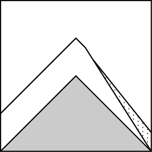
How to read the forecast
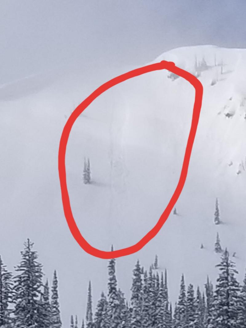
Wind Slab avalanches pose a danger on steep slopes with slabs of drifted snow a foot or more thick, which may have formed in unusual spots. On very steep slopes where the snow surface remains loose and soft, triggered sluffs pose a danger above terrain traps. Lurking below the surface is weak snow near crusts; triggering slides on these layers remains possible. Stick to moderately-angled, sheltered slopes for good riding with less exposure to these hazards.

2. Moderate
?
Above 6500 ft.
2. Moderate
?
5000-6500 ft.
2. Moderate
?
3500-5000 ft.
- 1. Low
- 2. Moderate
- 3. Considerable
- 4. High
- 5. Extreme
-
Type ?
-
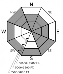
Aspect/Elevation ?
-
Likelihood ?CertainVery LikelyLikelyPossible
 Unlikely
 -
Size ?HistoricVery LargeLargeSmall

Be alert for slabs of freshly drifted snow sitting on softer, low density snow. You can trigger slides larger enough to injure or bury you where these slabs are a foot or so thick and sitting on steep slopes. Their distribution will be highly variable today, and very dependent on local wind direction and speed. This morning, there's lots of uncertainty about those factors, both last night and in today's forecast. At upper elevations, look for them in spots that typically collect wind-blown snow, like the lee sides of ridges and passes. At mid and low elevations, they may be cross-loaded into gullies from notheasterly winds, particularly on the eastern sides of the Whitefish and Swan ranges.
-
Type ?
-
Aspect/Elevation ?

-
Likelihood ?CertainVery LikelyLikelyPossible
 Unlikely
 -
Size ?HistoricVery LargeLargeSmall

Remember those high elevation rain and warming events from around the Holidays? The crusts and facets formed from those events are now buried by 3 to 5 feet of mostly soft snow. Available evidence says triggering them is still possible on steep slopes with lots of potential trigger points, like convex rollovers, small rock bands or large talus, and variable snow depths. As insurance, avoid this terrain and stick to the good riding on planar, well supported slopes with consistent snow cover.
-
Type ?
-
Aspect/Elevation ?
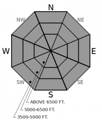
-
Likelihood ?CertainVery LikelyLikelyPossible
 Unlikely
 -
Size ?HistoricVery LargeLargeSmall

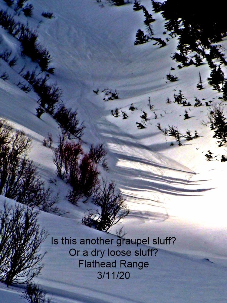
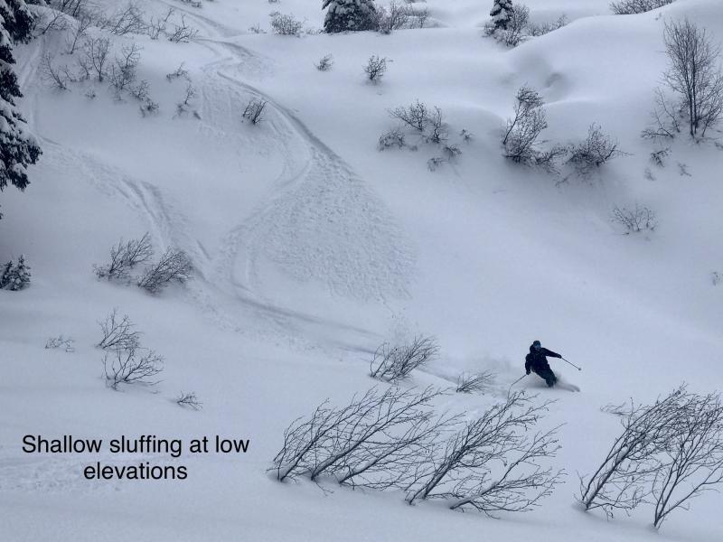
Sluffs of loose, dry snow can be dangerous in two situations. The first is small, steep slopes above terrain traps, where getting knocked off your feet can have outsized consequences. Consider tree wells a terrain trap today. The second is open slopes with long, continuously steep pitches. Point releases in this terrain can run long distances and entrain more than enough snow to bury you. Look for potential hazards below you before committing to steep slopes where the snow hasn't been affected by the wind and remains cohesionless.
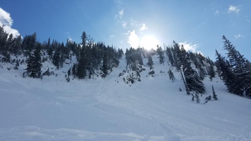
99 problems and a sluff is one. But just one, and maybe the easiest to manage. Riders Sunday reported triggering sluffs involving fresh snow across the forecast region, most of them small. With more new snow overnight, they will remain a hazard on slopes around 40 degrees in steepness. Don't underestimate the growing danger these pose on slopes not affected by the wind. A foot or more of fast-moving debris is more than enough to knock you off your feet and into trouble.
The big uncertainty this morning is how much and where winds have formed or will form slabs. The dense arctic air that's shoved over the Divide brought strong easterly and northerly winds to John F. Stevens Canyon and the Middle Fork valley. As of 6 AM this morning, those winds have been confined to low elevations; wind stations near ridges have recorded light to moderate, mostly southwesterly winds. It looks like that pattern will continue today. That means you might find biting wind and blowing snow at a trailhead, but breezes up high. In between, you might find snow drifted in unusual patterns: drifts down low, slabs on usually windward slopes, scouring on usually leeward slopes, more cross loading than top loading. The drifted snow will be easy to recognize, however. It's the cohesive or even hard slabs that may feel hollow or punchy. These slabs will be sitting on soft, low density snow, so avoid steep slopes where these are more than a foot or so thick. If today's winds are stronger than I expect, the wind slab problem will be more widespread than described above, and the slabs potentially larger. Sticking to slopes with a soft snow surface will help keep you out of trouble.
The crusts and facets formed by late December's high-elevation rain and warming events are now buried by 18 to 60 inches of snow. That's a lot of snow. Most of it is soft and unconsolidated, and we've had no reports of avalanches involving these layers in the past few days and only a few reports of propagation in tests. It appears that triggering these slabs is growing less likely, at least until the snow above them settles into a stiff slab. As insurance against surprise, it's best to hurry through the runouts of large avalanche paths and avoid terrain that's peppered with likely trigger points, especially in the Flathead Range and central Glacier National Park, where these payers may be closer to the surface.
Moisture from the west and cold air from the east will make for highly variable weather today. Expect snow showers that can be heavy at times, single digit temperatures, and sometimes gusty winds, especially in the valleys and downsloping out of passes. Wind directions and speeds will be highly dependent on local terrain features.
This forecast applies only to backcountry areas outside established ski area boundaries. The forecast describes general avalanche conditions and local variations always occur. This forecast expires at midnight on the posted day unless otherwise noted. The information in this forecast is provided by the USDA Forest Service who is solely responsible for its content.


