| Friday | Friday Night | Saturday | |
|---|---|---|---|
| Cloud Cover: | Mostly Cloudy | Partly Cloudy | Overcast |
| Temperatures: | 27 to 33 deg. F. | 20 to 25 deg. F. | 26 to 32 deg. F. |
| Wind Direction: | Southwest | Southwest | Southwest |
| Wind Speed: | 24G52 | 26G52 | 40G74 |
| Snowfall: | 1" in. | 0" in. | 4" to 6" in. |
| Snow Line: | 3500' | 3500' | 2000' |
Whitefish Range
Flathead Range and Glacier National Park
How to read the forecast
Continue to bring a conservative mindset to the mountains. As you gain elevation, the risk of triggering a slab avalanche 1 to 2 feet deep grows. The easiest way to avoid a potentially deadly avalanche is to stay off of and out from underneath slopes greater than 35 degrees.

3. Considerable
?
Above 6500 ft.
2. Moderate
?
5000-6500 ft.
1. Low
?
3500-5000 ft.
- 1. Low
- 2. Moderate
- 3. Considerable
- 4. High
- 5. Extreme
-
Type ?
-
Aspect/Elevation ?

-
Likelihood ?CertainVery LikelyLikelyPossible
 Unlikely
 -
Size ?HistoricVery LargeLargeSmall

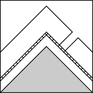
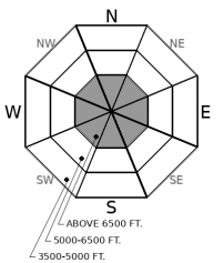
As you gain elevation, your likelihood of triggering a slab avalanche 1 to 2 feet deep grows. What may catch you off guard is that it has the potential to break surprisingly wide, be triggered remotely, and wrap around terrain features. Give yourself a wide margin for error and choose slopes less than 35 degrees. Since January 1st, numerous slab avalanches failed on surface hoar or near-surface facets near the 12/31 rain crust or the Christmas eve crust. As we distance ourselves from that storm, we have transitioned into calling this a persistent slab avalanche problem, due to the weak layer characteristics and we don’t expect it to go away anytime soon. We cannot rule out the potential for one of these avalanches in the upper snowpack to trigger a much larger, deep slab avalanche that fails near the ground.
-
Type ?
-
Aspect/Elevation ?
-
Likelihood ?CertainVery LikelyLikelyPossible
 Unlikely
 -
Size ?HistoricVery LargeLargeSmall

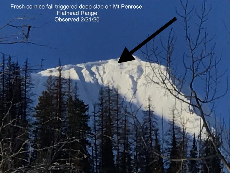
With a transition from the recent storm slab to now persistent slab, we must take note of the difference between two persistent weak layers we are dealing with. One is a slab 1 to 2 feet deep involving recent snow; the other is a thick, ugly beast that is difficult to trigger but even harder to survive: In isolated areas above 6,000’, hard slabs 3 to 5 feet deep comprising most of, or all of our season's snowpack are still a concern. Deep slab avalanches are unpredictable, dangerous, and should not be taken lightly. Give yourself a wide margin for error. Choose planar slopes and avoid weak, thin spots near rocky outcroppings or convexities where you are most likely to trigger one of these beasts. If triggered, they have proved time and time again to be deadly.
What a mixed bag of emotions since the turn of the New Year. I have experienced excitement with fresh snow on New Years Day, worry with the distribution of weak layers beneath, and sadness with a neighboring avalanche accident that resulted in two fatalities near Seeley Lake. I am embracing uncertainty with the hand we have been dealt this season. We can always hope for a pair of aces, but recently it seems more like a 7 and 2 hand (worst hand in poker).
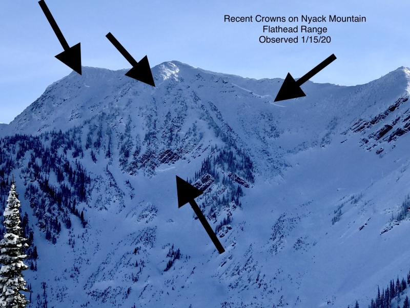
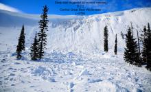
Since New Years Day, we have received reports of several skier triggered, remotely triggered, and natural storm slab avalanches. These avalanches have been failing on a variety of layers, some of which are fragile and persistent. The culprits include near surface facets and surface hoar located near the December 31st rain crust and the Christmas Eve melt-freeze crust. Avalanches have been most common near and above roughly 5800 feet on all aspects and in all ranges of our forecast area. Sensitivity with this interface was touchy on January 1st in the Whitefish and Flathead/Glacier National Park ranges(ob1, ob2). In the Swan Range, field teams to Lost Johnny and Noisy Basin have not identified any well developed persistent weak layers; the problem appears to be more difficult to find in the Northern Swan. However (ob3), the flurry of avalanches from south of our forecast boundary suggests that parts of the Swan Range did develop reactive weak layers. We are transitioning the storm slab problem into our newest persistent slab: as the slab settles and stiffens, it will behave more erratically with more potential for surprises.
What we haven’t heard of yet is of any activity involving the crust/facet combo from 11/19, which we are now transitioning to a deep slab problem. We’ve had limited views of suspect terrain since the storm though. People last saw activity crop up during the powerful storm cycle that occurred on 12/20. Recent snowpit tests have shown that this layer still has the propensity to propagate in some areas (ob4), and not in others (ob5), specifically in the Whitefish Range and Flathead Range/Glacier National Park. What is most troublesome about Deep Slab avalanches is their unpredictable nature. They are certainly the 7 and 2 hand in the game of poker. The only way we can effectively manage this problem is avoidance.
We have received a trace to two inches of snow overnight with another possible trace to two inches of wet snow on the way today. If the rain line rises into mid-elevations, watch for small wet loose avalanches in steep terrain.
Today expect moderate winds with gusts as strong as 45 mph out of the southwest. We are looking at a trace to 2 inches of snow throughout the day. Temperatures will be hovering around freezing at 6000 feet. Another storm will enter our region tonight, with the bulk of precipitation occurring tomorrow.
This forecast applies only to backcountry areas outside established ski area boundaries. The forecast describes general avalanche conditions and local variations always occur. This forecast expires at midnight on the posted day unless otherwise noted. The information in this forecast is provided by the USDA Forest Service who is solely responsible for its content.


