| Thursday | Thursday Night | Friday | |
|---|---|---|---|
| Cloud Cover: | Mostly Cloudy | Overcast | Mostly Cloudy |
| Temperatures: | 23 to 27 deg. F. | 15 to 18 deg. F. | 28 to 33 deg. F. |
| Wind Direction: | West | Southwest | Southwest |
| Wind Speed: | 10 to 20, G40 | 10 to 20, G30 | 10 to 20, G30 |
| Snowfall: | 1 to 4" in. | 3" to 6" in. | 0 to 1" in. |
| Snow Line: | 1000' | 2000' | 3000' |
Swan Range
How to read the forecast
Sadly, two snowmobilers were killed in an avalanche yesterday near Seeley Lake, south of our forecast area. This is a tragic reminder that the snowpack in our corner of the state is untrustworthy right now. Several tricky weak layers below a foot or more of new snow are conspiring to make dangerous avalanche conditions. Bring a conservative mindset into the backcountry today.

3. Considerable
?
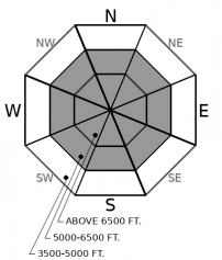
Above 6500 ft.
3. Considerable
?
5000-6500 ft.
1. Low
?
3500-5000 ft.
- 1. Low
- 2. Moderate
- 3. Considerable
- 4. High
- 5. Extreme
-
Type ?
-
Aspect/Elevation ?
-
Likelihood ?CertainVery LikelyLikelyPossible
 Unlikely
 -
Size ?HistoricVery LargeLargeSmall

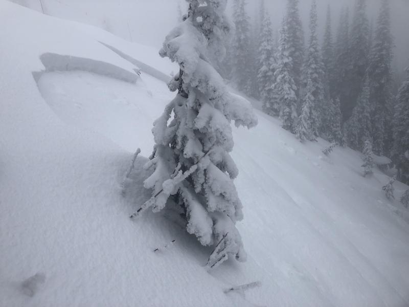
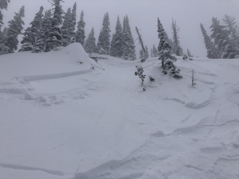
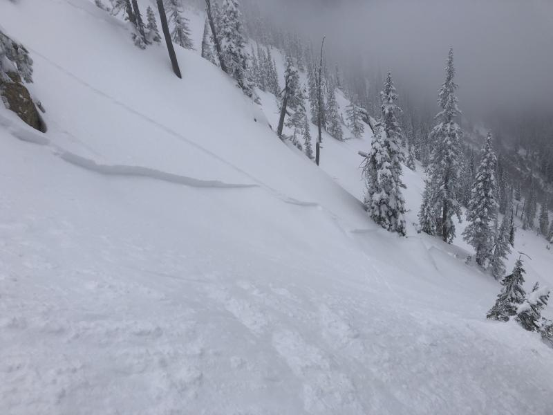
Numerous human triggered and natural storm slabs were reported yesterday from mid and upper elevations on slopes steeper than 35 degrees. These soft slabs were breaking 12" to 16" deep on a medley of slick crusts, facets, and surface hoar - the type of layers that don't heal quickly. Where slabs formed over faceted weak layers, they will remain sensitive to human triggers, especially in areas where winds have stiffened or thickened the snow. Some avalanches involving the new snow can be remotely triggered from lower angled terrain and propagate into steeper terrain above you. Be extra cautious of convex rollovers and leeward terrain features. Look for feedback from small test slopes before considering larger avalanche terrain: shooting cracks, collapsing snow, or recent avalanche activity are clear signs to dial your slope angles back.
Yesterday, three snowmobilers were involved in an avalanche accident near Seeley Lake, south of our forecast area. Two of the riders were buried and did not survive. We send our sincere condolences to all of those involved. The West Central Montana Avalanche Center will be investigating the slide and details on the accident are forthcoming. The WCMAC forecast team was in the area yesterday and reported the avalanche failed on the freezing rain crust/ surface hoar layer that was buried at the start of the New Year storm.
Settled storm totals since the 12/31 rime crust are 10" to 14" of dense snow around our forecast area (about 2" to 3" of SWE). Observations from our region yesterday highlight easily triggered storm slab instabilities, ranging from D1 to D2 in size, along with a handful of naturals. Slabs were larger and thicker in wind drifted areas. Some of these broke on storm snow layers above the December 31st crust, like this observation from the Southern Whitefish Range. Those slabs failed on non-persistent weak layers, the likes of which tend to stabilize a day or two after a warm, wet storm.
However, the avalanches that should grab your attention came from Clancy's observation in the Park and from the BNSF snow safety team in John F. Steven's Canyon. These avalanches were remotely triggered, failing on fragile grains of facets and surface hoar. Not only are the grains weak, but in some cases, they have a thin glaze from the freezing rain crust capping them, which is helping communicate failures longer distances than you would expect from such a soft, shallow slab. This is the stuff horror movies are made out of, and reportedly the same weak layer that caught the 3 snowmobilers near Seeley Lake yesterday. Because this weak layer / crust combo formed and was buried in a matter of days, we have limited data on its distribution. We went hunting for it in the Swan Range and couldn't find it, but we did observe surface hoar and/or near surface facets developing in the Whitefish Range, Glacier Park, and the Flathead Range earlier this week. To further complicate the matter, the freezing rain event that glazed the snow surface with a crust may have also destroyed some of these fragile weak layers below it. If there's one message to take home from all of this, it is that the most recent weak layer smorgasbord is complicated and variable, and it might lead to surprises. Some slopes are quickly healing, while others are not. Treat every slope as guilty until proven innocent. We wrote a new blog post to help further explain the complicated snowpack right now.
Mountain temperatures are in the mid to upper 20's this morning. Winds are easing in the Whitefish Range and increasing near John F. Stevens Canyon. A short wave will bring snow showers and gusty winds this morning, favoring the Flathead and Swan Ranges, before the weather quiets down later today. A warm front approaches this evening bringing widespread light to moderate snowfall to the region. Saturday's cold front will increase snowfall rates and wind speeds.
This forecast applies only to backcountry areas outside established ski area boundaries. The forecast describes general avalanche conditions and local variations always occur. This forecast expires at midnight on the posted day unless otherwise noted. The information in this forecast is provided by the USDA Forest Service who is solely responsible for its content.


