| Monday | Monday Night | Tuesday | |
|---|---|---|---|
| Cloud Cover: | Partly Cloudy | Mostly Cloudy | Mostly Cloudy |
| Temperatures: | 17 to 21 deg. F. | 14 to 18 deg. F. | 23 to 28 deg. F. |
| Wind Direction: | Southwest | Southwest | South |
| Wind Speed: | 18G37 | 23G44 | 0G41 |
| Snowfall: | 0" in. | 0" in. | 0" in. |
| Snow Line: | 0' | 500' | 1000' |
Flathead Range and Glacier National Park
How to read the forecast
Lots of observations yesterday highlight the snowpack is quieting down as stability improves. Use caution as you gain elevation towards and above alpine terrain where the threat of triggering a high consequence avalanche is most acute. Conditions are safer the lower you go: Softer slabs, stronger weak layers, and plenty of vegetation anchors make for improved stability.

2. Moderate
?
Above 6500 ft.
2. Moderate
?
5000-6500 ft.
1. Low
?
3500-5000 ft.
- 1. Low
- 2. Moderate
- 3. Considerable
- 4. High
- 5. Extreme
-
Type ?
-
Aspect/Elevation ?

-
Likelihood ?CertainVery LikelyLikelyPossible
 Unlikely
 -
Size ?HistoricVery LargeLargeSmall

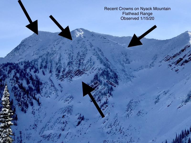
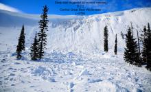
December's snowfall has left slabs several feet thick over a multitude of faceted crusts and surface hoar layers. Near and above 5500' in elevation, these layers have been barking at us for several weeks with natural avalanches, shooting cracks, and audible whumpfs in the snowpack. The snowpack is showing signs of improving during our current lull in snowfall. Take that with a healthy dose of caution: if you trigger an avalanche on one of these weak layers, it could surprise you with how wide it propagates and how difficult it will be to escape from. Be vigilant in your snowpack assessments and be wary of steep rollovers or thin, rocky parts of the slope.
-
Type ?
-
Aspect/Elevation ?
-
Likelihood ?CertainVery LikelyLikelyPossible
 Unlikely
 -
Size ?HistoricVery LargeLargeSmall

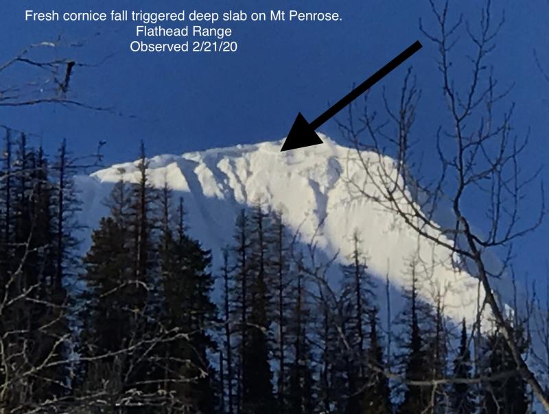
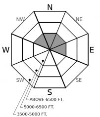
The joker in the deck. A deeper, more complex snowpack exists in the leeward, alpine start zones in Central Glacier National Park and along the Flathead Crest. In the past month, we have noted several D3 avalanches breaking on October crust layers near the ground. While human triggering one of these beasts is unlikely, it is not impossible. You might lose the lottery if you cross a thin, rocky spot on the slope or a slide in the upper snowpack steps down. Stay cautious in the alpine.
The Good News: Lots of observations came in yesterday from around our forecast area, and most of them highlighted an improving snowpack. Groups reported a general lack of signs of instability and non-propagating column tests in their travels. We still have a limited grasp on how much avalanche activity came from last Friday's big storm, but so far, it seems the activity wasn't as widespread as we expected from such a hefty load of snow. All of this data suggests it is appropriate to step out into more aggressive terrain, but with a big dose of caution. Here's why:
The Bad News: A few of yesterday's observations still raise concern. An observer near Marias Pass noted a whumpf, while one of our forecasters found propagating results in buried surface hoar on Big Mountain. Let's not forget the continuous streak of collapses that have been reported all month. We have very limited data from upper elevations since the storm ended, but we know that slabs will be thicker, denser and more dangerous. We also know that the weak layers were more continuous in the alpine prior to our December snowfalls. And we know that if you trigger a slab, it won't be pretty. It will be 3+ feet thick and could bring the whole slope with it.
A Final Note: You'll notice we have trimmed the distribution of persistent slabs to just upper elevations in the Swan and Whitefish Ranges, while it still extends into mid-elevations in the Flathead Range and Glacier Park. We did this after reviewing a month's worth of reports of collapses, test results, and avalanche activity. The mid elevations have been more reactive as you go further east for a number of reasons including fewer vegetation anchors and weaker faceted crusts. Blur your vision when looking at the exact boundary of the danger ratings and distribution roses. These lines aren't as definitive as they appear: there is some grey area between about 6,000' and 6,500'.
A high-pressure ridge is moving on-shore over the next couple of days. Today we are in breezy Northwest flow with dry conditions. Mountain temperatures in the teens this morning, we'll see a warming trend into tomorrow as the axis of the ridge moves overhead.
This forecast applies only to backcountry areas outside established ski area boundaries. The forecast describes general avalanche conditions and local variations always occur. This forecast expires at midnight on the posted day unless otherwise noted. The information in this forecast is provided by the USDA Forest Service who is solely responsible for its content.


