| Monday | Monday Night | Tuesday | |
|---|---|---|---|
| Cloud Cover: | Mostly Cloudy | Partly Cloudy | Mostly Cloudy |
| Temperatures: | 20 to 25 deg. F. | 13 to 18 deg. F. | 22 to 27 deg. F. |
| Wind Direction: | West | West | West |
| Wind Speed: | 2 to 12, G 20 | 2 to 12, G 20 | 2 to 12, G 20 |
| Snowfall: | 0" in. | 0" in. | 0" in. |
| Snow Line: | 1500' | 1500' | 1500' |
Flathead Range and Glacier National Park
How to read the forecast
In the wake of Saturday night's storm, we observed numerous large natural avalanches and produced clear signs of instability, both of which highlight the dangerous conditions that developed over the weekend. Although the avalanche danger is trending down now, we have uncertainty on how quickly the snowpack will adjust. Give it time and bring a conservative mindset into the backcountry, especially to wind affected upper elevation terrain, because triggering a large slab avalanche is a very real possibility today.

3. Considerable
?
Above 6500 ft.
2. Moderate
?
5000-6500 ft.
1. Low
?
3500-5000 ft.
- 1. Low
- 2. Moderate
- 3. Considerable
- 4. High
- 5. Extreme
-
Type ?
-
Aspect/Elevation ?

-
Likelihood ?CertainVery LikelyLikelyPossible
 Unlikely
 -
Size ?HistoricVery LargeLargeSmall

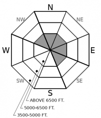
Shooting cracks and collapses are clear warnings to stay away from steep terrain. Unfortunately, as buried facets, crusts, and surface hoar slowly adjust from Saturday night's storm, these warning signs aren't always apparent before you get into trouble. Snowfall and wind transport from this past week have formed cohesive slabs 1 to 3 feet thick that are distributed across most terrain above about 5,500' or 6,000' in elevation. Because these slabs formed over tricky weak layers, they are slower to heal than normal storm instabilities. They can also surprise you by breaking above you or propagating long distances. Give yourself a wide margin for error when assessing and managing this problem.
-
Type ?
-
Aspect/Elevation ?
-
Likelihood ?CertainVery LikelyLikelyPossible
 Unlikely
 -
Size ?HistoricVery LargeLargeSmall

On leeward, upper elevation start zones in the Flathead Range and Glacier National Park, there is a low likelihood but high consequence threat of triggering a hard slab avalanche that involves the entire winter's snowpack, 5 or more feet thick. The most recent evidence comes from a step-down avalanche off of the NE face of Great Northern Peak that ran this weekend. An avalanche the breaks in the upper snowpack has the potential to initiate one of these beasts, or you might be able to as well, if you cross a thin spot on the slab. Be cautious of steep, rocky start zones in the alpine, where trigger points abound.
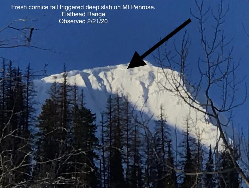
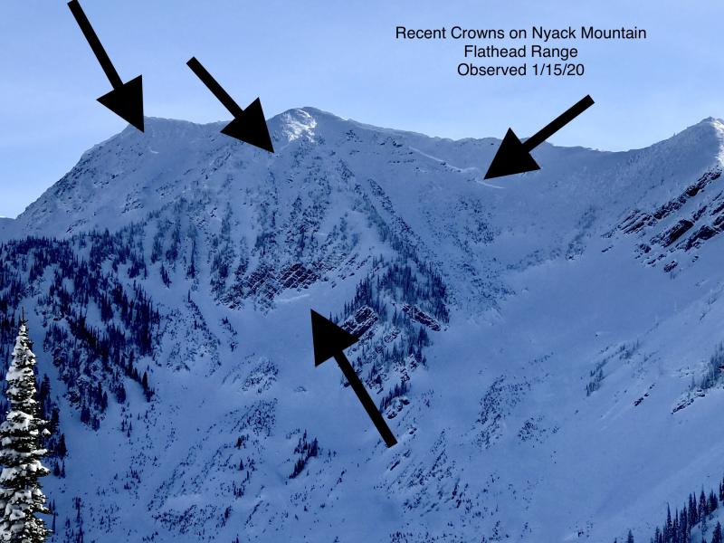
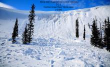
Evidence of our persistent slab problem is about as clear as yesterday's blue skies. Saturday night's storm, which treated us to a foot of relatively dense snow across much of the forecast area, tipped the scales. Clancy noted several large avalanche crowns in Glacier Park. He also experienced a BIG whumpf on a faceted crust, accompanied by a crack that shot 50' from his skis. In the Flathead Range, observers spotted several large crowns, one of which appeared to step down close to the ground. Just north of our forecast area, Fernie reported numerous natural and explosive triggered slides breaking 1.5 to 2.5 feet deep on the November crust.
Now we enter into tricky times. The powder is inviting, the weather is nice, slabs won't be as reactive today and the avalanche danger is starting to trend down. Yet some steep slopes are very capable of producing large and deadly avalanches. Those slopes are not readily apparent with the naked eye, and snowpack assessments on buried persistent weak layers carry uncertainty due to their notorious spatial variability. Watching your slope angles is still the safest bet for managing persistent slabs, but we also like to offer a few strategies if you are stepping out into more aggressive terrain. Seeking out the "less slabby" snow, like Blase found yesterday, will improve your odds. That means staying away from the higher, more wind-affected terrain. Choosing lines with shorter pitches and cleaner runouts will improve your odds if your snowpack assessments are wrong. That means avoiding terrain where an avalanche would dump you into a gulley or rake you through trees or thin snow coverage. And of course, traveling with partners who have solid travel protocols and rescue skills can make all the difference.
A high-pressure ridge is parked over the BC coast today. Moisture streaming over the ridge in Northwest flow will bring an increase in cloud cover and the potential for a few flurries. Winds are light this morning, and should stay relatively tame all day, with a few moderate gusts in the alpine. The pattern continues tomorrow.
This forecast applies only to backcountry areas outside established ski area boundaries. The forecast describes general avalanche conditions and local variations always occur. This forecast expires at midnight on the posted day unless otherwise noted. The information in this forecast is provided by the USDA Forest Service who is solely responsible for its content.


