Whitefish Range
Swan Range
Flathead Range and Glacier National Park
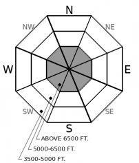
How to read the forecast
Avalanche hazards so far this season are generally localized to high elevation terrain with sufficient snow coverage to ski or ride. With a thin early season snowpack, avalanches can produce harsh consequences if they drag you over rocks, cliffs, or stumps. Pay attention to snow amounts and watch for rain on snow to increase the threat of wet avalanches through Monday.

No Rating
?
Above 6500 ft.
No Rating
?
5000-6500 ft.
No Rating
?
3500-5000 ft.
-
Type ?
-
Aspect/Elevation ?

-
Size ?HistoricVery LargeLargeSmall

The mountains picked up a 3" to 6" of new snow earlier in the week, overlying a variety of crusty surfaces. With warming temperatures and rain forecasted on Sunday and Monday, expect the recent snow to sluff off of steep terrain as small, wet loose avalanches. These can cause harm if they push you into trees, rocks, and gullies. Rollerballs, pinwheels, or adjacent wet avalanche activity are signs of instability. Above the rain line, you may encounter thin "top-heavy" storm slabs developing.
Conditions are changing as we shift back into a warmer, wetter flow that is more typical of November. Our snowpack is currently about 2 feet deep at 6,000', the base of which is comprised of a series of crusts and facets. Above these crusts, there is about 3" to 6" of recent snow that fell last Tuesday. On Sunday and Monday, freezing levels will rise into the alpine and we will see an increase in wet loose avalanche activity as the recent snow becomes damp. Forecasts are calling for as much as an inch of rain up to 7,000' or 8,000' over the next 24 hours. Above the rain/snow line, thin storm slabs may also develop. If you are traveling in the mountains early this week, pay attention for signs of instability in the surface snow as it warms up and gets wet. Rollerballs and pinwheels are precursers to avalanche activity. Wet avalanche concerns will diminish when temperatures decrease and snow surfaces refreeze. This looks to happen with another arctic intrusion on Tuesday.
This is an early season snowpack update. The FAC will continue to monitor conditions through the fall and post updates as conditions warrant. We anticipate daily forecasts and full operations to begin in December.
Thanks to everyone who helped make NRSAW a great event!
The NWS is producing automated mountain weather forecasts during the fall season here. We will be producing weather forecasts to accompany daily avalanche forecasts during regular operations.
This forecast applies only to backcountry areas outside established ski area boundaries. The forecast describes general avalanche conditions and local variations always occur. This forecast expires at midnight on the posted day unless otherwise noted. The information in this forecast is provided by the USDA Forest Service who is solely responsible for its content.
Call
Contact
In Partnership With

In Partnership With


