Whitefish Range
Swan Range
Flathead Range and Glacier National Park
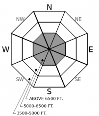
How to read the forecast
Avalanche hazards so far this season are generally localized to high elevation terrain with sufficient snow coverage to ski or ride. With a thin early season snowpack, avalanches can produce harsh consequences if they drag you over rocks, cliffs, or stumps. Pay attention to recent snowfall amounts, wind transport, and underlying weak layers if you are traveling on steep, snow covered terrain.

No Rating
?
Above 6500 ft.
No Rating
?
5000-6500 ft.
No Rating
?
3500-5000 ft.
-
Type ?
-
Aspect/Elevation ?

-
Size ?HistoricVery LargeLargeSmall

Lingering wind slab instabilities on high elevation, wind affected slopes are the primary concern through this weekend. Look for smooth, dense drifts of snow near ridgelines, in gullies, or behind tree fences to identify features of concern. Wind sheltered terrain is offering higher quality and safer riding. Unsettled weather early next week will likely reintroduce another round of new snow or wind blown surface instabilities.
Storms last Friday and Monday treated us to some fluffy, wintry-like snow conditions up high, and we took advantage of the clear weather this week to assess the foundations of this winter's snowpack. Friday's snowfall was preceded by a rain event that formed a stout rain crust to mountain top elevations on all aspects. While this has added strength and stability to our current snowpack structure (Observation A, Observation B, Observation C), it could pose an issue down the road, now that we have low density snow faceting above it. In the meantime, our primary concern through the weekend is thin slabs of wind drifted snow that formed from shifting winds, first northeasterly, then southwesterly. Observers on Wednesday were able to trigger small wind slabs and produce a collapse in a wind drifted lense at high elevations (See observation). The cold temperatures this week are delaying the healing process; its best to steer around them in consequential terrain. You can spot these lingering windslabs by paying close attention to the snow texture and density as you move into more wind affected snow. Elsewhere, last weekend's snow, which is up to a foot deep, continues to weaken and facet: expect to encounter small sluffs in steep, shaded terrain.
It looks like we will see another round of active weather early next week. New and windblown snow will be accumulating on faceted or crusty surfaces; a recipe for poor bonding. The amount of new snow and wind will dictate whether instabilities develop within the new snow. Pay attention to snowfall amounts next week and if you see more than 6" of new or windblown snow, expect to find small avalanches breaking on the weak layers that have developed this week (See photo). The potential size will increase if storms exceed forecasted amounts.
This is an early season snowpack update. The FAC will continue to monitor conditions through the fall and post updates as conditions warrant. We anticipate daily forecasts and full operations to begin in December.
Now is the time to get your gear dialed and brush up on your avalanche knowledge. The 2019 Northern Rockies Snow and Avalanche Workshop has a great lineup of presentations, vendor booths, raffles, and an all-around good time. The event is November 16th, 2019...all the details are here. Registration is open! Stay tuned for our upcoming avalanche class schedule later this fall.
The NWS is producing automated mountain weather forecasts during the fall season here. We will be producing weather forecasts to accompany daily avalanche forecasts during regular operations.
This forecast applies only to backcountry areas outside established ski area boundaries. The forecast describes general avalanche conditions and local variations always occur. This forecast expires at midnight on the posted day unless otherwise noted. The information in this forecast is provided by the USDA Forest Service who is solely responsible for its content.
Call
Contact
In Partnership With

In Partnership With


