| Friday | Friday Night | Saturday | |
|---|---|---|---|
| Cloud Cover: | Mostly Cloudy | Overcast | Mostly Cloudy |
| Temperatures: | 42 to 47 deg. F. | 27 to 32 deg. F. | 36 to 41 deg. F. |
| Wind Direction: | Southeast | Southwest | Southwest |
| Wind Speed: | 5 to 10 | 10 to 20, G35 | 15 to 25, G40 |
| Snowfall: | 0 to 1" in. | 2" to 4" in. | 0" in. |
| Snow Line: | 7000' | 5500' | 4000' |
Swan Range
How to read the forecast
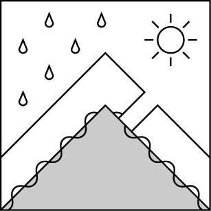
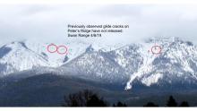
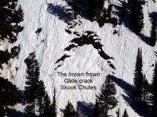
Watch for small, isolated instabilities in the recent snow, especially if it rains at high elevations today. Avoid traveling below glide cracks: they warn of the potential for full depth avalanches.

1. Low
?
Above 6500 ft.
1. Low
?
5000-6500 ft.
1. Low
?
3500-5000 ft.
- 1. Low
- 2. Moderate
- 3. Considerable
- 4. High
- 5. Extreme
-
Type ?
-
Aspect/Elevation ?
-
Likelihood ?CertainVery LikelyLikelyPossible
 Unlikely
 -
Size ?HistoricVery LargeLargeSmall

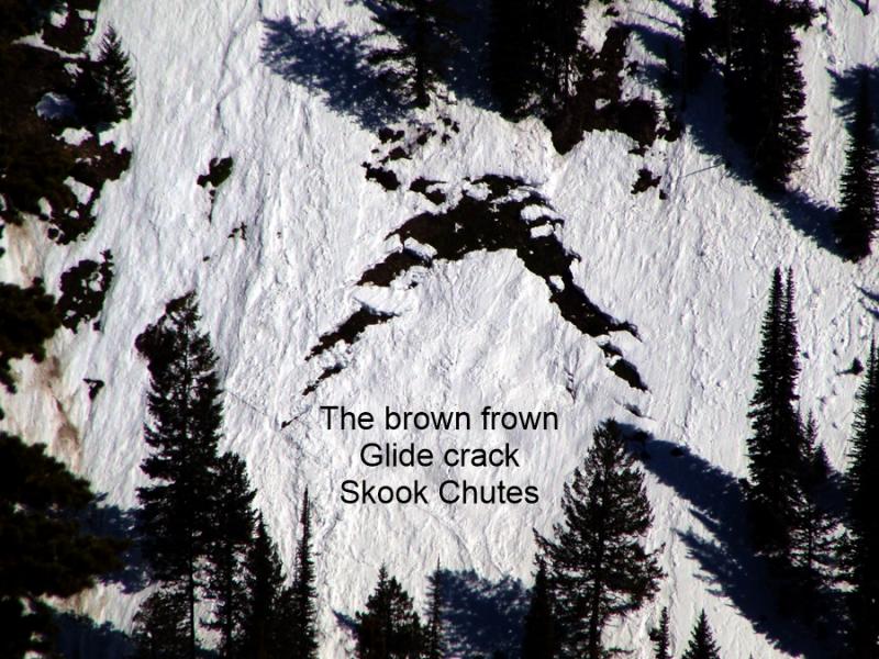
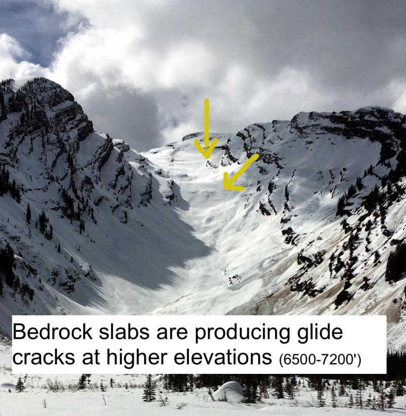
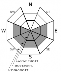
Glide cracks are the obvious "brown frowns" that open up as the season's snowpack starts to slide downhill on grass or bedrock. We have observed several destructive glide avalanches in the past few weeks. Although this is a low likelihood avalanche problem, the resulting slides are catastrophic failures that run surprisingly far distances. The most reliable way to manage their unpredictable failures is to choose routes that avoid slopes below open glide cracks.
-
Type ?
-
Aspect/Elevation ?
-
Likelihood ?CertainVery LikelyLikelyPossible
 Unlikely
 -
Size ?HistoricVery LargeLargeSmall

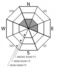
Yesterday, observers reported natural and human triggered point release avalanches at high elevations involving the 2" to 4" of fresh snow, both wet and dry. These instabilities remain a concern today, especially if dry snow on northerly aspects transitions to a wetter flavor under rising freezing levels and light rain. Watch for small natural wet loose avalanches this afternoon if you see rollerballs, pinwheels, or rain on dry snow. Avoid travel on or below steep gullies if you observe an unstable snow surface. Loose snow avalanches can also pose a threat if they sweep you over rocks or into a tree.
Wednesday night's storm produced 3" to 4" favoring the Whitefish Range and Glacier Park. Yesterday, the sun came out, wetted the new snow, and caused small point release avalanches on steep, sun-baked terrain. Observers in the Flathead Range also reported long-running dry sluffs on high, shaded aspects. Today's weather will be cooler and cloudier, but we are expecting light rain showers this afternoon up to 7,000' feet. If the weather forecast verifies, expect the threat of wet loose avalanches to continue, most commonly on high, north facing aspects where the snow surface remained dry yesterday. Although natural and human triggered avalanches are possible, this instability is easy to identify and avoid because it gives plenty of surface clues. Don't hang out below steep chutes and gullies if you see the snow surface producing rollerballs or pinwheels. The Swan Range received less snow on Wednesday night; these concerns are smaller and more isolated - the danger is LOW in areas that saw less than a couple inches of new snow.
Wednesday night's storm was accompanied by moderate southwest winds. In isolated locations on high, north facing terrain, you may still encounter a lingering wind slab. Our late March wet avalanche cycle brought a surge in glide avalanche activity and opened up a number of gaping glide cracks around the region. Glide avalanche activity has tapered since then, but the low likelihood/ high consequence threat remains. Glide releases are tricky to predict, but the last few days of warm weather and marginal freezes is more conducive for prodding these destructive beasts. Simply avoiding slopes with cracks looming above will make your day a less stressful one. No need to bet the house, the farm, the kids, and the dog on this high-stakes lottery game when there are plenty of slopes that are crack free.
EDUCATION: The Scoop on Spring Touring: Curious about spring snow and safe travel techniques? This is the talk for you. Join FAC Lead Forecaster Blase Reardon for a FREE one hour talk on spring conditions in the Flathead. The talk begins at 6:30 p.m. Thursday, April 11th at Rocky Mountain Outfitters in Kalispell. That evening is also a community night for the Friends of the Flathead Avalanche Center at Sweet Peaks in Kalispell. Stop by for a sweet treat and then head down the street to get the scoop on spring conditions.
Warm southwest flow will bring unsettled, showering weather today. Thunderstorms are possible this afternoon as the atmosphere destabilizes.
This forecast applies only to backcountry areas outside established ski area boundaries. The forecast describes general avalanche conditions and local variations always occur. This forecast expires at midnight on the posted day unless otherwise noted. The information in this forecast is provided by the USDA Forest Service who is solely responsible for its content.


