| Thursday | Thursday Night | Friday | |
|---|---|---|---|
| Cloud Cover: | Decreasing clouds | Increasing clouds | Mostly Cloudy |
| Temperatures: | 38 to 46 deg. F. | 28 to 31 deg. F. | 39 to 47 deg. F. |
| Wind Direction: | Southwest | South | Southeast |
| Wind Speed: | 10 to 15, G30 | 5 to 10, G20 | 5 to 10, G25 |
| Snowfall: | 0" in. | 0" in. | 0 to 1" in. |
| Snow Line: | 6000' | 5500' | 6000' |
Swan Range
How to read the forecast

1. Low
?
Above 6500 ft.
1. Low
?
5000-6500 ft.
1. Low
?
3500-5000 ft.
- 1. Low
- 2. Moderate
- 3. Considerable
- 4. High
- 5. Extreme
-
Type ?
-
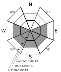
Aspect/Elevation ?
-
Likelihood ?CertainVery LikelyLikelyPossible
 Unlikely
 -
Size ?HistoricVery LargeLargeSmall

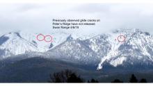
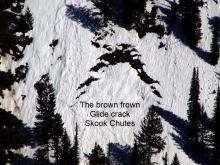
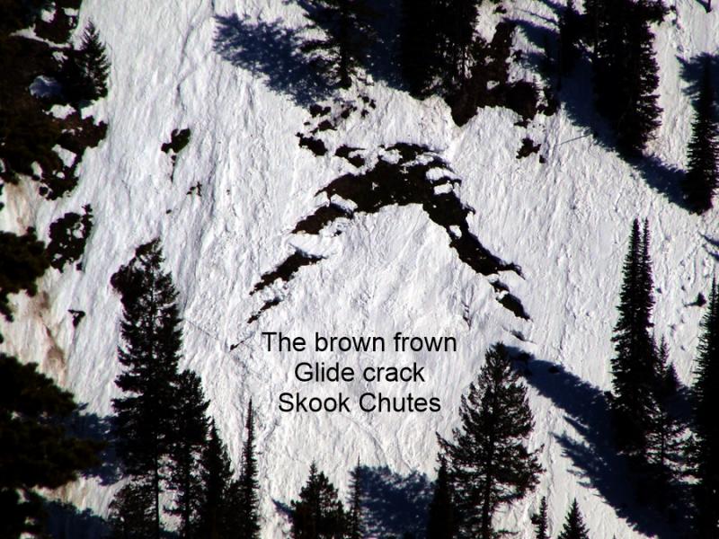
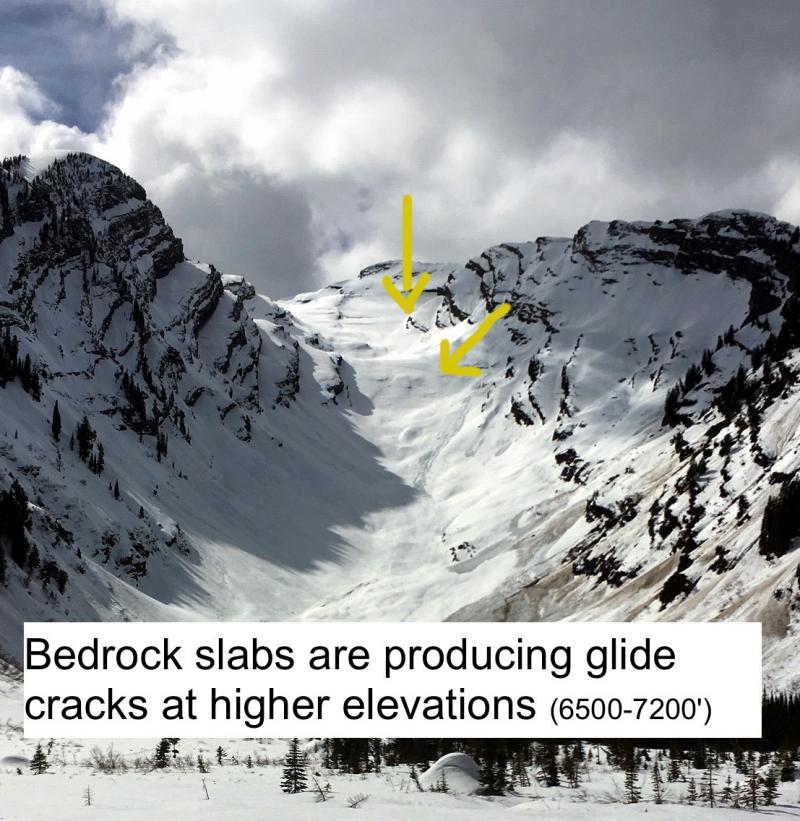
Glide cracks are the obvious "brown frowns" in that open up as the season's snowpack starts to slide downslopes on grass or bedrock. We have observed several glide avalanches in the past few weeks. Although this is a low likelihood avalanche problem, the resulting slides are catastrophic failures that run surprisingly far distances. The most reliable way to manage their unpredictable failures is to choose routes that avoid slopes below open glide cracks.
-
Type ?
-
Aspect/Elevation ?

-
Likelihood ?CertainVery LikelyLikelyPossible
 Unlikely
 -
Size ?HistoricVery LargeLargeSmall

Last night's fresh snow has potential to sluff off of very steep terrain as temperatures warm and the sun moistens the snow surface. These slides should be small and relatively harmless unless they knock you over a cliff band or drag you down a gully or into a tree. Pay attention to the snow surface: rollerballs, pinwheels, and adjacent avalanche activity are all warning signs that the snow surface is becoming unstable. Choose less consequential terrain or seek out colder snow to avoid the problem.
Last night's warm, wet system brought a few inches of dense, sticky snow to 6,000'. The Whitefish Range and Glacier Park saw the most precipitation (.5" to .7" of snow water equivalent), and the Swan got about half that. With the freezing level hovering around 6,000' last night, I would expect to find deeper snow accumulations at high elevations. Southwest winds were blowing 15 mph and gusting to 30 in some locations, which will make the snow stiffer and thicker in wind affected terrain. This all spells new slab formation and changing conditions in areas that saw more than a few inches of new or windblown snow. At upper elevations, the new snow fell on top of dry, faceted snow on shaded aspects and crusts on southerly aspects and may not bond well. Be suspicious of the new snow until it is proven innocent. Ease into bigger terrain by playing on smaller, less consequential slopes to get a feel for how deep and well bonded the snow is.
Today, snowfall should fizzle out and we should see some sun and warming temperatures this afternoon. Expect the new snow to moisten and peel off of rocky faces and chutes producing small sluffs. Seek out dryer, colder snow for better and safer riding conditions if this happens.
EDUCATION: The Scoop on Spring Touring: Curious about spring snow and safe travel techniques? This is the talk for you. Join FAC Lead Forecaster Blase Reardon for a FREE one hour talk on spring conditions in the Flathead. The talk begins at 6:30 p.m. Thursday, April 11th at Rocky Mountain Outfitters in Kalispell. That evening is also a community night for the Friends of the Flathead Avalanche Center at Sweet Peaks in Kalispell. Stop by for a sweet treat and then head down the street to get the scoop on spring conditions.
Last night's warm front has marched on to Eastern Montana. A few blobs of moisture are trailing upstream in its wake, but expect a drying, warming trend today. Showers return tomorrow.
This forecast applies only to backcountry areas outside established ski area boundaries. The forecast describes general avalanche conditions and local variations always occur. This forecast expires at midnight on the posted day unless otherwise noted. The information in this forecast is provided by the USDA Forest Service who is solely responsible for its content.


