| Friday | Friday Night | Saturday | |
|---|---|---|---|
| Cloud Cover: | Partly Cloudy | Partly Cloudy | Mostly Clear |
| Temperatures: | 35 to 45 deg. F. | 20 to 25 deg. F. | 40 to 50 deg. F. |
| Wind Direction: | Northeast | East | Southwest |
| Wind Speed: | 5 to 10, gusting to 20 | Around 10 | Around 5 |
| Snowfall: | 0 in. | 0 in. | 0 in. |
| Snow Line: | 3500 | 3500 | 4000 |
Whitefish Range
Swan Range
Flathead Range and Glacier National Park
How to read the forecast
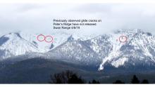
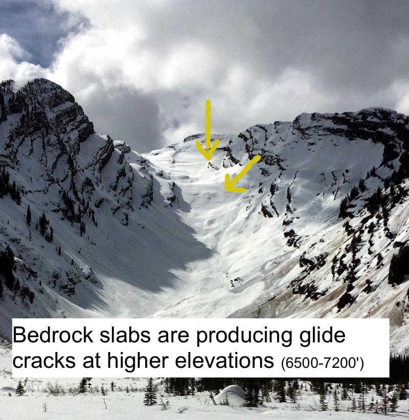
Expect generally stable conditions today. You can find exceptions to the rule on steep, lower elevation slopes where the snow warms enough to break down the surface crust. If you start sinking in to slushy snow, or see rollers coming down the hill, move to lower-angled, shadier terrain to avoid wet snow avalanches. Stay out from under slopes with open glide cracks.

1. Low
?
Above 6500 ft.
1. Low
?
5000-6500 ft.
2. Moderate
?
3500-5000 ft.
- 1. Low
- 2. Moderate
- 3. Considerable
- 4. High
- 5. Extreme
-
Type ?
-
Aspect/Elevation ?
-
Likelihood ?CertainVery LikelyLikelyPossible
 Unlikely
 -
Size ?HistoricVery LargeLargeSmall

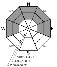
After several days of cooler temperatures and overnight refreezes, wet snow avalanches have become less likely. They are confined to a few steep slopes where the snow surface melts during the day. More sunshine can increase the melting on easterly and westerly aspects. High and hazy clouds can create a greenhouse effect that thaws northerly slopes. In either case, melt water may weaken the snow surface, or less likely, faceted snow where the snowpack is still layered. Without X-Ray goggles, it's impossible to tell if the latter is happening. Minimize your exposure to this isolated hazard by avoiding slopes below steep, rocky terrain as the surface thaws. You may find the most unsupportable snow in the trees. If you begin to sink into wet snow, head for lower-angled slopes or terrain where the snow surface remains supportable.
-
Type ?
-
Aspect/Elevation ?
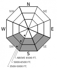
-
Likelihood ?CertainVery LikelyLikelyPossible
 Unlikely
 -
Size ?HistoricVery LargeLargeSmall

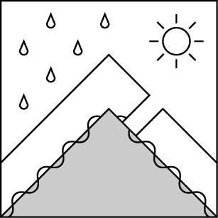
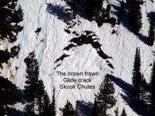
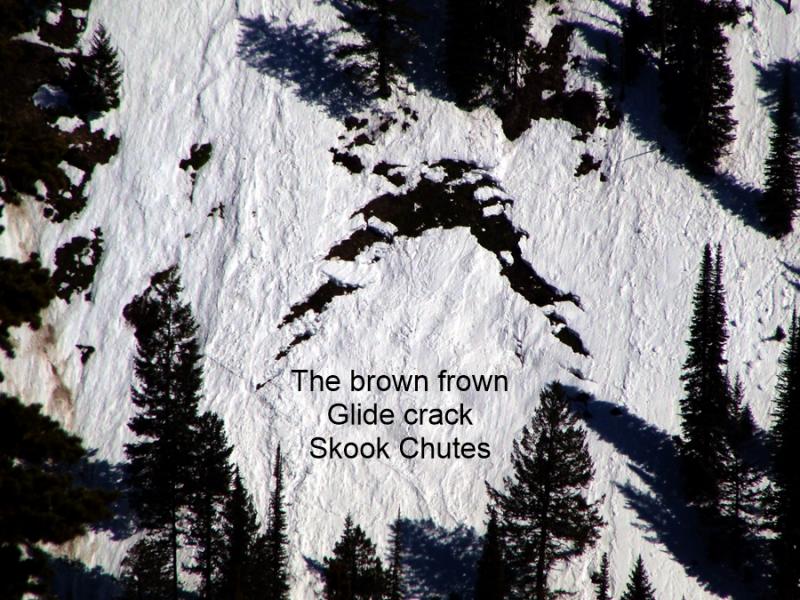
Glide cracks are the gaping, down-curved gaps where a slab of snow has pulled free from the snow upslope. The snow downhill of the slab is often wrinkled. They release when the snow at their flanks and base becomes saturated and weakens. That's hard to predict, so stay out from under these brown frowns.
Mountain weather stations continue to deliver the good news: the snowpack is freezing overnight and last night was cooler than the night before. While we continue to assess the carnage from last week’s thermal meltdown, no new avalanches have been reported. Yesterday, lower elevations melted early after a poor refreeze on Wednesday night. But the snow surface was supportable above about 5,000’. We found great spring riding conditions at middle elevations in the Apgar Range. Zach reported good quality sledding up high in the northern Whitefish Range.
The balance between sun and clouds continues to be a major factor regarding how much, where, and when the snow surface melts. It is also one of the hardest things to forecast. More sun means more warming on east, south, and west facing terrain. Clouds can create a greenhouse effect and warm northerly slopes. The results are the same no matter where in the mountains you are: melt water breaks down the bonds between snow grains and increases the risk of wet snow avalanches. Loose wet avalanches run on the surface and become more dangerous as they entrain more snow. If melt water percolates down into buried weak layers, wet slabs can release. Glide avalanches can fail whenever their flanks or base lose the strength needed to support the slabs. You don't need X-ray googles to see these; they're the obvious brown frowns. Stay out from under them. All of these problems are unlikely today after several nights of below freezing temperatures. But look for the exceptions to the rule and you’ll know what to avoid - and where to find better, safer riding. Rollers coming down the hill are a warning sign. Stepping off of your boards or machine and sinking into wet snow means you’ve overstayed your welcome. Head for slopes where the surface remains supportable and that aren't under steep terrain with softening snow.
EDUCATION: The Scoop on Spring Touring: Curious about spring snow and safe travel techniques? This is the talk for you. Join FAC Lead Forecaster Blase Reardon for a FREE one hour talk on spring conditions in the Flathead. The talk begins at 6:30 p.m. Thursday, April 11th at Rocky Mountain Outfitters in Kalispell. That evening is also a community night for the Friends of the Flathead Avalanche Center at Sweet Peaks in Kalispell. Stop by for a sweet treat and then head down the street to get the scoop on spring conditions.
Expect partly cloudy skies and a warming trend going into Saturday. The next notable precipitation is expected along the Continental Divide on early next week.
This forecast applies only to backcountry areas outside established ski area boundaries. The forecast describes general avalanche conditions and local variations always occur. This forecast expires at midnight on the posted day unless otherwise noted. The information in this forecast is provided by the USDA Forest Service who is solely responsible for its content.


