| Thursday | Thursday Night | Friday | |
|---|---|---|---|
| Cloud Cover: | Mostly Cloudy | Partly Cloudy | Partly Cloudy |
| Temperatures: | 32 to 37 deg. F. | 20 to 25 deg. F. | 35 to 40 deg. F. |
| Wind Direction: | Northeast | Northeast | Northeast |
| Wind Speed: | 10 to 15, gusting to 35 | 5 to 10, gusting to 25 | 5 to 10, gusting to 20 |
| Snowfall: | 0-2 in. | 0 in. | 0 in. |
| Snow Line: | 3500 | 3500 | 3500 |
Whitefish Range
Swan Range
Flathead Range and Glacier National Park
How to read the forecast
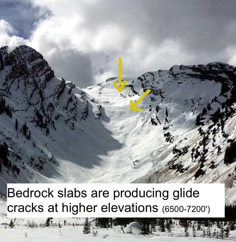
After another night with mostly below freezing temperatures, wet snow avalanche problems are isolated to slopes where the snow surface didn't freeze or the crust breaks down. Look for these exceptions to the generally stable conditions at low elevations. If the snow trapdoors open under you or your snowmachine, head for shadier, lower-angled slopes. Stay out from under slopes with open glide cracks.

1. Low
?
Above 6500 ft.
1. Low
?
5000-6500 ft.
2. Moderate
?
3500-5000 ft.
- 1. Low
- 2. Moderate
- 3. Considerable
- 4. High
- 5. Extreme
-
Type ?
-
Aspect/Elevation ?
-
Likelihood ?CertainVery LikelyLikelyPossible
 Unlikely
 -
Size ?HistoricVery LargeLargeSmall

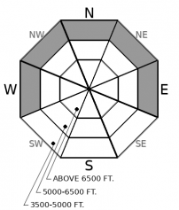
After several days of cooler temperatures and overnight refreezes, wet snow avalanches have become unlikely. They are confined to a few steep slopes where the snow surface didn't freeze, or the surface crust melts during the day. Either case produces a shot of meltwater that might weaken the snow surface, or less likely, faceted snow where the snowpack is still layered. Without X-Ray goggles, it's impossible to tell if the latter is happening. Minimize your exposure to this isolated hazard by traveling early, avoiding slopes below steep, rocky terrain. If you step off your skis or sled and plunge to your waist, extricate yourself and head for lower-angled slopes or terrain where the snow surface remains supportable.
-
Type ?
-
Aspect/Elevation ?
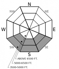
-
Likelihood ?CertainVery LikelyLikelyPossible
 Unlikely
 -
Size ?HistoricVery LargeLargeSmall

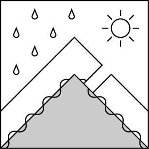
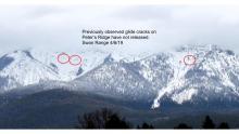
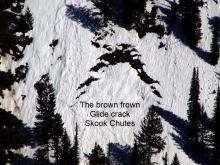
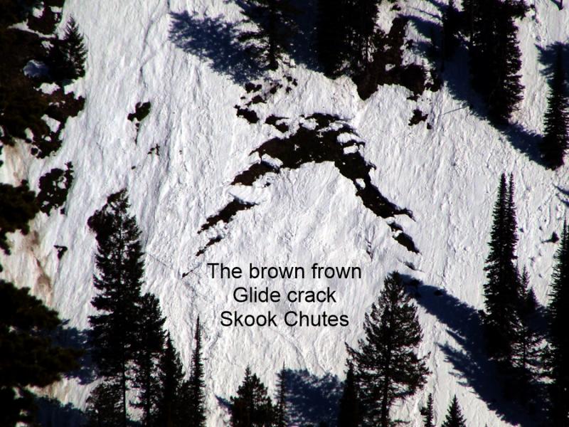
Glide cracks are the gaping, down-curved gaps where a slab of snow has pulled free from the snow upslope. Often the base of the slab is wrinkled. They release when the snow at their flanks and base becomes saturated and weakens. That's hard to predict, so stay out from under these brown frowns.
Wednesday, Zach and I found a refrozen, supportable snow surface in the southern Swan and southern Glacier National Park. Sweet, buttery corn, to be more precise. Last night's temperatures dropped below freezing at most stations above 5000 feet, so I expect similar conditions at mid and upper elevations today. The refrozen snow surface means little to no meltwater in the near-surface snow or percolating down to buried weak layers. Thus, minimal wet snow avalanche hazards so long as that crust stays intact. The exceptions will be steep slopes below about 5000 feet where the overnight refreeze was brief or rain showers introduce water. If you trapdoor through the snow surface on your skis or snowmachine, you've found one of these exceptions. Head for slopes where the snow surface remains supportable and that aren't under steep slopes with softening snow. The wild cards are Glide Slabs, which can fail whenever their flanks or base lose the strength needed to support the slabs. But you don't need X-ray googles to see these; they're the obvious brown frowns. Stay out from under them. There's nothing proud about getting slid downhill by something that leaves a long, dirty brown streak.
Snow showers the past few days have left a few inches of new snow pasted to the snow surface in the Swan and southern Whitefish Ranges. Lingering showers today could brush on another layer. Accumulations aren't or won't be enough to cause new snow avalanche hazards except on one or two slopes - and that's very close to an exact count - where easterly winds drift it into slabs more than 8 inches thick. If you find one of these golden tickets, avoid steep terrain above gullies, rocks, or dense trees.
EDUCATION: The Scoop on Spring Touring: Curious about spring snow and safe travel techniques? This is the talk for you. Join FAC Lead Forecaster Blase Reardon for a FREE one hour talk on spring conditions in the Flathead. The talk begins at 6:30 p.m. Thursday, April 11th at Rocky Mountain Outfitters in Kalispell. That evening is also a community night for the Friends of the Flathead Avalanche Center at Sweet Peaks in Kalispell. Stop by for a sweet treat and then head down the street to get the scoop on spring conditions.
This morning's clear skies will give way to increasing clouds as clouds sweeps in from the south. Sadly, most of the moisture and snow will remain south of the forecast region. Winds veer easterly and become moderate with strong gusts this afternoon.
This forecast applies only to backcountry areas outside established ski area boundaries. The forecast describes general avalanche conditions and local variations always occur. This forecast expires at midnight on the posted day unless otherwise noted. The information in this forecast is provided by the USDA Forest Service who is solely responsible for its content.


