| Saturday | Saturday Night | Sunday | |
|---|---|---|---|
| Cloud Cover: | Increasing clouds | Mostly Cloudy | Mostly Cloudy |
| Temperatures: | 40 to 45 deg. F. | 25 to 30 deg. F. | 35 to 45 deg. F. |
| Wind Direction: | Southwest | North | Northeast |
| Wind Speed: | 5 to 10, gusting to 15 | 5 to 10, gusting to 20 | 5 to 10, gusting to 20 |
| Snowfall: | 0" in. | 0" in. | 0 to 1 in. |
| Snow Line: | 5500' | 5000' | 5000' |
Whitefish Range
Swan Range
Flathead Range and Glacier National Park
How to read the forecast
Today's cooler, cloudier, and breezier conditions will help to limit wet snow instabilities. Pay attention to the warming of the surface as the day progresses and move to a shadier slope if you find yourself or machine sinking into mushy snow. Steer around steep sunny slopes as they warm later today. Due north aspects still hold quality safer snow.

2. Moderate
?
Above 6500 ft.
2. Moderate
?
5000-6500 ft.
1. Low
?
3500-5000 ft.
- 1. Low
- 2. Moderate
- 3. Considerable
- 4. High
- 5. Extreme
-
Type ?
-
Aspect/Elevation ?
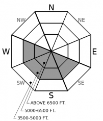
-
Likelihood ?CertainVery LikelyLikelyPossible
 Unlikely
 -
Size ?HistoricVery LargeLargeSmall

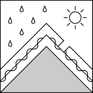
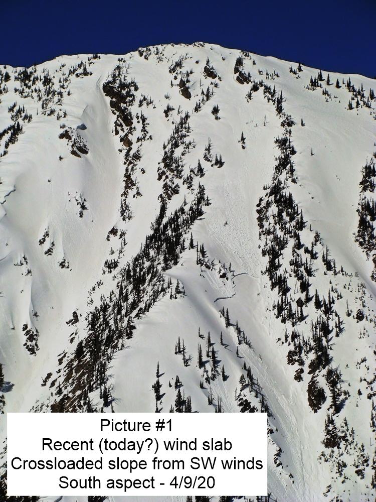
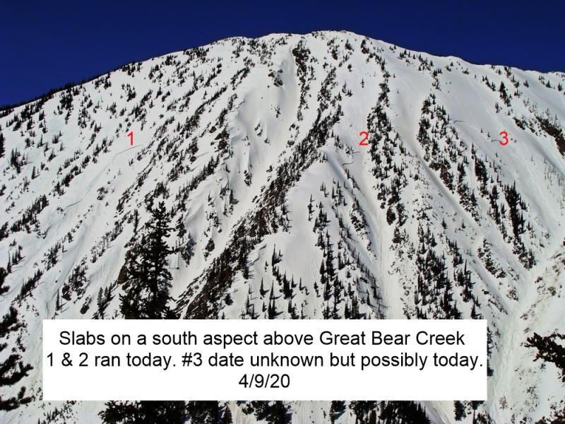
Large destructive wet slabs have occurred naturally each of the past few days. Above normal temperatures, combined with poor overnight refreezing, allowed meltwater to percolate to weak layers in the snowpack triggering thick slides. Sunny south and west aspects at mid and upper elevation have seen the majority of the action. Slightly cooler cloudy weather will slow meltwater production today, but wet slabs are unpredictable. Be wary of steep sunny slopes, especially if the sun appears more than forecast. A wet loose slide may initiate a wet slab. Pay attention to overhead hazards, even as you travel on low-angled, sheltered terrain.
-
Type ?
-
Aspect/Elevation ?
-
Likelihood ?CertainVery LikelyLikelyPossible
 Unlikely
 -
Size ?HistoricVery LargeLargeSmall

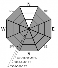
Natural point-release avalanches have been observed daily since Saturday at all elevations and on all aspects, except true north. These slides have run surprisingly long distances and, in many instances, have gouged through most of the snowpack. Move to a shadier aspect when you find yourself or machine sinking into sloppy snow. These sluffs are more dangerous in terrain features such as long-running gullies and above terrain traps. Loose wet avalanches can act as triggers for larger wet slabs.
Slightly cooler overnight temperatures are a good starting point. The 7-day wet avalanche cycle may be coming to an end. Today's increasing clouds and windier conditions will limit melting of the surface snow and subsequent water percolating into the snowpack. Many slopes across our region have been "worked over" by recent avalanche activity and have limited material to slide again. The wet avalanche problem is diminishing, but we are not out of the woods just yet. BNSF snow safety reported a handful of natural loose wet slides yesterday including one that gouged down and removed the entire season's snowpack. Zach noted 2 large destructive slides which failed yesterday in Glacier Park and the Flathead Range. Remain vigilant in your travels. Watch for slopes where you or your machine are sinking into deep mushy snow. These are areas where you can encounter a wet loose slide. If sunny aspects warm today, it would prudent to avoid traveling on or below this terrain due to the threat of natural wet slabs. Reports continue to filter in of enjoyable faceted powder on true north aspects which offer a much more enjoyable and safer experience.
EDUCATION: The Scoop on Spring Touring: Curious about spring snow and safe travel techniques? This is the talk for you. Join FAC Lead Forecaster Blase Reardon for a FREE one hour talk on spring conditions in the Flathead. The talk begins at 6:30 p.m. Thursday, April 11th at Rocky Mountain Outfitters in Kalispell. That evening is also a community night for the Friends of the Flathead Avalanche Center at Sweet Peaks in Kalispell. Stop by for a sweet treat and then head down the street to get the scoop on spring conditions.
Increasing clouds and slightly cooler breezier weather is on tap for today. Precipitation and cooler temperatures will arrive tomorrow.
This forecast applies only to backcountry areas outside established ski area boundaries. The forecast describes general avalanche conditions and local variations always occur. This forecast expires at midnight on the posted day unless otherwise noted. The information in this forecast is provided by the USDA Forest Service who is solely responsible for its content.


