| Friday | Friday Night | Saturday | |
|---|---|---|---|
| Cloud Cover: | Mostly Clear | Increasing Clouds | Mostly Cloudy |
| Temperatures: | 45 to 55 deg. F. | 25 to 35 deg. F. | 35 to 45 deg. F. |
| Wind Direction: | Southwest | Southwest | Southwest |
| Wind Speed: | Light | 7 to 9, gusting to 20 | 6 to 10, gusting to 20 |
| Snowfall: | 0" in. | 0" in. | 0 to Trace in. |
| Snow Line: | 8000' | 6500' | 6000' |
Whitefish Range
Swan Range
Flathead Range and Glacier National Park
How to read the forecast
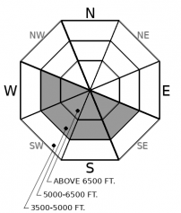
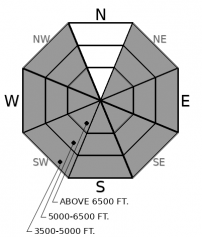
An AVALANCHE WARNING is in effect until 8pm for all areas. The avalanche danger will rise to HIGH as a result of unusual and prolonged warming. We expect more wet snow avalanches that are large, destructive, and can run long distances. Many avalanches have entrained the entire season’s snowpack. Travel in, or under, avalanche terrain is not recommended.

4. High
?
Above 6500 ft.
4. High
?
5000-6500 ft.
3. Considerable
?
3500-5000 ft.
- 1. Low
- 2. Moderate
- 3. Considerable
- 4. High
- 5. Extreme
-
Type ?
-
Aspect/Elevation ?
-
Likelihood ?CertainVery LikelyLikelyPossible
 Unlikely
 -
Size ?HistoricVery LargeLargeSmall

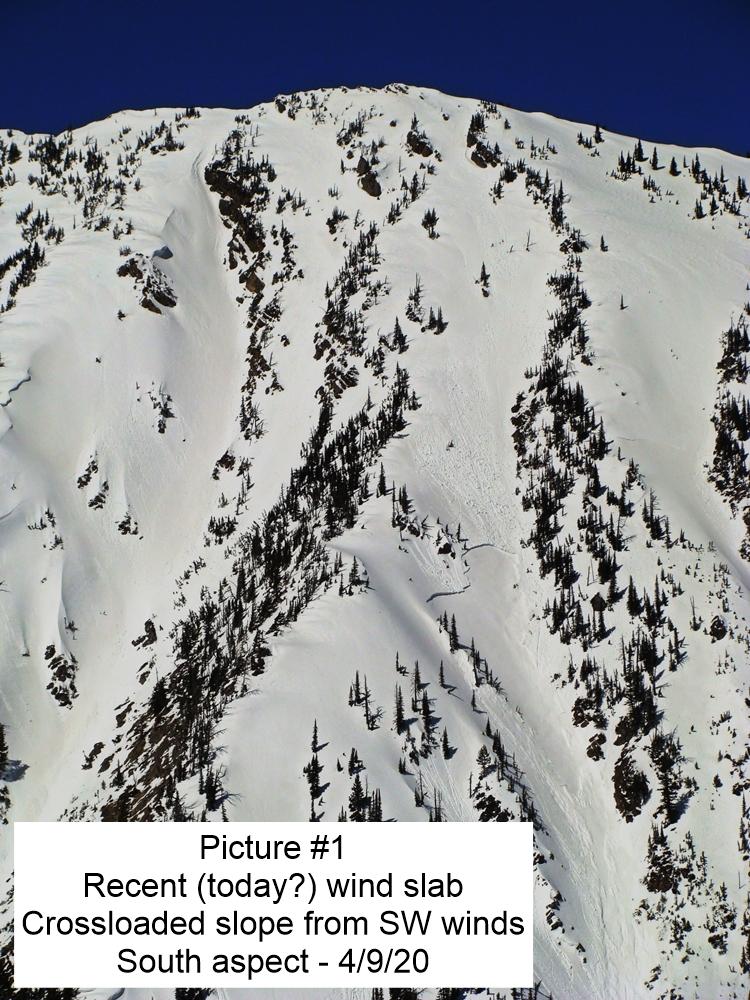
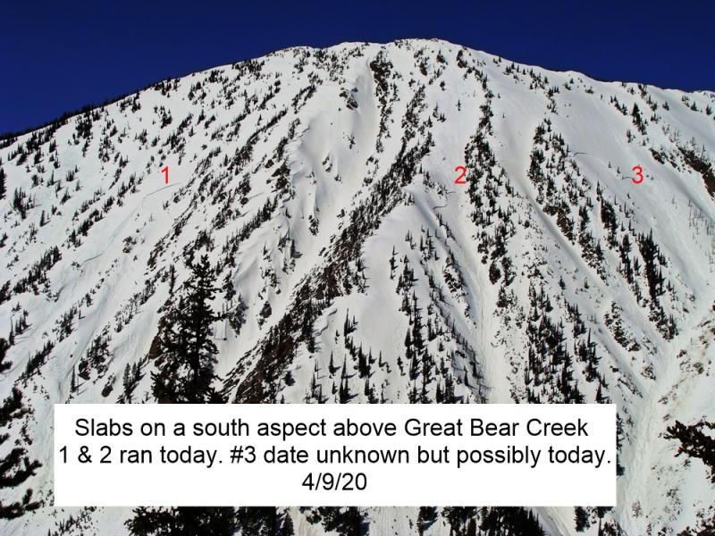
The potential for thick slabs to release naturally on old weak layers continues after 4 days of prolonged warming and poor overnight refreezes. Very large, destructive slabs have failed at middle and upper elevations on southerly and westerly aspects across the forecast area. Whitefish Mountain Resort ski patrol continues to see mitigation results on the same slopes. Wet slab avalanches are unpredictable and rarely give clear feedback underfoot; they can fail on unseen layers and run on lower slope angles than expected. Upper elevation slopes, especially rocky, sun-baked terrain is expected to produce more slabs today that can entrain the entire season’s snowpack. Pay attention to overhead hazards, even as you travel on low-angled, sheltered terrain.
-
Type ?
-
Aspect/Elevation ?
-
Likelihood ?CertainVery LikelyLikelyPossible
 Unlikely
 -
Size ?HistoricVery LargeLargeSmall

Point-release avalanches entraining wet or moist snow will be easy to trigger or can run naturally as the sun softens the snow surface. Numerous loose wet avalanches have occurred each day this week on sunny terrain, and in some cases, they have gouged through the entire season's snowpack growing to surprisingly destructive sizes. We have seen recent, large wet sluffs at all elevations and even on northerly aspects. On Wednesday, I easily triggered rollerballs and small sluffs on northwest slopes that were still in the shade. Avoid traveling below long-running gullies as the day progresses. Loose wet avalanches can act as triggers for larger wet slabs.
Spring Break 2019 may soon be winding down. A few party-goers are already sleeping off hangovers on the couch, but the die-hards are still raging out in the March sun and they wont go home until the temperature drops and the clouds force them to swap their flip-flops for boots again.
The warming trend of the past week may have peaked yesterday afternoon when mountain temperatures reached the low 60s. But last night was the fourth in a row without a solid refreeze and the snowpack has been shedding its weakest layers like t-shirts at a beach party. Reports of widespread, destructive avalanches continue to pour into the FAC inbox from across the area. Yesterday afternoon Zach and I documented the wet snow avalanche cycle in the Apgar and Swan Ranges. Numerous parties shared pictures of the loose wet and wet slab avalanches running near Whitefish Mountain Resort.
The snowpack, especially at upper elevations, became weak and faceted during last month’s relentless cold. That loose surface snow is primed for sluffing as it becomes saturated with melt water. Deeper down, weak layers remain around crusts that formed earlier in the season. As water infiltrates those layers, wet slab avalanche can fail in unpredictable ways and entrain surprisingly large amounts of debris. South, west, and even northerly aspects have seen the majority of the action so far, but avalanches continue to run – even on slopes that have previously slid. Despite constant mitigation efforts by ski patrol, there have been several slopes repeatedly sliding on Big Mountain. A snowboarder triggered a dangerously large slide from a closed area yesterday. Closures are in place for your safety and I recommend that you respect them.
One more day of warm, mostly clear, weather before spring showers replace spring sun. Expect light, sporadic, patchy precipitation this weekend with high snow levels falling to around 5,000 feet by Sunday morning.
This forecast applies only to backcountry areas outside established ski area boundaries. The forecast describes general avalanche conditions and local variations always occur. This forecast expires at midnight on the posted day unless otherwise noted. The information in this forecast is provided by the USDA Forest Service who is solely responsible for its content.


